Dismal River facts for kids
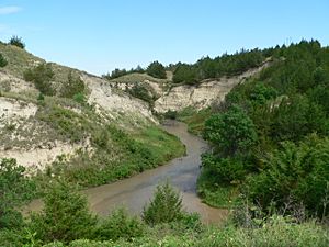
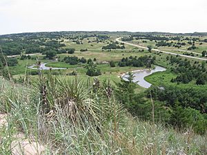
The Dismal River is a cool, winding river in the state of Nebraska. It stretches about 72 miles (116 kilometers) long. This river gets its start when two smaller streams, called forks, join together. One fork begins in Grant County, and the other in Hooker County.
These two forks meet up near Nebraska Highway 97, between the towns of Mullen and Tryon. From there, the Dismal River flows mostly southeast into Thomas County. It crosses U.S. Highway 83 south of Thedford. The river then passes just south of the Nebraska National Forest. Finally, it turns a bit northeast before joining the Middle Loup River near Dunning in Blaine County.
Life Along the River
Most of the land along the Dismal River is privately owned. It is mainly used for ranching, where cattle graze on the open land. The river's water comes from a huge underground water source called the Ogallala Aquifer. In some spots, this water bubbles up from below the riverbed. This can sometimes create areas of quicksand, so it's important to be careful!
The area around the Dismal River is home to many different animals. You might spot deer, coyotes, and beavers. There are also wild turkeys and even rattlesnakes living in this natural habitat.
Fun Facts
Even though much of the Dismal River flows through quiet, unpopulated areas, there's a special place along its banks. The Dismal River Golf Course, designed by famous golfer Jack Nicklaus, is located south of Mullen, right next to the river. It's a unique spot for golf lovers!
 | James Van Der Zee |
 | Alma Thomas |
 | Ellis Wilson |
 | Margaret Taylor-Burroughs |


