Dorset Heaths facts for kids
Quick facts for kids
Designations
|
|
| Official name: Dorset Heathlands | |
| Designated: | 1 October 1998 |
|---|---|
| Reference #: | 964 |
The Dorset Heaths are a very important natural area in southern England. They are mostly made up of heathland, which is a special type of open land with small shrubs. You can find them in a place called the Poole Basin. A lot of this area is protected to keep it safe for nature.
Contents
Where are the Dorset Heaths?
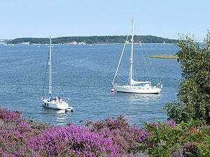
The Dorset Heaths cover a huge area, about 61,662 hectares! That's like 150,000 football fields. This special area stretches from places like Bockhampton and Warmwell in the west. It goes all the way to Wimborne Minster and Fordingbridge in the northeast. Then it turns south towards Hengistbury Head. It follows the coastline to Studland and Brownsea Island. Finally, it heads west, staying north of the Purbeck Hills and the Weymouth Lowlands. This brings it back to the Warmwell area.
What do the Dorset Heaths look like?
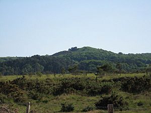
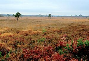
The Dorset Heaths look very different from the areas around them. You'll see rolling heathland with lots of heather, pine trees, and gorse. This mixes with open farmland, woodland, and scrub. You might also spot large blocks of conifer trees. These trees stand out in the landscape.
Most of the area is quiet, with only a few small villages and towns. The big towns of Poole, Bournemouth, and Christchurch are mainly on the coast. The valleys are flat and open, with green pastures. Around the edges, you'll find low, rolling hills. These hills mark where the heathland changes into chalk downland.
Geography of the Heaths
How high is the land?

The land in the Dorset Heaths isn't very high. The highest point is Creech Barrow Hill, which is about 193 meters (633 feet) tall. But on average, the land is much lower, only about 32 meters (105 feet) high.
Which rivers flow through the Heaths?
Several important rivers flow through the Dorset Heaths. These include the Frome, Stour, Moors, Piddle, Sherford, Allen, Corfe, and the Dorset Avon.
What are the main towns?
The biggest towns in the Dorset Heaths are Poole, Bournemouth, and Christchurch. These three towns form a large connected area. Other important towns include Wareham, Fordingbridge, and Wimborne Minster. In 2011, about 466,626 people lived in this area.
Protecting the Dorset Heaths

The Dorset Heaths are home to many protected areas. These areas help to keep the unique plants and animals safe. Some of these protected areas include:
- Ramsar sites and Special Protection Areas (SPAs): These are important for birds and wetlands. Examples are the Dorset Heathlands SPA, Poole Harbour SPA, and the Avon valley SPA.
- Special Areas of Conservation (SACs): These protect important habitats and species. Examples include the Dorset Heaths SAC, Dorset Heaths (Purbeck & Wareham) & Studland Dunes SAC, and the Isle of Portland to Studland Cliffs SAC. The River Avon is also an SAC.
- National Nature Reserves (NNRs): These are areas managed for nature conservation. Some NNRs here are Studland and Godlingston Heath NNR, Holt Heath NNR, Hartland Moor NNR, Stoborough Heath NNR, Holton Heath NNR, Morden Bog NNR, and Arne Reedbeds NNR.
 | Emma Amos |
 | Edward Mitchell Bannister |
 | Larry D. Alexander |
 | Ernie Barnes |


