Easingwold facts for kids
Quick facts for kids Easingwold |
|
|---|---|
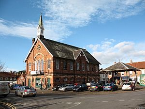 Easingwold Town Hall and Market Cross |
|
| Population | 4,627 (2011 census) |
| OS grid reference | SE529696 |
| • London | 185 mi (298 km) S |
| Civil parish |
|
| Unitary authority |
|
| Ceremonial county | |
| Region | |
| Country | England |
| Sovereign state | United Kingdom |
| Post town | YORK |
| Postcode district | YO61 |
| Dialling code | 01347 |
| Police | North Yorkshire |
| Fire | North Yorkshire |
| Ambulance | Yorkshire |
| EU Parliament | Yorkshire and the Humber |
| UK Parliament |
|
Easingwold is a friendly market town and civil parish in North Yorkshire, England. It's a place where people have traded goods for centuries!
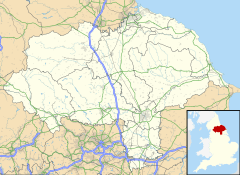
This town is part of the historic North Riding of Yorkshire. In 2001, about 4,233 people lived here, and by 2011, the population grew to 4,627. Easingwold is located about 12 miles (19 km) north of York, close to the beautiful Howardian Hills.
Contents
A Look at Easingwold's History
Easingwold has a long history, even being mentioned in the famous Domesday Book from 1086. Back then, it was called "Eisicewalt." The land changed hands many times, from powerful earls to kings, including King Henry III and King Edward I. Eventually, it became part of the Crown's lands.
How Easingwold Got Its Name
The town we know today was actually formed from two smaller villages: Uppleby and Lessimers. Uppleby was a settlement named after a Dane called Upple. Lessimers was an Angle settlement on land that was often wet and leased out.
The name Easingwold itself comes from old Anglo-Saxon words. Wold means forest, and the first part, Easin, might come from a Saxon family name like Esa. Did you know that King John once had a hunting lodge here? The area was surrounded by a large royal forest called the Forest of Galtres.
The Market Place and Old Buildings
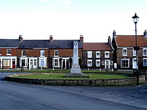
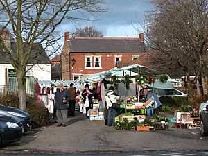
The heart of Easingwold is its market place. This is where an old toll booth used to stand. You can still see the base of the old market cross next to the Easingwold Town Hall. The Town Hall was built as a public meeting place and replaced some old butcher shops.
People have been holding markets in Easingwold since at least 1221! These markets became official when King Charles I granted special permission. In the 1700s, two important inns, the New Inn and the Rose and Crown, served travelers passing through town.
From Workhouse to Hospital
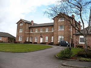
A building that was once a "workhouse" (a place where poor people could live and work) was built in Easingwold in 1756. Later, in 1934, this building was changed into a hospital. It was known as Claypenny Hospital and cared for people with learning disabilities. Most of the site was later sold and turned into homes.
The Old Railway Line
In 1891, a private railway line was built to connect Easingwold to the main railway line between London and Edinburgh. This was a big deal because earlier attempts to get the main line to pass closer to the town hadn't worked. The Easingwold line carried passengers until 1948 and goods until 1957. Today, all that's left of the old station is the station house.
Historic Buildings and Conservation Areas
Easingwold has many historic buildings! There are 51 buildings listed as Grade II, which means they are important and protected. These include some old mileposts and even a telephone box! Certain areas, like Long Street, the Parish Church area, Uppleby, and the market place, are special "Conservation Areas" to protect their historic look.
The Scout Movement in Easingwold
In 1908, Baden-Powell, who started the Scout Movement, visited Easingwold. Just two years later, Easingwold got its very own Scout Group!
How Easingwold is Governed
Easingwold is part of the Wetherby and Easingwold area for the UK Parliament. This area was created in 2024. Before that, it was part of a different area called Thirsk and Malton.
The town also has its own local government called the Town Council. It's made up of 11 councillors who help make decisions for the town.
Easingwold's Location and Surroundings
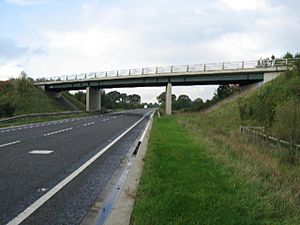
Easingwold is a central point for many smaller villages nearby. A major road, the A19, now goes around the town, making it easier for traffic to pass through.
The closest larger towns are York (12 miles or 19 km south), Boroughbridge (8 miles or 13 km west), Thirsk (10 miles or 16 km northwest), and Malton (16 miles or 26 km east). The highest point in Easingwold is about 200 feet (61 meters) high, located on Oulston Road.
Parks and Green Spaces
After the Claypenny Hospital closed, the land was turned into a housing estate and a beautiful 34-acre park called Millfields Park. It opened in 1999 and is now looked after by the Woodland Trust. It's a great place for walks and has many different types of trees and shrubs. Every Saturday morning, a 5 km event called Millfield parkrun takes place here!
Closer to the town center is Memorial Park. This park opened in 1955 and is another lovely green space for everyone to enjoy.
What Easingwold's Economy is Like
Easingwold has many local shops and businesses. While there used to be many more pubs and breweries, you can still see the names of old breweries on some local houses!
Buses connect Easingwold to nearby villages, towns, and the city of York. These services are now run by Reliance Motor Services.
The Cabinet Office, a part of the UK government, has its Emergency Planning College located at Hawkhills in Easingwold. This college helps people prepare for emergencies.
The town also has its own local newspaper, the Easingwold Advertiser, which shares news and interesting stories about the town and its surrounding areas.
Public Services in Easingwold
Easingwold has important public services. The police station on Church Avenue is open part-time. The fire station on Stillington Road is staffed by firefighters who are on-call from their homes or workplaces. St Monica's Community Hospital is located on Long Street, but it does not have an emergency room.
The town also has local council offices, a public library in Tanpit Lane, and a tourist information office in Chapel Lane.
Education in Easingwold
In 1781, a grammar school was started in Easingwold. Today, that same site is home to Easingwold Community Primary School. Another school, built in 1862, now houses the town library.
In 1954, a secondary school called Easingwold School was built. It's now known as Outwood Academy Easingwold and has about 1,000 students. This school serves students from many local primary schools in the area.
Media and News
For local news and TV shows, people in Easingwold can watch BBC Yorkshire and BBC North East and Cumbria on BBC One, and ITV Yorkshire and ITV Tyne Tees on ITV1.
Local radio stations include BBC Radio York, Greatest Hits Radio Yorkshire, YO1 Radio, and YorkMix Radio. As mentioned before, the town also has its own newspaper, the Easingwold Advertiser.
Culture and Entertainment
Fans of the historical TV drama Downton Abbey might recognize Easingwold! Characters in the show sometimes mention going to church in Easingwold, along with nearby towns like Thirsk and Ripon.
Sports and Activities
Easingwold is a great place for sports! The Easingwold Town AFC football club was founded way back in 1892. They've won the York FA Senior Cup before.
The Galtres Centre offers many activities like badminton, tennis, netball, and gymnastics. It also has an indoor shooting range for a local rifle and pistol club.
Easingwold Cricket Club plays at Memorial Park and is part of the York & District Senior League. If you enjoy golf, Easingwold Golf Club is located just south of the town.
Places of Worship
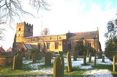
Easingwold has several churches. A church dedicated to St John and All Saints has been here since Saxon times, though the current building dates from the 15th century.
St John's Church, Easingwold, the Catholic church on Long Street, was built in 1833. It was designed by Charles Hansom, whose brother invented the famous Hansom cab.
There has been a Wesleyan chapel in Easingwold since 1786, moving to its current location in Chapel Street in 1975. There used to be another Methodist chapel, built in 1870.
Images for kids
See also
 In Spanish: Easingwold para niños
 | Delilah Pierce |
 | Gordon Parks |
 | Augusta Savage |
 | Charles Ethan Porter |


