Elk Garden, West Virginia facts for kids
Quick facts for kids
Elk Garden, West Virginia
|
|
|---|---|

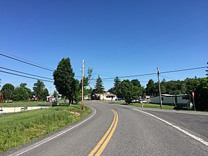
View entering Elk Garden from the south via West Virginia Route 42
|
|

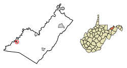
Location of Elk Garden in Mineral County, West Virginia.
|
|
| Country | United States |
| State | West Virginia |
| County | Mineral |
| Area | |
| • Total | 0.26 sq mi (0.67 km2) |
| • Land | 0.26 sq mi (0.67 km2) |
| • Water | 0.00 sq mi (0.00 km2) |
| Elevation | 2,264 ft (690 m) |
| Population
(2020)
|
|
| • Total | 211 |
| • Estimate
(2021)
|
210 |
| • Density | 821.71/sq mi (317.81/km2) |
| Time zone | UTC-5 (Eastern (EST)) |
| • Summer (DST) | UTC-4 (EDT) |
| ZIP code |
26717
|
| Area code(s) | 304 |
| FIPS code | 54-24484 |
| GNIS feature ID | 2390165 |
Elk Garden is a small town located in Mineral County, West Virginia, in the United States. It's part of a larger area that includes Cumberland, MD. In 2020, about 211 people lived there.
Elk Garden High School joined Keyser High School in 1997. However, the Elk Garden Primary School is still open. It teaches students from pre-kindergarten up to fifth grade. The school's mascot is the Elk Garden Stags. The town of Elk Garden was officially formed in 1890. It got its name from a place where elk used to go to lick salt from the ground, which was near the original town site.
Contents
About Elk Garden's Location
Elk Garden is a small town. According to the United States Census Bureau, the town covers an area of about 0.67 square kilometers (0.26 square miles). All of this area is land.
Getting Around Elk Garden
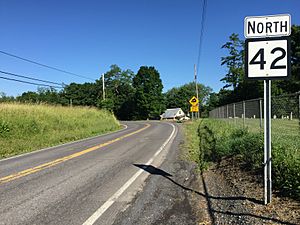
The main road that goes through Elk Garden is West Virginia Route 42. This road goes north into Maryland. It also goes south to connect with U.S. Route 50 and continues towards Petersburg. Just east of Elk Garden, another road called West Virginia Route 46 begins. Route 46 then heads northeast, eventually reaching Luke.
Elk Garden's Population Over Time
| Historical population | |||
|---|---|---|---|
| Census | Pop. | %± | |
| 1890 | 723 | — | |
| 1900 | 581 | −19.6% | |
| 1910 | 438 | −24.6% | |
| 1920 | 422 | −3.7% | |
| 1930 | 299 | −29.1% | |
| 1940 | 342 | 14.4% | |
| 1950 | 318 | −7.0% | |
| 1960 | 329 | 3.5% | |
| 1970 | 291 | −11.6% | |
| 1980 | 291 | 0.0% | |
| 1990 | 261 | −10.3% | |
| 2000 | 217 | −16.9% | |
| 2010 | 232 | 6.9% | |
| 2020 | 211 | −9.1% | |
| 2021 (est.) | 210 | −9.5% | |
| U.S. Decennial Census | |||
What the 2010 Census Showed
In 2010, the census counted 232 people living in Elk Garden. There were 92 homes, and 69 of these were families. The town had about 892 people per square mile (344 people per square kilometer). There were 108 housing units in total.
Most of the people living in Elk Garden were White (98.3%). A small number (1.7%) were from two or more racial backgrounds.
About 34.8% of homes had children under 18 living there. More than half (53.3%) were married couples. Some homes were led by a single mother (13.0%) or a single father (8.7%). About 25.0% of homes were not families.
The average age of people in Elk Garden was 41 years old. About 22.8% of residents were under 18. Around 15.9% were 65 years old or older. The town had slightly more males (51.7%) than females (48.3%).
See also
 In Spanish: Elk Garden (Virginia Occidental) para niños
 | John T. Biggers |
 | Thomas Blackshear |
 | Mark Bradford |
 | Beverly Buchanan |


