
Fairmount, Georgia facts for kids
Quick facts for kids
Fairmount, Georgia
|
|
|---|---|

Fairmount City Hall
|
|

Location in Gordon County and the state of Georgia
|
|
| Country | United States |
| State | Georgia |
| County | Gordon |
| Incorporated (town) | January 1, 1897 |
| Incorporated (city) | 1927 |
| Area | |
| • Total | 1.83 sq mi (4.73 km2) |
| • Land | 1.83 sq mi (4.73 km2) |
| • Water | 0.00 sq mi (0.00 km2) |
| Elevation | 745 ft (227 m) |
| Population
(2020)
|
|
| • Total | 772 |
| • Density | 422.78/sq mi (163.22/km2) |
| Time zone | UTC-5 (Eastern (EST)) |
| • Summer (DST) | UTC-4 (EDT) |
| ZIP code |
30139
|
| Area code(s) | 706/762 and 770/678/470 |
| FIPS code | 13-28492 |
| GNIS feature ID | 0355758 |
Fairmount is a small city in Gordon County, Georgia, in the United States. In 2010, about 720 people lived there. By 2020, the population grew to 772.
Fairmount is close to the southern part of the Blue Ridge Mountains. It's also near the Chattahoochee National Forest, a beautiful natural area. Gordon County is famous for New Echota. This was once the capital city of the Cherokee Nation. The Cherokee people developed their written language and newspaper, the Cherokee Phoenix, there.
Contents
A Look Back: Fairmount's History
Fairmount has been around for a long time. A post office opened here in 1850. The city got its name from another place called Fairmont, West Virginia. Fairmount officially became a town on January 1, 1897. Later, in 1927, it was recognized as a city.
Fairmount's Location: Geography
Fairmount is located in the southeastern part of Gordon County. It sits in a valley near Salacoa Creek. This creek flows northwest and joins the Coosawattee River.
How to Get Around: Roads and Routes
U.S. Route 411 goes right through the middle of Fairmount. It's known as Salacoa Avenue here. If you go north on US 411, you'll reach Chatsworth in about 24 miles. Going south for 21 miles takes you to Cartersville.
Georgia State Route 53 also crosses US 411 in Fairmount. Driving east on State Route 53 for 18 miles leads to Jasper. If you head west for 17 miles, you'll arrive in Calhoun. Calhoun is the main town in Gordon County.
Size of the City
The United States Census Bureau says that Fairmount covers a total area of about 4.6 square kilometers (or 1.8 square miles). All of this area is land.
Who Lives Here: Demographics
Fairmount's population has changed over the years. Here's how many people have lived in the city during different census years:
| Historical population | |||
|---|---|---|---|
| Census | Pop. | %± | |
| 1880 | 92 | — | |
| 1900 | 191 | — | |
| 1910 | 326 | 70.7% | |
| 1920 | 497 | 52.5% | |
| 1930 | 504 | 1.4% | |
| 1940 | 474 | −6.0% | |
| 1950 | 573 | 20.9% | |
| 1960 | 619 | 8.0% | |
| 1970 | 623 | 0.6% | |
| 1980 | 842 | 35.2% | |
| 1990 | 657 | −22.0% | |
| 2000 | 745 | 13.4% | |
| 2010 | 720 | −3.4% | |
| 2020 | 772 | 7.2% | |
| U.S. Decennial Census | |||
In 2000, there were 745 people living in Fairmount. There were 307 households, which are groups of people living together. Most people in Fairmount were White (about 95.7%). A smaller number were African American (3.22%) or from other racial backgrounds. About 1.21% of the population was Hispanic or Latino.
Most households (57.3%) were married couples living together. About 30% of households had children under 18. The average household had 2.43 people.
The median age in Fairmount was 39 years old. This means half the people were younger than 39 and half were older.
Learning in Fairmount: Schools
Students in Fairmount attend several local schools:
- Fairmount Elementary School
- Red Bud Middle School
- Sonoraville High School
- Gordon Central High School (This school is located in nearby Calhoun, GA)
Images for kids
-
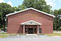
Fairmount City Hall
-
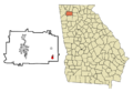
Location of Fairmount in Gordon County, Georgia
See also
 In Spanish: Fairmount (Georgia) para niños
