Farmington (CDP), Maine facts for kids
Quick facts for kids
Farmington, Maine
|
|
|---|---|

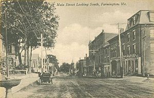
Main Street
|
|
| Country | United States |
| State | Maine |
| County | Franklin |
| Town | Farmington |
| Area | |
| • Total | 4.04 sq mi (10.48 km2) |
| • Land | 4.04 sq mi (10.45 km2) |
| • Water | 0.01 sq mi (0.03 km2) |
| Elevation | 413 ft (126 m) |
| Population
(2020)
|
|
| • Total | 4,168 |
| • Density | 1,032.96/sq mi (398.79/km2) |
| Time zone | UTC-5 (Eastern (EST)) |
| • Summer (DST) | UTC-4 (EDT) |
| ZIP code |
04938
|
| Area code(s) | 207 |
| FIPS code | 23-24740 |
| GNIS feature ID | 0566054 |
Farmington is a special area in the state of Maine, United States. It's called a census-designated place (CDP). This means it's a part of the larger town of Farmington that the government counts separately for population. Farmington is also the main town, or county seat, of Franklin County.
In 2020, about 4,168 people lived in the Farmington CDP. The whole town of Farmington had about 7,760 people. A big part of Farmington is the University of Maine at Farmington, which is located right in the CDP.
Where is Farmington?
Farmington CDP is located right in the middle of the town of Farmington. You can find it at these coordinates: 44°40′11″N 70°8′46″W / 44.66972°N 70.14611°W.
Several important roads pass through Farmington. U.S. Route 2 goes through the southern part of the area. It connects Farmington to Skowhegan (about 27 miles east) and Rumford (about 30 miles west).
Maine State Route 4 runs through the center of Farmington. This road leads northwest to Rangeley (about 40 miles away) and south to Lewiston (about 46 miles away).
Maine State Route 27 also goes through the center of town. It heads north towards the Canada–US border at Coburn Gore (about 72 miles north). To the southeast, it goes to Augusta, which is the capital city of Maine (about 37 miles away).
Land and Water
The Farmington CDP covers a total area of about 4.04 square miles (10.48 square kilometers). Most of this area is land, about 4.04 square miles (10.45 square kilometers). Only a tiny part, about 0.01 square miles (0.03 square kilometers), is water.
The Sandy River flows through the western side of Farmington. This river is a branch of the larger Kennebec River. On the west side of the Sandy River is a neighborhood called West Farmington. It's connected to the town center by a bridge on US 2. Another stream, Temple Stream, also joins the Sandy River in the southwestern part of the CDP.
People of Farmington
| Historical population | |||
|---|---|---|---|
| Census | Pop. | %± | |
| 2020 | 4,168 | — | |
| U.S. Decennial Census | |||
In 2000, there were 4,098 people living in the Farmington CDP. There were 1,568 households, which are groups of people living together in one home.
The population was quite diverse. Most people were White, but there were also people who identified as Black or African American, Native American, Asian, and from other backgrounds. Some people identified with two or more races. A small percentage of the population was Hispanic or Latino.
The average age of people in Farmington was 24 years old. This is because many young people attend the University of Maine at Farmington.
See also
 In Spanish: Farmington (condado de Franklin) para niños
 | Charles R. Drew |
 | Benjamin Banneker |
 | Jane C. Wright |
 | Roger Arliner Young |


