Ford Butte facts for kids
Quick facts for kids Ford Butte |
|
|---|---|

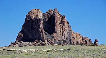
Southwest aspect
|
|
| Highest point | |
| Elevation | 6,156 ft (1,876 m) |
| Prominence | 526 ft (160 m) |
| Isolation | 1.74 mi (2.80 km) |
| Parent peak | Bennett Peak (6,471 ft) |
| Geography | |
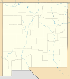
| Location | San Juan County, New Mexico, US |
| Parent range | Chuska Mountains Colorado Plateau |
| Topo map | USGS Little Water |
| Geology | |
| Age of rock | Oligocene |
| Mountain type | Volcanic plug |
| Type of rock | Volcanic breccia |
| Climbing | |
| First ascent | 1971 |
| Easiest route | class 5.7 climbing |
Ford Butte is a cool mountain peak in northwest New Mexico, United States. It stands tall at 6,156 feet (1,876 meters) above sea level. This landmark is found on Navajo Nation land in San Juan County.
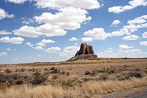
Ford Butte is easy to spot, just one mile east of U.S. Route 491. Its taller neighbor, Bennett Peak, is on the other side of the highway. Ford Butte is a special kind of ancient volcano called a volcanic plug. It rises about 450 feet (137 meters) from the flat desert ground.
This interesting peak is part of the Navajo volcanic field. This area has many unique rocks that formed about 30 million years ago. That was during a time called the Oligocene epoch. The name "Ford Butte" became official in 1915.
Climbing Ford Butte
Many people enjoy climbing mountains, and Ford Butte offers a challenge. The very first time someone climbed the north peak was in 1971. Mark Dalen and David Nordstrom were the first to reach the top. They used a climbing route rated as 5.7.
Later, on April 6, 1990, Cameron Burns and Mike Baker climbed the south peak. Their route was a bit harder, rated as 5.9. If you ever want to climb Ford Butte, remember you need to get permission first. This is because the mountain is on Navajo land.
Weather Around Ford Butte
Ford Butte is in a semi-arid climate zone. This means it gets very little rain. Winters here are cold, and summers can be quite hot. The mountain is also part of the Chaco River area, which collects water from the land.
More to Explore


