Forest of Dartmoor facts for kids
The Forest of Dartmoor is an ancient royal forest covering part of Dartmoor, Devon, England.
A royal forest was a special area of land. The king reserved it for hunting. William the Conqueror brought this idea to England in the 1000s. He introduced special "forest laws." These laws were very strict. They controlled who could hunt and what they could do in these areas.
Until 1204, all of Devon was a royal forest. But in that year, King John agreed to change things. He removed forest law from most of Devon. This was done after the people of Devon paid a large sum of money. Only Dartmoor and Exmoor remained under forest law.
This change was confirmed by King Henry III in 1217. In 1239, King Henry III gave the Forest of Dartmoor to his brother, Richard, Earl of Cornwall. After this, it was technically called a chase. A chase was similar to a forest but owned by a nobleman, not the king. However, the name "Forest of Dartmoor" stayed the same.
The next year, in 1240, King Henry III ordered a survey. He wanted to record the exact borders of the Forest. This was because Richard had a disagreement with some knights. These knights owned land next to the forest. The survey happened on July 24, 1240. It is known as "the 1240 Perambulation." Around this time, the first old farms, called Ancient Tenements, were built inside the Forest.
Richard's son, Edmund, inherited the forest. But he died in 1300 without any children. So, the forest went back to the king. King Edward II gave it to his friend, Piers Gaveston, in 1308. When Gaveston died in 1312, it returned to the king again.
Then, in 1337, King Edward III gave the forest to Edward, the Black Prince. He also made him the first Duke of Cornwall. Today, the forest still belongs to the Duchy of Cornwall. In 1982, a walking path was created. It follows the old forest boundaries as closely as possible.
The Forest Boundaries: "Perambulations"
The original document describing the 1240 Perambulation is now lost. However, many copies from that time still exist. They only have small differences in spelling. This table shows the places mentioned in the 1240 Perambulation. It compares the old names with modern place names.
| Original text of 1240 (alternative spellings in brackets) | Modern placename | Notes |
|---|---|---|
| …ad hogam de Cossdonne | Cosdon | A prominent hill on the northern edge of Dartmoor |
| et inde linealiter usque ad parvam hogam que vocatur parva Hundetorre, | Hound Tor | |
| et inde linealiter usque ad Thurlestone, | Watern Tor | |
| et inde linealiter usque ad Wotesbrokelakesfote que cadit in Tyng, | Hew Lake Foot | |
| et inde linealiter usque ad Heigheston (Hengheston) | The Longstone on Shovel Down | A Bronze Age standing stone |
| et inde linealiter usque ad Langestone (Yessetone) | The Heath Stone | |
| et inde linealiter usque per mediam turbariam de Alberysheved (Aberesheved) | The marsh at the head of the Metheral Brook | |
| et sic in longum Wallebroke | Acknowledged to be a scribe's error | |
| et inde linealiter usque ad Furnum regis | King's Oven | |
| et inde linealiter usque ad Wallebrokeshede | The head of the Walla Brook | |
| et sic in longum Wallebroke usque cadit in Dertam, | Along the Walla Brook to its confluence with the East Dart River | |
| et sic per Dertam usque ad aliam Dertam, | Dartmeet | |
| et sic per aliam Dertam ascendendo usque Okebrokysfote, | Up the West Dart River to the foot of the O Brook | |
| et sic ascendendo Okebroke usque ad la Dryeworke, | Up the O Brook to Dry Lake | A tinner's gulley |
| et ita ascendendo usque ad la Dryfeld ford, | The Sandy Way | |
| et sic inde linealiter usque ad Battyshull (Cattyshill, Gnattishull) | Ryder's Hill | |
| et inde linealiter usque ad caput de Wester Wellabroke | The head of the Weston Wella Brook | |
| et sic per Wester Wellabroke usque cadit in Avenam, | Down the Weston Wella Brook to its confluence with the River Avon | |
| et inde linealiter usque ad Ester Whyteburghe | Eastern Whittabarrow | A large cairn |
| et inde linealiter usque ad la Redelake (Rodelake) que cadit in Erme | The confluence of Red Lake and the River Erme | |
| et inde linealiter usque ad Grymsgrove | The head of the River Erme | |
| et inde linealiter usque ad Elysburghe | Eylesbarrow | |
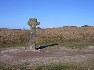
| et sic linealiter usque at crucem Sywardi | Nun's Cross | |
| et inde usque ad Ysfother | South Hessary Tor | |
| et sic per aliam Ysfother | North Hessary Tor | |
| et inde per mediam Mystor (Mistmore) | Great Mis Tor | |
| usque ad Mewyburghe | White Barrow | |
| et inde usque ad Lullingesfote (Hullingssete) | Limsboro Cairn | |
| et inde usque ad Rakernesbrokysfote, | The confluence of the Rattle Brook and the River Tavy | |
| et sic ad caput ejusdem aque | Up the Rattle Brook to its head | |
| et deinde usque ad la Westsolle | Stenga Tor | |
| et inde linealiter usque ad Ernestorre | High Willhays | Some sources say this is Yes Tor |
| et inde linealiter usque at vadum proximum in orientali parte capelle Sancti Michaelis de Halgestoke | Halstock Chapel | |
| et inde linealiter usque ad predictum hogam de Cossdonne in orientali parte | Return to Cosdon |
Another survey of the forest boundaries happened in 1608. This survey made some changes. It also added more boundary points between the existing ones. The exact borders of the forest remained unclear or debated until the late 1800s.
 | William Lucy |
 | Charles Hayes |
 | Cleveland Robinson |


