River Erme facts for kids
Quick facts for kids River Erme |
|
|---|---|
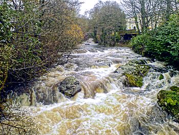
The Erme flowing through the town of Ivybridge
|
|
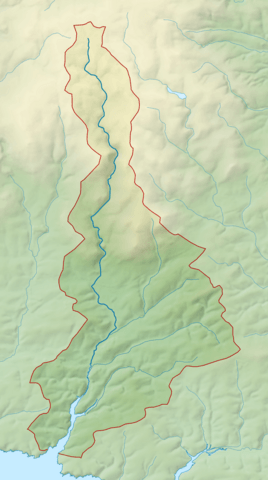
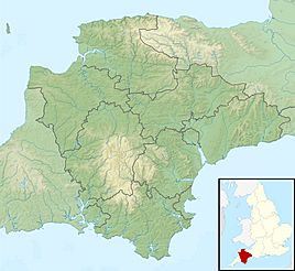
Map of the course and catchment of the River Erme
|
|
|
Location within Devon
|
|
| Country | England |
| Counties | Devon |
| Physical characteristics | |
| Main source | Dartmoor |
| River mouth | English Channel Mothecombe 50°18′29″N 3°57′03″W / 50.3080°N 3.9509°W |
The River Erme is a river in south Devon, England. It starts high up on Dartmoor and flows south. Along its path, you can see some amazing old ruins from history. The river then leaves the moor at Ivybridge town. It continues south, passing through villages like Ermington, Modbury, and Holbeton. Near Holbeton, it turns into a special type of river mouth called a ria. Finally, it flows into the English Channel in Bigbury Bay. The Erme is located between the River Yealm and the River Avon.
Contents
The River Erme
The name "Erme" has been used for a long time. One of the first times it was written down was in 1240. People have spelled it in different ways over the years, like Irym or Arme. No one is exactly sure where the name came from.
Where the River Starts
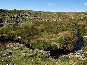
The River Erme begins near the middle of southern Dartmoor. Its source is close to the Abbot's Way walking path. It's less than a mile south of where the River Plym starts. Near these sources, you'll find Duck's Pool. This spot has a special plaque and a letterbox in memory of a famous Dartmoor writer, William Crossing.
Ancient History on Dartmoor
Close to the river's source are many old tin mining sites called Erme Pits. Some of these pits are over 15 meters deep! For its first mile, the river flows southeast. Smaller streams like Wollake, Dry Lake, and Red Lake join it. Red Lake starts near an old clay works. The spot where Red Lake joins the Erme is one of the 33 places that mark the old boundary of the Forest of Dartmoor.
Further downstream, the river flows through an area called The Meadow. Here, it's crossed by the Upper Erme stone row. This is the longest stone row on Dartmoor, stretching for over 3,320 meters. For more than a mile below this point, you can see many old archaeological remains along the riverbanks. These include Erme Pound, which is a large Bronze Age enclosure. You can also find Downing's House, a well-preserved "tinner's hut" where tin miners used to live. There are also many other tinner's huts and blowing houses, which were used to process tin.
As the river leaves the high moor, it flows through a gorge. This gorge was carved by the river between Stalldown Barrow and Piles Hill. On the eastern side of the gorge is Piles Copse. This is one of the few areas of ancient woodland left on Dartmoor. It's also a Site of Special Scientific Interest, meaning it's protected for its special nature.
Even though the Erme valley on Dartmoor looks natural today, the entire valley floor was actually changed by people. This happened because of a lot of tin-streaming work between the 4th and 14th centuries. Tin-streaming was a way of finding tin by washing away the soil.
The river then goes into enclosed land and under its first road bridge at Harford. Here, a smaller stream called Butter Brook joins it. From Harford down to the edge of the national park, the river flows through woodlands. This part of the river is popular for kayaking and canoeing, especially in Long Timber Woods.
Through Towns and Countryside
After leaving the national park, the river continues south through the town of Ivybridge. The river was very important to Ivybridge's success. It powered mills that made flour, paper, and processed wool. In 1813, the only bridge in the village inspired a famous painting by J. M. W. Turner called The Ivy Bridge.
Just south of Ivybridge, the river flows under the Devon Expressway. This is a major road connecting Exeter and Plymouth. The Erme then continues through the countryside. On its western bank is the village of Ermington, known for its church with a crooked spire. Near Ermington, the river's flow has been measured since 1973, showing an average flow of about 1.95 cubic meters per second.
The A379 road crosses the river at Sequer's Bridge. Shortly below this bridge, the river flows over a weir and becomes tidal. This means the water level here goes up and down with the ocean tides. Around this part of the river, you can still see some apple orchards. The field boundaries here are made of walls built from rounded river stones, which look like the dry stone walls found on Dartmoor.
The Erme Estuary
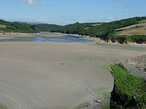
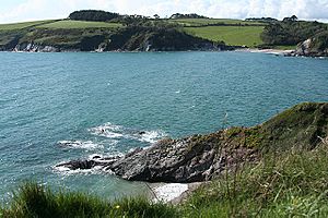
As the river passes east of Holbeton, it becomes a ria. A ria is a river valley that has been flooded by the sea. This area has large sections of salt marsh and mud that appear when the tide is low. The rocks in this area are mostly slate from the Devonian period. The river flows into the English Channel near the villages of Kingston and Mothecombe. At the mouth of the estuary are the beaches of Wonwell and Mothecombe. The entire estuary is surrounded by the large 5,000-acre Flete Estate.
A Look Back in Time
In the early 1990s, 42 tin ingots (blocks of tin) were found in the mouth of the estuary. These ingots are very old, dating from between 500 BC and 600 AD. Tin mining was very important on Dartmoor for a long time. It was a big part of the economy in South Devon.
There's an Iron Age hill fort at Holbury, overlooking the estuary. There's also evidence of an early fort and settlement from the 11th century at Oldaport. In the 1950s and 1990s, pieces of ancient Roman pots were found on Mothecombe beach.
You can see four ruined lime kilns in the estuary. These kilns were used to make lime, which was important for building and farming. Limestone was brought by sea from Plymouth, and coal came from South Wales. The coal was unloaded onto horse-drawn carts or small barges to be moved further up the estuary. There used to be a canal from Clyng Corn Mill to Orcheton Quay. This canal helped move goods to and from Modbury.
For many years, there was a fishing community on Wonwell beach. The houses are now in ruins. Fishermen worked here until the 1960s, catching lobster and crab. They would boil their catch on the beach and carry it to Kingston village on donkeys.
Many ships have been lost in this area over the centuries. The Salcombe Cannon Wreck from the 1630s is a famous underwater site. A large Swedish gun from the late 1600s was also found in the estuary. In 1793, a ship called HMS Pigmy ran aground on the East Mary rocks, which are mostly underwater. The ship's pilot thought he was entering Plymouth Sound, which is 14 miles away!
Smugglers and Coastguards
Smuggling used to happen in the estuary. At first, "Riding Officers of the Preventive" patrolled the coast. Later, the coastguards took over. You can still see the original Coastguard Cottages above Coastguard Beach. In the 1800s, the Coastguard Station at Mothecombe had five boatmen and an officer. Coastguards were also based in Kingston village.
The Erme During World War II
During World War II, a ship called Persier was hit by a torpedo near the Eddystone Lighthouse in 1945. Its wreck is just outside the estuary. In 1940, Indian troops were stationed nearby. They used mules to deliver barbed wire for coastal defenses at Mothecombe.
There's a story about a dog setting off mines in the estuary. A group of soldiers was stationed on Wonwell Beach. There was a minefield at the high-water mark, fenced off from the land. Mothecombe Beach had a similar minefield. One of the mines on Wonwell exploded because of a missing dog. Other mines became unstable and also exploded. Old maps from 1919 and 1947 show a "rifle range" stretching up the estuary, which might have been used during the war.
Filming Locations
The Erme estuary has been used for filming many movies and TV shows. Parts of the Hornblower TV series were filmed on Wonwell and Mothecombe beaches. The opening scene of International Velvet (1978) was shot across the sands. In 1985, Scobbiscombe Farm, near the estuary, was used for the film Revolution, which was about the American War of Independence. This movie starred famous actors like Al Pacino and Donald Sutherland. Sense and Sensibility (1995) was filmed at several spots on the estuary, including Efford House and Mothecombe Beach. The TV miniseries Rebecca (1996) was also filmed at Mothecombe.
The Erme Today
Today, the estuary is a protected area called an Area of Outstanding Natural Beauty. There's a plan in place to help manage and protect the Erme Estuary. The South West Coast Path crosses the estuary between the slipways on the Wonwell (east) and Mothecombe (west) sides. You can only cross at low tide, and even then, you'll likely get your knees wet! The alternative route by road is about 9 miles around the estuary.
Plants and Animals
The Erme estuary is home to many interesting plants and animals. Little egrets live here all year round. You can also regularly see curlews, oystercatchers, and common shelducks. Kingfishers are often spotted above Holbeton. Weaverfish like to bury themselves in the gravel when the water is low.
Beaches to Explore
Mothecombe Beach (also called Meadowsfoot Beach) is open on Wednesdays, Saturdays, and Sundays. There's an old building on the south side of the beach. It was built in the 1870s as a private tea room for picnics. It stands on the foundations of an even older lime kiln. A little further south, there's a small circular stone wall that fills with water at high tide. This used to be a swimming pool. You can also find a World War II pillbox nearby.
Coastguards Beach and Wonwell Beach are open every day. Coastguards Beach also has a pillbox, though it's now mostly covered by plants. The remains of another pillbox are south of Coastguards beach, but it has been damaged by the sea.
 | Shirley Ann Jackson |
 | Garett Morgan |
 | J. Ernest Wilkins Jr. |
 | Elijah McCoy |


