Ivybridge facts for kids
Quick facts for kids Ivybridge |
|
|---|---|
 Fore Street, Ivybridge |
|
| Population | 11,851 (2011) |
| OS grid reference | SX635560 |
| • London | 182 mi (293 km) |
| Civil parish |
|
| District | |
| Shire county | |
| Region | |
| Country | England |
| Sovereign state | United Kingdom |
| Post town | IVYBRIDGE |
| Postcode district | PL21 |
| Dialling code | 01752 |
| Police | Devon and Cornwall |
| Fire | Devon and Somerset |
| Ambulance | South Western |
| EU Parliament | South West England |
| UK Parliament |
|
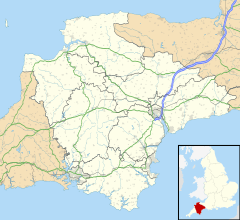
Ivybridge is a town and civil parish in Devon, England. It is located in an area called the South Hams. The town lies about 13 miles (21 km) east of Plymouth. Ivybridge is found at the southern edge of Dartmoor, which is a beautiful National Park. The A38 "Devon Expressway" road runs right by the town. In 2011, Ivybridge had a population of 11,851 people.
Ivybridge was first mentioned in the 1200s. It was important because it had a key crossing point over the River Erme. This bridge was on the main road between Exeter and Plymouth. In the 1500s, mills were built here. They used the river's power to work. Ivybridge became a civil parish in 1894 and officially a town in 1977.
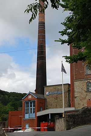
The town grew a lot during the Industrial Revolution. A large paper mill, Stowford Paper Mill, was built in 1787. It was rebuilt bigger in the 1860s. In 1848, the South Devon Railway arrived. The paper mill closed in 2013 after 226 years. Its buildings are now being turned into homes and shops. Many people who live in Ivybridge travel to work in other towns. However, some people work in Ivybridge itself. Farming is also important in the areas around the town.
Contents
- History of Ivybridge
- How Ivybridge is Governed
- Geography and Climate
- Population of Ivybridge
- What People Do in Ivybridge (Economy)
- Famous Places (Landmarks)
- Getting Around (Transport)
- Shopping in Ivybridge
- Schools and Learning (Education)
- Churches and Religion
- Sports and Activities
- News and Media
- Public Services
- Famous People from Ivybridge
- Ivybridge in Art and Books
- See also
History of Ivybridge
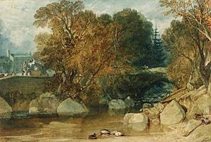
The name Ivybridge comes from a small bridge built in the 1200s. This bridge was shaped like a hump. It was covered in ivy, which is why it was called the "Ivy Bridge." For a long time, this was the only way to cross the river. Because the bridge was so important, the whole area was named the "parish of Ivybridge" in 1894.
The first record of a settlement here was in 1086. This was the manor of Stowford. Ivybridge itself was first mentioned in 1280. It was described as "land on the west side of the River Erme, by the Ivy Bridge." A chapel was built in 1402 where Saint John's Church is today. From the 1500s, mills used the river's power. Records show there was a corn mill, a tin mill, and an edge mill. One corn mill, 'Glanville's Mill', is now where many shops are. The shopping centre is named after it.
The first church, Saint John's, was built in 1790. It became a proper church in 1835. The oldest burial in its churchyard is from 1836. In the 1830s, a 'New Bridge' was built. This connected Fore Street and Exeter Road. It meant the Ivy Bridge was no longer the only crossing. Today, this new bridge has been updated for modern traffic.
Stowford Mill is shown on a special coin made for Ivybridge. This coin also features the town's tall viaduct. The viaduct is an impressive 104 feet high.
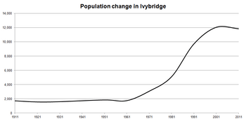
In 1977, Ivybridge officially became a town. It grew very quickly in the 1980s and 1990s. It was even called the fastest growing town in Europe. The building of the A38 "Devon Expressway" helped the town grow a lot.
How Ivybridge is Governed
Ivybridge has different levels of government that help run the town.
- The Town Council is the closest level of government. It has sixteen members elected from two areas: Ivybridge East and Ivybridge West. These members are elected every four years. They choose a mayor each year. The Town Council looks after parks, open spaces, and cemeteries. They also advise on building plans and speak for the town on things like transport and policing. They collect a local tax called the parish precept.
- The next level is the South Hams District Council. They handle things like building permits, local roads, and rubbish collection. They also look after leisure services and tourism.
- Then there is Devon County Council. They are in charge of bigger things like education, libraries, main roads, and public transport. They also manage policing and fire services.
- Finally, the Parliament of the United Kingdom makes laws for the whole country. This includes areas like health and justice.
Ivybridge is divided into two voting areas: Ivybridge East and Ivybridge West. The current mayor is Councillor Alan Spencer, chosen in May 2023. In 2007, the Ivybridge Town Council won an award for being the "Council of the Year." The old town hall is in Chapel Place. The new town hall is at Erme Court.
Before 1894, Ivybridge was part of four different parishes. These were Harford, Ugborough, Ermington, and Cornwood. All their borders met at the Ivy Bridge. In 1836, the Parish of Saint John was created. This covered the small central area of Ivybridge. In 1894, this became the parish church for the new parish of Ivybridge.
The town is part of the South West Devon area for national elections. Its Member of Parliament (MP) is Gary Streeter. He is a member of the Conservative party.
International Connections
Ivybridge has special links with towns in other countries. These are called "twin towns."
 France: Saint-Pierre-sur-Dives, in France, since 1972.
 Germany: Beverungen, in Germany, since 1975.
 United States: Bedford, Virginia, in the USA, since 2004.
Geography and Climate
| Weather chart for Ivybridge | |||||||||||||||||||||||||||||||||||||||||||||||
|---|---|---|---|---|---|---|---|---|---|---|---|---|---|---|---|---|---|---|---|---|---|---|---|---|---|---|---|---|---|---|---|---|---|---|---|---|---|---|---|---|---|---|---|---|---|---|---|
| J | F | M | A | M | J | J | A | S | O | N | D | ||||||||||||||||||||||||||||||||||||
|
114
9
3
|
92
8
3
|
87
10
4
|
59
12
6
|
61
15
8
|
57
18
11
|
55
20
13
|
69
19
13
|
76
18
11
|
95
15
9
|
101
11
6
|
116
10
4
|
||||||||||||||||||||||||||||||||||||
| temperatures in °C precipitation totals in mm |
|||||||||||||||||||||||||||||||||||||||||||||||
|
Imperial conversion
|
|||||||||||||||||||||||||||||||||||||||||||||||
Ivybridge is in the south western part of England. It is 182 miles (293 km) from London. The main road, the A38, makes it easy for people to travel to nearby Plymouth.
The land in Ivybridge is mostly hilly. This is because the River Erme flows right through the middle of town. The land rises up on both sides of the river, forming a valley. The river enters the town at 300 feet (91 m) above sea level. It leaves at 130 feet (40 m) above sea level. The highest points of the valley are 260 feet (79 m) above sea level.
Western Beacon is a hill that looks over the town. Its peak is 1,076 feet (328 m) above sea level. You can see it from almost anywhere in Ivybridge. There are also beautiful woods called Longtimber Woods to the north. Many people enjoy walking along the river path there.
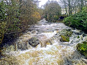
The rocks in Ivybridge are mostly Old Red Sandstone. This is a type of sedimentary rock. To the north, you can find Granite rock. This is because Ivybridge is on the edge of Dartmoor, which is a large granite area. The River Erme carries large rocks from Dartmoor. The Ivy Bridge itself is made of granite.
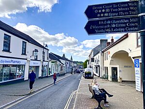
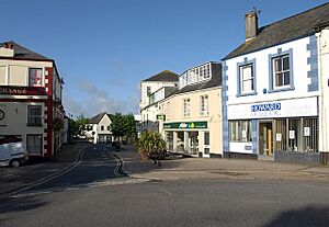
Most of Ivybridge has suburban streets and houses. In the town centre, you can see many Victorian buildings. Many of these old buildings are now shops along Fore Street. This is the main shopping area. Further out, you find more semi-detached and detached houses.
The town's growth has been shaped by the railway line to the north and the A38 road to the south. Because of these, Ivybridge has mostly grown east and west. It stretches about 1.76 miles (2.83 km) from east to west.
Ivybridge has a mild and wet climate, like the rest of South West England. The average yearly temperature is about 11°C (52°F). February is the coldest month. July and August are the warmest, with temperatures over 19°C (66°F). The area gets a lot of sunshine, over 1,600 hours a year. Rain often comes from storms over the Atlantic Ocean. The average yearly rainfall is about 980 mm (39 inches). Snow usually falls less than ten days each winter.
Population of Ivybridge
In 2011, Ivybridge had a population of 11,851 people. This means Ivybridge makes up about 14% of the total population of the South Hams area. It is about 1% of Devon's total population. The average age in Ivybridge is 42. This is a bit older than the national average for England, which is 39.
Most people in Ivybridge are white. About 98.7% of the population identify as white. This is higher than the average for England. A small number of people are from other ethnic groups.
What People Do in Ivybridge (Economy)
Ivybridge's early economy depended on the River Erme. There were mills for corn, tin, and other things. Later, the town grew because of the river and the railway. The Stowford Paper Mill was the biggest employer for a long time. It opened in 1787 and closed in 2013.
Today, many jobs in Ivybridge are in the service industry. Because of the A38, many people travel to Plymouth for work. Ivybridge also has some of its own businesses. There is a small industrial area in the south of town. Another industrial area is nearby at Lee Mill.
People are trying to make Ivybridge known as a great place for walking. It has good access to Dartmoor. You can walk along the old china clay railway route. Or you can follow the River Erme through Longtimber Woods. The Two Moors Way, a long walking path, starts in Ivybridge.
The main shopping area is along Fore Street and in Glanvilles Mill. These shops and restaurants provide many jobs. The local schools are also big employers. There are also large stores like Tesco Extra at Lee Mill. Ivybridge has six traditional public houses (pubs).
Famous Places (Landmarks)
The natural landmark of Ivybridge is Western Beacon. This hill gives amazing views of the town and the South Hams. The town's first man-made landmark is the Ivy Bridge. It is a 13th-century bridge covered in ivy. It is still used today and gives the town its name.
Two important industrial landmarks are the viaduct over the River Erme and the paper mill. The first viaduct was built by Isambard Kingdom Brunel in 1848. Only its granite pillars remain. The railway line used today was built in 1894. These structures were key to the town's growth.
In the town centre, there is a war memorial. It was built in 1922. Every year on Remembrance Day, a ceremony is held there. Another memorial nearby remembers American soldiers. They were stationed near Ivybridge in the 1940s. Many died on D-Day.
The Watermark is a modern landmark. It was finished in 2008. It is a library, an entertainment place, and a cinema.
Getting Around (Transport)
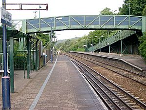
Ivybridge has always been a stop on the road between Exeter and Plymouth. The original "Ivy Bridge" is still used today for cars (one-way) and people walking. In the 1830s, a new bridge was built at the top of Fore Street. It is now a one-way road for cars. A separate bridge for walkers is next to it. Another bridge, Marjorie Kelly Way, was built in the 1990s. In 1974, the A38 road opened. This connected Ivybridge to Plymouth and Exeter.
The first railway station in Ivybridge opened in 1848. It was on the north side of the track. Passenger trains stopped running in 1959. A new station opened in 1994. It cost £380,000. This station is operated by Great Western Railway. They run trains to London Paddington and to Cornwall. The station is also used by people who want to park and ride to Plymouth.
The town has bus services. The Gold bus goes to Plymouth, Totnes, Paignton, and Torquay. It runs every half hour. The X38 bus goes to Exeter every two hours. Plymouth Citybus runs the 20A service to Plymouth every hour. This bus is popular with shoppers because it stops at the Tesco Superstore.
Shopping in Ivybridge
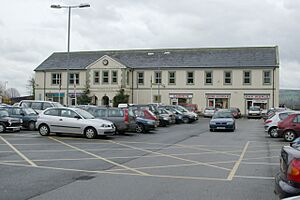
The main shopping area is along Fore Street. There are also small shops and restaurants in the Glanvilles Mill shopping centre. You can get to Glanvilles Mill from Fore Street or the car park.
Schools and Learning (Education)
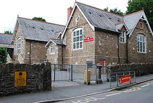
Ivybridge has six schools. There are four state primary schools. There is also Dame Hannah Roger's special school. Ivybridge Community College is the town's secondary school. It also has a sixth form for older students. The college is known for sports, science, maths, and languages. It serves a large area, including many villages.
Dame Hannah Rogers School offers boarding for children with disabilities. The closest university is the University of Plymouth. In 2008, a new library and resource centre called the Watermark opened. It replaced the old small library.
Some famous people from the college include:
- Michaela Breeze, a sports teacher who won gold medals in weightlifting at the Commonwealth Games.
- Nigel Martin, a footballer.
- Chris Bell, a retired rugby player.
- Geoffrey Rees, the former principal, who received an award for his work in education.
Churches and Religion
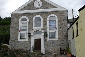
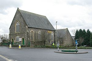
Ivybridge has five churches. St John's Church is the main Anglican church. There is also an Evangelical Baptist church and a Methodist church. On the edge of town is a Roman Catholic church called St Austin's Priory. The Salvation Army Church holds meetings in Fore Street.
In 2011, most people in Ivybridge (65.1%) said they were Christian. About 26.5% said they had no religion. A small number of people followed other religions like Buddhism, Islam, and Hinduism.
Sports and Activities
Ivybridge has many sports teams and clubs:
- Ivybridge Town F.C. is a football club founded in 1925. They play in a regional league.
- Manstow FC also plays football in Filham Park.
- The town has a flat green bowls club.
- Ivybridge Rugby Football Club has rugby pitches.
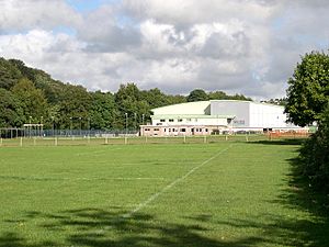
- Filham Park has a cricket club, football pitches, and a fishing lake.
There are also several places for sports and fun:
- South Dartmoor Leisure Centre has indoor and outdoor swimming pools. It also has a sports hall, squash courts, and a gym.
- South Devon Tennis Centre has four indoor and four outdoor tennis courts.
- Erme playing fields have a cricket field and two football pitches. The Erme Valley Harriers (athletics club) also use these fields.
- There is a skatepark in the town centre.
News and Media
Local news and TV shows come from BBC South West and ITV West Country.
Local radio stations include BBC Radio Devon, Heart West, and Greatest Hits Radio South West. TorDab is a local community radio station.
The town's local newspaper is the Ivybridge & South Brent Gazette. It is published every Friday.
Public Services
South West Water provides water and sewage services to the town. South Hams District Council manages waste and recycling.
Ivybridge has two health centres: Ivybridge Health Centre and Highlands Health Centre. Both are near the town centre. There are also four dentist surgeries. The nearest hospital is Derriford Hospital in Plymouth.
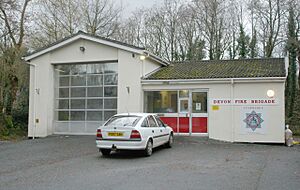
The Devon and Cornwall Constabulary police the town. There is a small police station in the centre. Ivybridge has one fire station. It is part of the Devon and Somerset Fire and Rescue Service. The fire station has a water tender and other equipment.
Famous People from Ivybridge
- Edmund Hartley was born in Ivybridge in 1847. He won a very brave award called the Victoria Cross during a war. Hartley Court in Fore Street is named after him.
- Hugh Morton, an actor, was born in the town in 1903.
Ivybridge in Art and Books
A picture of the river by Thomas Allom was made into an engraving. It was published in a book in 1835. A poem by Letitia Elizabeth Landon and music by Henry Russell were also included.
See also
 In Spanish: Ivybridge para niños
 | Claudette Colvin |
 | Myrlie Evers-Williams |
 | Alberta Odell Jones |


