
Fort Indiantown Gap facts for kids
Quick facts for kids Fort Indiantown Gap |
|
|---|---|
| Lebanon County, Pennsylvania | |
 |
|
| Coordinates | 40°26′13″N 76°34′34″W / 40.436987°N 76.576055°W |
| Type | National Guard Training Site |
| Site information | |
| Controlled by | Pennsylvania |
| Site history | |
| Built | 1931 |
| In use | 1931–present |
| Garrison information | |
| Current commander |
Col. Lane Marshall |
| Garrison | 28th Infantry Division and 213th Area Support Group |
Fort Indiantown Gap, often called "The Gap" or "FIG", is a special area in Lebanon County, Pennsylvania. It's a big training center for the National Guard. A small part of it is also in Dauphin County. You can find it near Interstate 81, about 23 miles (37 km) northeast of Harrisburg.
This place is a very busy training center for the National Guard. It's also where the main offices for the Pennsylvania Department of Military and Veterans Affairs and the Pennsylvania National Guard are located. The base covers about 18,000 acres (73 km2) of land. It has many areas for training soldiers and other military groups. Even law enforcement agencies use it for practice.
Fort Indiantown Gap is next to Memorial Lake State Park and Indiantown Gap National Cemetery. The local post office that serves the fort is in Annville, Pennsylvania. In 2010, about 143 people lived there. The official home of Pennsylvania's Lieutenant Governor, called State House, is also on the grounds.
The Fort Indiantown Gap Military Reservation has its own police force. The Fort Indiantown Gap Police Department helps keep everyone safe and makes sure traffic and other state laws are followed.
Contents
History of Fort Indiantown Gap
The story of Fort Indiantown Gap goes back a long time, to 1755. At that time, the Susquehannock Native Americans were upset with white settlers. Because of this, the government of Pennsylvania decided to build a fort in the area. The Susquehannock people, who lived and farmed this land, became allies against the colonists when the French and Indian War started.
During the war, the Susquehannock attacked colonial settlements. They used mountain passes like those in Blue Mountain, including Indiantown Gap. To stop these attacks, a line of forts was built across the northern part of Lebanon County. Fort Indiantown Gap was one of these important forts.
.jpg)
The current training base was first set up in 1931 by the Commonwealth of Pennsylvania. This happened because General Edward Martin suggested it as a training site for the National Guard. Over the years, the base has been home to the Pennsylvania National Guard and other parts of the United States Army.
In 1941, the base was officially named Indiantown Gap Military Reservation (IGMR). General Martin later became the Governor of Pennsylvania and then a U.S. Senator. After he passed away, the Pennsylvania Legislature tried to rename the base the Edward Martin Military Reservation. However, military people who served there never really accepted this new name. In 1975, the Secretary of the Army changed the name back to Fort Indiantown Gap. This made it more like other active military bases across the United States. Pennsylvania also brought back the Indiantown Gap name, which it still has today.
World War II and Expansion
World War II showed how important Fort Indiantown Gap was. It became one of the most important Army training camps in the country. It was a place where soldiers got ready before sailing overseas from New York. Building work started very quickly. About 13,000 workers built over 1,400 buildings. These included offices, fire stations, guest houses, chapels, theaters, a sports arena, and a large hospital.
Seven U.S. Army divisions completed their final training at The Gap before going to war. After the war ended, many units returning from Europe also came to The Gap to be sent home.
After World War II
From 1951 to 1953, during the Korean War, The Gap was important again. It became home to the 5th Infantry Division. Their job was to train 32,000 troops who would be sent to Korea.
In the late 1960s and early 1970s, during the Vietnam War, Fort Indiantown Gap hosted large summer camps for the Reserve Officers Training Corps (ROTC). This program trains college students to become Army officers.
In 1975, The Gap became a refugee camp for people from Southeast Asia. For eight months, over 32,000 refugees from Vietnam and Cambodia were helped to find new homes through the base.
In 1976, a part of Fort Indiantown Gap was chosen to be a new national cemetery. This cemetery would serve veterans from Delaware, Maryland, New Jersey, Virginia, and West Virginia. Pennsylvania gave the land for this special purpose.
In 1980, The Gap became a refugee camp once more. Over 19,000 people from Cuba came to The Gap after the Mariel boatlift. They were processed and helped to find sponsors. Some people were held longer by U.S. authorities. The last people from this group left The Gap in late 1981.
In 1990, The Gap was a center for military units getting ready for the first Persian Gulf War. Both active duty and reserve units used it.
In 1991, The Gap also served as a training center for the Pennsylvania State Police academy classes.
In 1995, a government commission suggested closing most of Fort Indiantown Gap. However, they wanted to keep some essential training areas for reserve military groups. In 1998, Pennsylvania took control of the land from the federal government. It was then turned back into a training site for the Army National Guard and U.S. Army Reserve units. Today, over 177,000 military personnel train at The Gap every year.
After September 11th
Fort Indiantown Gap is a key place for the 56th Stryker Brigade Combat Team. This is part of the 28th Infantry Division. It is the only National Guard Stryker brigade in the U.S. Army.
Since the September 11th attacks, The Gap has been a place where troops get ready for missions. These missions include operations in Bosnia and Kosovo. It also supports operations like Enduring Freedom and Iraqi Freedom. The Air National Guard Band of the Northeast (553rd Air Force Band) is also based here.
Geography
Fort Indiantown Gap covers a total area of about 19.0 square miles (49.2 km2). Most of this area, about 18.8 square miles (48.8 km2), is land. A small part, about 0.2 square miles (0.4 km2), is water.
Images for kids
-
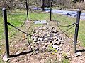
Franklin Stichler's grave along McLean Road at Fort Indiantown Gap, Pa.

See also
 In Spanish: Fort Indiantown Gap para niños
