Fort O'Rourke facts for kids
Quick facts for kids Fort O'Rourke |
|
|---|---|
| Part of the Civil War defenses of Washington, D.C. | |
| Fairfax County, Virginia, USA | |
| Type | Earthwork fort |
| Site information | |
| Controlled by | Union Army |
| Condition | Stabilized |
| Site history | |
| Built | 1862-3 |
| In use | 1862–1865 |
| Materials | Earth, timber |
| Demolished | 1865 |
| Battles/wars | American Civil War |
Fort O'Rourke was a military base used by the Union Army during the American Civil War. It is now located in the Belle Haven area of Fairfax County, Virginia. This fort was the southernmost one built to help defend Washington, D.C. during the war.
Contents
Why Northern Virginia Was Occupied
After Fort Sumter in Charleston, South Carolina, was attacked on April 14, 1861, President Abraham Lincoln said there was a "rebellion." He asked for 75,000 soldiers to help stop it. This made many southern states angry, and they started talking about leaving the United States.
The state of Virginia decided to vote on whether to leave the Union. The U.S. Army then created the Department of Washington. This group brought all Union soldiers in Washington, D.C., and Maryland under one leader.
General J.F.K. Mansfield was in charge of the Department of Washington. He believed that Northern Virginia should be taken over quickly. He worried that the Confederate Army might put cannons on the hills near Arlington. From there, they could shoot at government buildings in Washington.
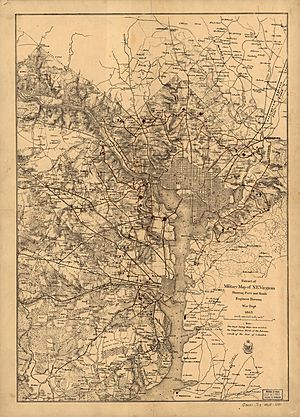
General Mansfield also wanted forts built on the Virginia side of the Potomac River. These forts would protect the ends of important bridges like the Chain Bridge and Long Bridge. His leaders agreed, but they waited until Virginia voted on leaving the Union.
On May 23, 1861, Virginia voted to leave the Union. Most people voted yes. That night, U.S. Army troops started crossing the bridges from Washington, D.C., into Virginia.
Building Defenses on High Ground
For the next seven weeks, forts were built along the Potomac River. They also built forts near the main bridges connecting Virginia to Washington and Georgetown.
While these river forts were being built, plans were made for a huge new ring of forts. These new forts would protect Washington from all directions, not just the direct path through Arlington. But in mid-July, this work stopped because of the First Battle of Bull Run. Soldiers who were building forts went to fight instead.
After the Union Army lost at Bull Run, people were scared of a Confederate attack on Washington. They quickly built temporary trenches and earthworks. These were mostly in Arlington and near the main roads into Washington.
On July 26, 1861, General George B. McClellan took command of the military district of Washington. He was shocked by how weak the city's defenses were. He said that the city was not ready to stop a strong enemy attack. There were no defenses on the Maryland side, and the enemy could easily shell the city.
To fix this, General McClellan ordered a big expansion of Washington's defenses. Forts and trenches would be built everywhere around the city. They needed to be strong enough to stop any attack. Alexandria was especially important. It had a large port and was a key location.
Building Fort O'Rourke
Fort O'Rourke was named after Patrick Henry O'Rourke, a soldier who died at Gettysburg. It was built in late 1862 and early 1863. It was a smaller fort, called a "redoubt," that helped protect a larger fort nearby, Fort Lyon.
Fort O'Rourke had a perimeter of 160 yards. This means its outer walls measured 160 yards around. It was designed to hold 16 cannons.
What's Left Today
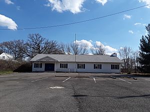
The place where Fort O'Rourke once stood is now at the corner of Fort Drive and Park Place. A small community center for the Fair Haven neighborhood is there today. You cannot see any remains of the old fort.
 | Bayard Rustin |
 | Jeannette Carter |
 | Jeremiah A. Brown |


