Fort Thomas, Arizona facts for kids
Quick facts for kids
Fort Thomas, Arizona
|
|
|---|---|
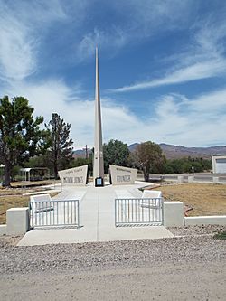
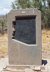
Monument dedicated to local native Melvin Jones, founder of Lions Club International.
|
|
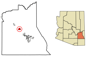
Location of Fort Thomas in Graham County, Arizona.
|
|
| Country | United States |
| State | Arizona |
| County | Graham |
| Area | |
| • Total | 8.67 sq mi (22.46 km2) |
| • Land | 8.67 sq mi (22.46 km2) |
| • Water | 0.00 sq mi (0.01 km2) |
| Elevation | 2,763 ft (842 m) |
| Population
(2020)
|
|
| • Total | 319 |
| • Density | 36.79/sq mi (14.21/km2) |
| Time zone | UTC−7 (Mountain (MST)) |
| ZIP code |
85536
|
| Area code(s) | 928 |
| GNIS feature ID | 2582785 |
Fort Thomas (which is called Western Apache: Gowąh Golgai Gohoshé in the Apache language) is a small community in Graham County, Arizona, United States. It's known as a census-designated place, which means it's an area with a lot of people but not an official city or town.
In 2020, about 319 people lived there. Fort Thomas has its own elementary school and high school. It's also part of the larger Safford area. The ZIP code for Fort Thomas is 85536.
Contents
History of Fort Thomas
The first military camp in this area was built in 1864. It was called Camp Goodwin, named after Arizona's first governor, John N. Goodwin. However, this camp was soon left empty because the buildings were not good and people got sick from malaria.
In 1876, a new spot was chosen for a military post near the Gila River. This new post was named Camp Thomas. It was named after George Henry Thomas, a important general from the American Civil War. Over the next few years, the area had different names like Clantonville and Maxey before finally becoming Fort Thomas in 1882.
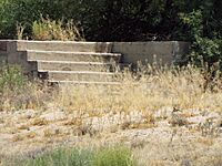
At its busiest, Fort Thomas had 27 buildings. Soldiers built all of these buildings using adobe, a type of mud brick. Even with new buildings, malaria was still a big problem. Because of this, Fort Thomas was sometimes called the "worst fort in the Army." The fort did not even get money from the government until 1884.
After the famous Apache leader Geronimo was captured in 1886, the Army slowly moved its soldiers away. In 1891, the fort was given to the Department of the Interior.
The town grew a lot in 1895. This happened when the Southern Pacific railroad stopped building nearby. The local Apache people did not want the railroad to go through their reservation. During this time, Fort Thomas also had a Wells Fargo station, which was important for sending money and goods.
Education
Fort Thomas has its own school system called the Fort Thomas Unified School District. This district serves students from Fort Thomas and also from nearby Bylas. The schools in the district are the Fort Thomas Elementary School and the Fort Thomas High School.
Population Facts
As of the 2020 census, the population of Fort Thomas was 319 people.
Geography and Climate
Fort Thomas is located at an elevation of about 2,822 feet above sea level. Its exact location is 33°2′14″N 109°57′58″W / 33.03722°N 109.96611°W.
Weather in Fort Thomas
Fort Thomas has a very dry climate, similar to a desert. Summers are very hot, and winters have mild days but cold nights. It often gets chilly enough for frost in winter, but it almost never snows.
Days in winter are usually comfortable, but it gets hot quickly as summer arrives. By May, temperatures often reach over 90°F (32°C). It can get over 100°F (38°C) many days during the year.
Rainfall is rare in Fort Thomas. Most of the rain comes from summer storms, but these are less common here than in other places. The wettest month ever recorded was January 1993. The driest year was 1989.
|
||||||||||||||||||||||||||||||||||||||||||||||||||||||||||||||||||||||||||||||||||||||||||||||||||||||||||||||||||||||||||||||
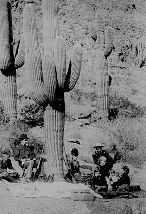
Pictures from the Past
Famous Person from Fort Thomas
- Melvin Jones – He started Lions Clubs International, a big service organization.
See also
 In Spanish: Fort Thomas (Arizona) para niños
 | Aurelia Browder |
 | Nannie Helen Burroughs |
 | Michelle Alexander |


