Fuar Tholl facts for kids
Quick facts for kids Fuar Tholl |
|
|---|---|

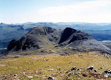
Fuar Tholl, seen from the adjoining Munro of Sgorr Ruadh. 2 km to the NW.
|
|
| Highest point | |
| Elevation | 907 m (2,976 ft) |
| Prominence | c. 237 m |
| Listing | Marilyn, Corbett |
| Naming | |
| English translation | Cold hollow |
| Language of name | Gaelic |
| Geography | |
| Location | Wester Ross, Scotland |
| Parent range | Northwest Highlands |
| OS grid | NG975489 |
| Topo map | Ordnance Survey Landranger 25 |
Fuar Tholl is a mountain in the highlands of Scotland. It is located in the Coulin deer forest. This mountain is about 21 kilometers southwest of Achnasheen. It's part of the Wester Ross region in the Highland council area.
About Fuar Tholl
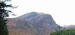
Fuar Tholl has a very rocky top. People sometimes call it Wellington's Nose. This is because its summit ridge looks like an upside-down face. It's said to resemble Arthur Wellesley, 1st Duke of Wellington. The "nose" part is the tip of the Mainreachan Buttress. You can just see it over the main summit.
Fuar Tholl is 907 meters (2976 feet) tall. This makes it the 13th highest Corbett. A Corbett is a Scottish mountain between 2,500 and 3,000 feet high. Fuar Tholl is only seven meters short of being a Munro. Munros are Scottish mountains over 3,000 feet. Many people think Fuar Tholl is the best mountain in the Glen Carron area.
The mountain's name comes from the Gaelic language. It means "Cold Hole." Ancient settlers in Glen Carron probably gave it this name. It refers to a deep eastern corrie, which is a bowl-shaped hollow. This corrie is often shaded from the sun.
Exploring Fuar Tholl's Features
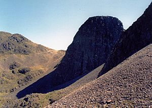
One of Fuar Tholl's best parts is Coire Mainnrichean. This is a rough, stone-filled hollow on the mountain's western side. Inside it are the amazing Mainreachan Buttress cliffs. These cliffs are about 500 feet high.
The Mainreachan Buttress is a top spot for ice climbing in Scotland. Many climbing routes were first explored here by Andy Nisbet.
The summit ridge of Fuar Tholl is one kilometer long. It has three high points. The main top is 907 meters high. It has a trig point, which is a marker used for surveying. This point is at the eastern end of the ridge. It sits above the eastern corrie that gave the mountain its name.
The top of the Mainreachan Buttress is the second high point. It is 895 meters tall. The third peak is Creag Mainnrichean. This peak is at the western end of the summit ridge. It reaches a height of 857 meters.
How to Climb Fuar Tholl
This mountain is close to the A890 road. It is also near the Kyle of Lochalsh railway line. The most common way to climb Fuar Tholl starts from Achnashellach station.
First, you follow a path towards Torridon for about 2 kilometers. Then, another path turns left. This path leads to a bealach. A bealach is a mountain pass or saddle between two peaks. This one is between Fuar Tholl and Sgorr Ruadh. From here, you can reach the summit. The path is steep and can be a bit loose with rocks.
There are other ways to climb the mountain from the south. These routes are often used for coming down. This allows climbers to make a circular journey.
You can also climb Fuar Tholl as part of a bigger trip. This trip involves going around Corrie Lair. It also includes climbing two Munros: Sgorr Ruadh and Beinn Liath Mhòr.
 | William Lucy |
 | Charles Hayes |
 | Cleveland Robinson |


