Geography of Melbourne facts for kids
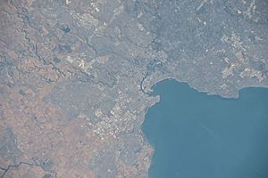
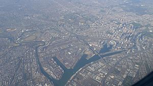
Melbourne is the capital city of Victoria, a state in Australia. It's located on the southeastern edge of the Australian continent. Melbourne is also in the southern central part of Victoria.
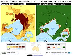
The city covers a large urban area of about 2,453 square kilometers. This makes it bigger than cities like Sydney, Greater London, and Mexico City in terms of land size. On average, about 16 people live in each hectare of land in Melbourne.
Melbourne is in a region with alpine forests called the High Country. The city and its surrounding areas also stretch along the lower parts of the Yarra River. To the east of Melbourne, you'll find the Dandenong Ranges. These are low mountains located about 35 kilometers from the city.
Contents
Understanding Melbourne's Land and Rocks
How Melbourne's Land Was Formed
Melbourne sits on different types of land formations. To the west, the land was shaped by ancient lava flows from the Quaternary period. To the east, you'll find Silurian mudstone rocks. Along Port Phillip, in the southeast, there's sand that has built up over the Holocene period.
The southeastern suburbs are also located on the Selwyn fault. This is a crack in the Earth's crust that runs through Mount Martha and Cranbourne.
Melbourne's Shape and Spread
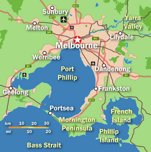
Melbourne stretches along the Yarra River towards the Yarra Valley and the Dandenong Ranges in the east. It also spreads north through the hilly, bushy valleys of the Yarra's smaller rivers. These include the Moonee Ponds Creek (which goes towards Tullamarine Airport), Merri Creek, Darebin Creek, and Plenty River. The city reaches the outer suburbs of Craigieburn and Whittlesea in the north.
To the southeast, Melbourne extends through Dandenong to Pakenham, heading towards West Gippsland. It also goes south through the Dandenong Creek valley and the Mornington Peninsula. This includes the city of Frankston and hills like Olivers Hill, Mount Martha, and Arthurs Seat. The city continues along the shores of Port Phillip Bay, forming one large connected area. It reaches as far as the fancy suburbs of Portsea and Point Nepean.
In the west, Melbourne follows the Maribyrnong River and its smaller rivers north towards Sunbury. This area is near the foothills of the Macedon Ranges. The city also spreads across the flat volcanic plains towards Melton in the west. It reaches Werribee, which is at the base of the You Yangs granite hills. Melbourne is also considered part of the wider metropolitan area that includes Geelong to the southwest.
Melbourne's Coastal Areas
Melbourne has many popular beaches along Port Phillip Bay in its southeastern suburbs. You can find these beaches in places like Port Melbourne, Albert Park, St Kilda, Elwood, Brighton, Sandringham, Mentone, and Frankston. There are also beaches in the western suburbs, such as Altona and Williamstown.
If you're looking for surf beaches, the closest ones are about 85 kilometers (53 miles) southwest of Melbourne's city center. These are the beaches behind the towns of Rye, Sorrento, and Portsea.
 | Madam C. J. Walker |
 | Janet Emerson Bashen |
 | Annie Turnbo Malone |
 | Maggie L. Walker |


