
Geology of Puerto Rico facts for kids


The geology of Puerto Rico is all about the rocks, landforms, and natural processes that have shaped this amazing island. Think of it like the Earth's history book, written in stone! Puerto Rico is made up of different types of rocks, some formed by volcanoes and others by tiny sea creatures over millions of years.
The island can be divided into three main geological areas: the Cordillera Central (a mountain range), the Carbonate area (where you find lots of limestone), and the Coastal Lowlands (the flat areas near the sea).
Some of the oldest rocks on the island are about 190 million years old! You can find them in a place called Sierra Bermeja in the southwest. Scientists think these ancient rocks might have come all the way from the Pacific Ocean! Long, long ago, during a time called the Carboniferous period, Puerto Rico was completely underwater.
Contents
Puerto Rico's Place on Earth's Plates
Puerto Rico sits right on the edge where two giant pieces of the Earth's crust meet. These pieces are called tectonic plates: the Caribbean Plate and the North American plate. Imagine them like huge puzzle pieces that are always slowly moving!
When these plates rub, push, or slide past each other, it creates a lot of pressure and stress. This stress can cause the ground to shake, leading to earthquakes. Sometimes, these earthquakes can even cause giant ocean waves called tsunamis. Earthquakes and tsunamis, along with landslides, are some of the biggest natural dangers for people living in Puerto Rico and the nearby islands.
Earthquakes in Puerto Rico
Puerto Rico has experienced many earthquakes because of its location on a plate boundary. One of the biggest recent earthquakes happened on October 11, 1918. It was very strong, with an estimated magnitude of 7.5 on the Richter scale. This earthquake started off the coast of Aguadilla and was followed by a tsunami.
More recently, on September 24, 2019, an earthquake with a magnitude over 6.0 was recorded. It happened about 49 miles off the northwest coast of the island. The United States Geological Survey (USGS) keeps track of these events.
The Puerto Rico Trench
Just about 75 miles (120 km) north of Puerto Rico, in the Atlantic Ocean, lies an incredibly deep part of the sea floor called the Puerto Rico Trench. This trench is also where the Caribbean and North American plates meet.
The Puerto Rico Trench is the largest and deepest trench in the entire Atlantic Ocean! It stretches for about 1,090 miles (1,750 km) and is about 60 miles (100 km) wide. At its deepest point, known as the Milwaukee Depth, it plunges an astonishing 27,493 feet (8,380 meters) down! That's deeper than Mount Everest is tall!
How the Trench Forms
At this trench, the North American plate is actually sliding *under* the Caribbean plate. This process is called subduction. When one plate slides beneath another, it can cause volcanoes to form. This is why you see many volcanoes on the islands to the southeast of Puerto Rico, like those in the West Indies.
A major transform fault (a type of crack in the Earth's crust where plates slide past each other horizontally) extends from the Puerto Rico Trench. It runs along the northern coast of Puerto Rico and continues all the way through the Cayman Trough to the coast of Central America.
There's another deep spot nearby called the Virgin Islands Trough. It's located about 50 miles (80 km) southeast of Fajardo, past the island of Vieques, and south of Saint Thomas in the US Virgin Islands. This trough can be more than 14,000 feet (4,267 meters) deep in some places!
Gallery
-
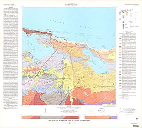
1977 Geologic Map of San Juan Quadrangle, showing San Juan Antiguo, Santurce and other northern barrios of San Juan
-
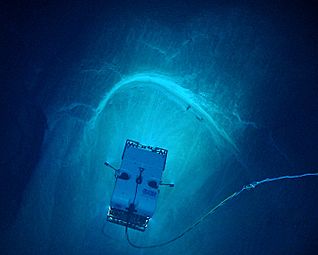
"Image of remotely operated vehicle Deep Discoverer exploring a spectacular arcuate, headwall scarp measuring 20 meters (66 feet) across, seen in the carbonate Juana Diaz Formation, Guayanilla Canyon, to the south of Puerto Rico" (NOAA)
-
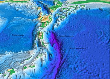
Diagram of the Atlantic Trench
-
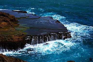
Atlantic Ocean and rocks in Isabela, Puerto Rico


See also
 In Spanish: Geología de Puerto Rico para niños
