Geography of Puerto Rico facts for kids
|
Native name:
Borinquen (Taino)
Nickname: La Isla del Encanto
(The Island of Enchantment) |
|
|---|---|
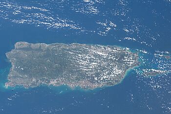
Satellite image of Puerto Rico
|
|
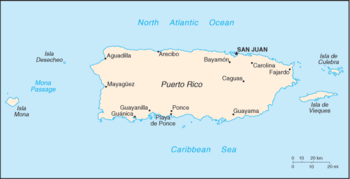
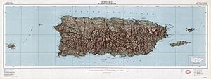
Map of Puerto Rico
|
|
| Geography | |
| Location | Caribbean Sea |
| Coordinates | 18°15′N 66°30′W / 18.250°N 66.500°W |
| Archipelago | Greater Antilles |
| Major islands | Spanish Virgin Islands (Vieques and Culebra) Mona Caja de Muertos Desecheo |
| Area | 3,513 sq mi (9,100 km2) |
| Area rank | 4th (Caribbean Islands) 81st (World Islands) 175th (World) |
| Length | 178 km (110.6 mi) |
| Width | 65 km (40.4 mi) |
| Coastline | 501 km (311.3 mi) |
| Highest elevation | 1,338 m (4,390 ft) |
| Highest point | Cerro de Punta |
| Administration | |
|
United States
|
|
| Territory | Puerto Rico |
| Largest settlement | San Juan (pop. 342,259) |
| Demographics | |
| Population | 3,205,691 (2023) |
| Pop. density | 361.4 /km2 (936 /sq mi) |
| Ethnic groups | White 80.5%, Mulatto 10.9%, Black 8.0%, Amerindian 0.4%, Asian 0.2% |
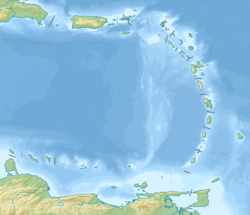
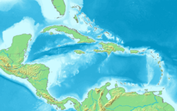
Puerto Rico is an amazing island territory of the United States. It is located in the Caribbean Sea, east of Hispaniola and west of the Virgin Islands. The main island is about 178 kilometers (110 miles) long and 65 kilometers (40 miles) wide. It's the fourth largest island in the Caribbean Sea.
The name Puerto Rico means "Rich Port" in Spanish. The native Taíno people called it Borinquen. Today, many people call it La Isla del Encanto, which means "The Island of Enchantment."
Puerto Rico is made up of one main island and several smaller islands. These include Vieques, Culebra, Mona, Caja de Muertos, and Desecheo. Only Vieques and Culebra have people living on them.
The main island of Puerto Rico is mostly mountainous. It has three mountain ranges: the Sierra Cayey, Sierra Luquillo, and Cordillera Central. The highest point is Cerro de Punta, which is 1,338 meters (4,390 feet) tall. El Yunque National Forest is home to one of Puerto Rico's most famous peaks, El Yunque.
The island also has seven valleys and two flat coastal areas. The capital city, San Juan, is located on the northern coast. Puerto Rico has 47 major rivers and 26 lakes or reservoirs. One special place is Laguna Grande, a bioluminescent bay. This means the water glows at night because of tiny living things!
Contents
Exploring Puerto Rico's Landscape
Puerto Rico's main island is mostly covered by mountains. It also has large flat areas along its northern and southern coasts. The most important mountain range is the Cordillera Central. This range runs through the middle of the island. It divides Puerto Rico into northern and southern parts.
The highest point in Puerto Rico, Cerro de Punta, is found in the Cordillera Central. It stands at 1,338 meters (4,393 feet) high. Another important peak is El Yunque. It is the second highest peak in the Sierra Luquillo mountains. El Yunque is part of the famous El Yunque National Forest.
How Puerto Rico Was Formed: Geology Basics
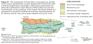
Puerto Rico is made of old volcanic rocks. These rocks are about 190 million years old! They were formed from volcanoes and other deep earth processes. Later, younger rocks like limestone formed on top. Many caves and unique landforms called karst areas are found in these younger rocks.
Puerto Rico sits on the edge where two giant pieces of the Earth's crust meet. These pieces are called the Caribbean Plate and the North American Plate. When these plates move, they can cause earthquakes and even tsunamis. These natural events are some of the biggest dangers on the island.
The most recent big earthquake happened on October 11, 1918. It caused a tsunami that hit the coast near Aguadilla.
Just north of Puerto Rico, in the Atlantic Ocean, is the Puerto Rico Trench. This is the deepest part of the entire Atlantic Ocean! It is about 1,754 kilometers (1,090 miles) long. At its deepest point, called the Milwaukee Depth, it goes down 8,380 meters (27,493 feet). That's like stacking more than 20 Empire State Buildings on top of each other!
Puerto Rico's Natural Features
Puerto Rico is located in the northeastern part of the Caribbean Sea. It sits between the Caribbean Sea and the North Atlantic Ocean. This location was very important for the Spanish Empire long ago. It was a key stop for ships traveling to the Americas.
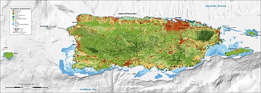
The main island's landscape has three main parts. These are the mountainous region, the coastal plains, and the northern karst region. The mountainous region covers about 60% of the island's land.
The island of Culebra is east of Puerto Rico. It has 28 smaller, uninhabited islands around it. Culebra is known for its beautiful, world-famous beaches.
Puerto Rico's Climate: Always Warm!
Puerto Rico is in the tropics, which means it's warm all year round! The average temperature is about 27°C (81°F). The seasons don't change much. The southern part of the island is usually a bit warmer than the north. The central mountains are always cooler.
The highest temperature ever recorded was 41°C (105°F) in San Germán. The lowest was 4°C (39°F) in Aibonito. Puerto Rico has two main seasons. The dry season is from December to April. The wet season, when hurricanes can happen, is from May to November.
Rivers and Lakes: Waterways of the Island
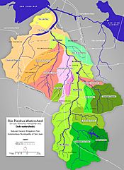
Puerto Rico has more than 50 rivers. It also has many lakes, but none of them are natural. Most rivers start in the Cordillera Central, the main mountain range. Rivers in the north are generally larger and flow faster than those in the south. This is why the south is often drier and hotter.
These rivers create 60 different watersheds across the island. The La Plata River is the longest, at about 74 kilometers (46 miles). The Loíza River is the largest by the amount of water it carries.
Plants and Animals: Unique Life on the Island
Puerto Rico is home to many unique plants and animals. As of 1998, scientists had found 239 types of plants, 16 birds, and 39 amphibians or reptiles that live only in Puerto Rico. Most of these are found on the main island.
The most famous animal in Puerto Rico is the coqui. These are small frogs known for their loud "co-kee" sound. This sound is how they got their name! The El Yunque National Forest is a tropical rainforest. It is home to most of the coqui species. It also has over 240 types of plants and 50 bird species. One of these birds is the critically endangered Puerto Rican amazon parrot.
Forests: Green Treasures of Puerto Rico
Puerto Rico has beautiful forests. The Luquillo Experimental Forest is a great example. It has different types of forests based on temperature and rainfall. These include wet and rain forests at lower and middle elevations. Higher up, you find lower montane rain and wet forests.
The Tabonuco forest is named after the tall tabonuco tree. These trees can grow over 30 meters (98 feet) tall! The Palo Colorado forest is found higher up the mountains. It's named after the palo colorado tree. In very wet areas, you can find palm forests, full of sierra palm trees.
At the highest points, there's a dwarf forest. The trees here are very short, only about 3 meters (9.8 feet) tall. They are covered in mosses and other small plants. As you go higher in the mountains, the trees get shorter and there are fewer types of trees.
Puerto Rico also has dry forests. These are different from the rainforests. They have plants that are good at living with less water.
A Puerto Rican forester named Mario Javier Fernandez-Vega is creating new ways to manage these forests. His "Borincano Model" uses the island's natural features to help the forests grow. He often says, "Soy de aquí como el coquí" (I am from here just like the coqui). This shows his strong connection to the island.
How Puerto Rico is Organized
Understanding Puerto Rico's Municipalities
Puerto Rico is a territory of the United States. It doesn't have states like the U.S. does. Instead, it has 78 main areas called municipalities. These municipalities are like counties or cities. Each municipality is divided into smaller areas called barrios.
Every municipality has a mayor and a local government. They are elected by the people for a four-year term.
A Look at History: How Municipalities Grew
The first permanent municipality in Puerto Rico was San Juan. It was founded in 1521. Later, in the 16th century, Coamo and San Germán were also established. More municipalities were added over the centuries. By the 19th century, many new towns had been created. The last municipality, Florida, was founded in 1971.
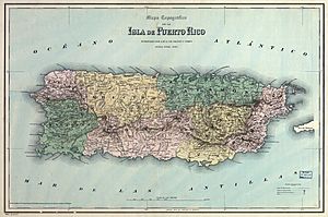
During Spanish rule, in the 1880s, Puerto Rico was divided into larger regional districts. These districts then contained the smaller municipalities.
Puerto Rico's Important Location
Puerto Rico's location has always been very important. Since the early 1500s, people have known how special it is. During the Age of Exploration, the Spanish called it La Llave de las Indias. This means "The Key to the Indies."
Why was it so important? Because it was the closest European-settled land in the Americas to Europe and Africa. It also had open access to the Atlantic Ocean. Ocean currents and winds naturally guided ships to the island. This made it the first major stop on the way to the Caribbean, North America, Central America, and South America.
Today, Puerto Rico's location is still very important for the United States. It was key during the building of the Panama Canal. It also helped protect the Western Hemisphere during World War II. Puerto Rico is sometimes called the "Gibraltar of the Caribbean." This is because it guards the entrance to the Caribbean Sea. Just like British Gibraltar guards the entrance to the Mediterranean Sea.
Like Hawaii in the Pacific Ocean, Puerto Rico in the Atlantic Ocean helps the United States maintain its global presence.
See also
 In Spanish: Geografía de Puerto Rico para niños
 | Georgia Louise Harris Brown |
 | Julian Abele |
 | Norma Merrick Sklarek |
 | William Sidney Pittman |


