German Run facts for kids
Quick facts for kids German Run |
|
|---|---|

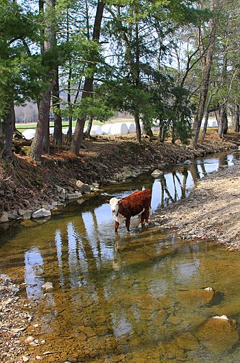
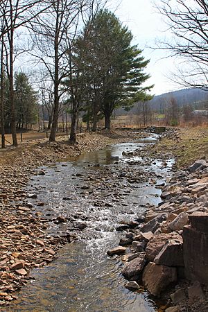
German Run looking downstream
|
|
| Physical characteristics | |
| Main source | hill between Buck Ridge and Northside Ridge in Franklin Township, Lycoming County, Pennsylvania 1,273 ft (388 m) |
| River mouth | Little Muncy Creek in Moreland Township, Lycoming County, Pennsylvania near Moreland 646 ft (197 m) 41°11′50″N 76°38′15″W / 41.1973°N 76.6374°W |
| Length | 4.9 mi (7.9 km) |
| Basin features | |
| Progression | Little Muncy Creek → Muncy Creek → West Branch Susquehanna River → Susquehanna River → Chesapeake Bay |
| Basin size | 6.87 sq mi (17.8 km2) |
| Tributaries |
|
German Run is a small stream, also called a tributary, located in Lycoming County, Pennsylvania. It flows into a larger stream called Little Muncy Creek.
This stream is about 4.9 miles (7.9 km) long. It travels through two areas: Franklin Township and Moreland Township. The land area that collects water for German Run, known as its watershed, covers about 6.87 square miles (17.8 km2).
German Run is an important home for fish and other water creatures. It is known as a Coldwater Fishery, meaning its waters are cool enough for fish like trout. It's also a Migratory Fishery, which means fish travel through it to reach other places.
However, some parts of German Run and its smaller streams have problems. They are called "impaired waterbodies" because they are not as healthy as they should be. This is mainly due to farming activities nearby.
Contents
Where German Run Flows
German Run starts on a hill between Buck Ridge and Northside Ridge in Franklin Township. Imagine it beginning high up, then flowing downhill.
It flows south through a valley. Along its journey, it picks up water from several smaller, unnamed streams. These streams join German Run from both its left and right sides.
The stream changes direction a few times, heading west-northwest, then west-southwest. As it continues, it enters Moreland Township. Here, the valley around the stream becomes less deep.
Finally, German Run reaches its end. It flows into Little Muncy Creek. This meeting point is about 10.78 miles (17.35 km) upstream from where Little Muncy Creek itself ends.
Water Health of German Run
Some parts of German Run are not as clean as they should be. This means they are "impaired waterbodies." The main issues are:
- Low Oxygen: The water doesn't have enough oxygen for aquatic life.
- Sediment: Too much dirt and tiny particles are in the water.
These problems are mostly caused by farming activities in the area. For example, soil from farms can wash into the stream, and certain farm materials can reduce oxygen levels. One of German Run's smaller streams, called Unt 19501, also has these same issues.
Scientists also measure how much water flows in German Run, especially during big storms. For example, during a very large storm that might happen only once every 100 years, the stream could carry a huge amount of water.
Land and Rocks Around the Stream
The land around German Run changes in height. Where the stream begins, its source, the elevation is about 1,273 feet (388 m) above sea level. This is like being on top of a tall building!
As the stream flows downhill, it loses elevation. Where it meets Little Muncy Creek, its mouth, the elevation is much lower, about 646 feet (197 m) above sea level.
The area around German Run is part of the United States Geological Survey map sections called Hughesville and Lairdsville. The mouth of the stream is close to the town of Moreland.
Life in German Run
German Run is important for aquatic life, which means all the plants and animals that live in the water.
As mentioned, it's a Coldwater Fishery. This classification helps protect the stream so that fish that need cold water, like certain types of trout, can live and thrive there. It's also a Migratory Fishery, which means it's a pathway for fish that travel between different bodies of water.
History of German Run
The name "German Run" was officially recorded in the Geographic Names Information System on August 2, 1979. This system keeps track of names for places like rivers and mountains.
Over the years, several bridges have been built to cross German Run:
- A concrete bridge for State Route 2019 was built in 1937.
- Another concrete bridge for State Route 2015 was built in 1949.
- A newer concrete bridge for State Route 2019 was constructed in 2009.
In recent times, there have been some activities related to natural gas in the area. In 2011, a company received permission to build a natural gas pipeline that would cross some of the smaller streams feeding German Run.
Later, in 2015, another company faced a fine. This was because problems with their natural gas wells caused methane gas to escape into German Run and Little Muncy Creek. This also affected some private water wells nearby.


