Glengallan, Queensland facts for kids
Quick facts for kids GlengallanQueensland |
|||||||||||||||
|---|---|---|---|---|---|---|---|---|---|---|---|---|---|---|---|

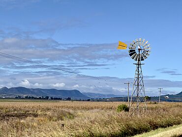
Windmill in Glengallan, 2023
|
|||||||||||||||
| Population | 57 (2021 census) | ||||||||||||||
| • Density | 2.556/km2 (6.62/sq mi) | ||||||||||||||
| Postcode(s) | 4370 | ||||||||||||||
| Elevation | 460 to 601 m (1,509 to 1,972 ft) | ||||||||||||||
| Area | 22.3 km2 (8.6 sq mi) | ||||||||||||||
| Time zone | AEST (UTC+10:00) | ||||||||||||||
| Location | |||||||||||||||
| LGA(s) | Southern Downs Region | ||||||||||||||
| State electorate(s) | Southern Downs | ||||||||||||||
| Federal Division(s) | Maranoa | ||||||||||||||
|
|||||||||||||||
Glengallan is a small rural area, also called a locality, in Queensland, Australia. It is part of the Southern Downs Region. In 2021, only 57 people lived in Glengallan.
Contents
Glengallan's Location and Land
Glengallan is found in a larger area known as the Darling Downs. This region is famous for its rich farming land.
Two important roads pass through Glengallan. The New England Highway comes from the north-west. The Cunningham Highway enters from the south-east. These two highways then join up and leave Glengallan towards the south.
Most of the land in Glengallan is quite flat. It sits about 460 meters (about 1,500 feet) above sea level. However, there is a hill called Mount Marshall in the north-east. Mount Marshall rises higher, reaching about 601 meters (about 1,970 feet).
The land in Glengallan is mostly used for growing crops. On the slopes of Mount Marshall, people also graze animals like cattle.
A Look Back at Glengallan's History
The name Glengallan comes from a large farm, or "pastoral run," that was started by Colin and John Campbell way back in 1841.
Schools in Glengallan's Past
A school called Glengallan Station School opened around 1886. It was for the children of the people who worked at Glengallan Station. Later, in 1891, it became Glengallan Provisional School. On January 1, 1909, it changed its name again to Glengallan State School. This school closed in 1921.
In 1922 or 1923, it joined with another school, Wilsonville State School. Together, they became Mount Marshall State School. This combined school eventually closed in 1965.
Old Churches of Glengallan
Several churches were built in Glengallan many years ago.
- St Andrew's Anglican Church: The first stone for this church was laid on September 14, 1908. It was officially opened on November 23, 1908. This church closed in 1962.
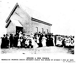
- Glengallan Methodist Church: This church opened on October 4, 1908. A special tea meeting was held a few days later to celebrate.
- Glengallan Presbyterian Church: This church was officially opened on September 19, 1909. It was built on land given by Walter Skerman.
How Many People Live Here?
In 2016, Glengallan had a population of 54 people. By 2021, the number of people living in Glengallan had slightly increased to 57.
Important Historic Places
Glengallan has some special places that are protected because of their history. These are called heritage-listed sites. One important site is:
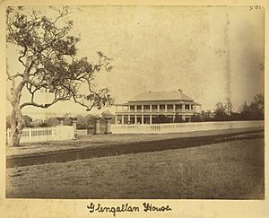
- Glengallan Homestead, located on the New England Highway. A homestead is the main house on a large farm or station.
Learning in Glengallan
There are no schools located directly in Glengallan today. Children living here usually go to schools in nearby towns.
The closest primary schools are Allora State School in Allora and Freestone State School in Freestone. For high school, students can attend Allora State School (which goes up to Year 10) or Warwick State High School in Warwick (which goes up to Year 12).
 | Misty Copeland |
 | Raven Wilkinson |
 | Debra Austin |
 | Aesha Ash |


