Goddard, Kansas facts for kids
Quick facts for kids
Goddard, Kansas
|
|
|---|---|

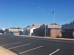
Goddard (2018)
|
|

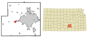
Location within Sedgwick County and Kansas
|
|

|
|
| Country | United States |
| State | Kansas |
| County | Sedgwick |
| Founded | 1883 |
| Incorporated | 1910 |
| Named for | J.F. Goddard |
| Area | |
| • Total | 4.96 sq mi (12.84 km2) |
| • Land | 4.90 sq mi (12.70 km2) |
| • Water | 0.06 sq mi (0.14 km2) |
| Elevation | 1,463 ft (446 m) |
| Population
(2020)
|
|
| • Total | 5,084 |
| • Density | 1,025.0/sq mi (395.95/km2) |
| Time zone | UTC-6 (CST) |
| • Summer (DST) | UTC-5 (CDT) |
| ZIP code |
67052
|
| Area code | 316 |
| FIPS code | 20-26725 |
| GNIS ID | 474001 |
Goddard is a city in Sedgwick County, Kansas, United States. It is a western suburb of Wichita. In 2020, the city had a population of 5,084 people.
Contents
History of Goddard
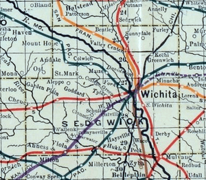
Goddard was founded in 1883 by Ezekiel Wilder. He bought land where the Atchison, Topeka, and Santa Fe Railway was planning to build tracks. This spot was about 10 miles (16 km) west of Wichita.
The town was named after J. F. Goddard, who used to be a vice-president of the ATSF Railway. The railroad reached Goddard in 1884. A post office was also opened that same year.
Some buildings, like the town hall and a church, were moved to Goddard from a nearby town called Blendon. Goddard officially became an incorporated city in 1910. This means it became an official town with its own local government.
On June 23, 1969, a very strong F4 tornado hit Goddard. Luckily, no one died, but six people were hurt.
In recent years, as Wichita has grown bigger, many people who work in Wichita have moved to Goddard. This has changed Goddard from a small farming community into a suburb.
Geography of Goddard
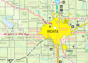
Goddard is located in south-central Kansas, just west of Wichita. It sits at an elevation of 1,463 feet (446 meters) above sea level.
The city is located on U.S. Route 54. It is about 12 miles (19 km) southwest of the Arkansas River. It is also about 8 miles (13 km) north-northeast of the Ninnescah River. Goddard is in a flat area called the Wellington-McPherson Lowlands, which is part of the larger Great Plains region.
The United States Census Bureau says that Goddard covers a total area of about 4.49 square miles (11.63 square kilometers). Most of this area, 4.43 square miles (11.47 square kilometers), is land. The rest, 0.06 square miles (0.16 square kilometers), is water.
Population and People
| Historical population | |||
|---|---|---|---|
| Census | Pop. | %± | |
| 1890 | 210 | — | |
| 1900 | 225 | 7.1% | |
| 1910 | 225 | 0.0% | |
| 1920 | 255 | 13.3% | |
| 1930 | 255 | 0.0% | |
| 1940 | 248 | −2.7% | |
| 1950 | 274 | 10.5% | |
| 1960 | 533 | 94.5% | |
| 1970 | 955 | 79.2% | |
| 1980 | 1,427 | 49.4% | |
| 1990 | 1,804 | 26.4% | |
| 2000 | 2,037 | 12.9% | |
| 2010 | 4,344 | 113.3% | |
| 2020 | 5,084 | 17.0% | |
| U.S. Decennial Census 2010-2020 |
|||
Goddard is part of the larger Wichita, KS Metropolitan Statistical Area. This means it is connected to the economy and population of Wichita.
2020 Census Information
According to the 2020 United States census, Goddard had 5,084 people living there. There were 1,662 households and 1,313 families. The population density was about 997 people per square mile (385 per square kilometer).
Most of the people, about 84.8%, were white. About 8.4% of the population was Hispanic or Latino.
About 33.5% of the people were under 18 years old. About 10.9% were 65 years or older. The average age in Goddard was 32.5 years. For every 100 females, there were about 102 males.
The average income for a household was about $82,270 per year. For families, the average income was about $93,393 per year. A small number of families, about 0.8%, lived below the poverty line.
Economy and Jobs
In 2012, about 75.9% of people over 16 years old in Goddard had jobs or were looking for work. Most of these jobs were in the civilian workforce.
People in Goddard work in many different areas. About 40.3% work in management, business, science, and arts. Another 22.5% work in sales and office jobs. Other common jobs are in services, production, transportation, and construction.
The top three industries where people work are:
- Manufacturing (making things in factories)
- Educational services, health care, and social help
- Retail trade (stores and shops)
Living in Goddard is generally affordable. The cost of living is lower than the average for the United States. In 2012, the average value of a home in Goddard was $140,400.
Education in Goddard
Goddard has a strong focus on education. The Goddard USD 265 school district runs twelve schools in and around the city.
Schools in Goddard
|
|
The Roman Catholic Diocese of Wichita also operates one Catholic school in Goddard: Holy Spirit Catholic School, which teaches students from pre-kindergarten to 8th grade.
Goddard Public Library
The Goddard Public Library is located downtown. It has over 19,000 books and offers computer services and reading programs for everyone. The library started in 1969.
In 2021, the library bought an old RV and turned it into a mobile library. This "Goddard Public Mobile Library" started service in 2022. It helps bring library services, programs, and information to people in the wider school district area and parts of West Wichita.
City Services and Transportation
Transportation
Major roads, U.S. Route 54 and U.S. Route 400, run through Goddard. They are concurrent, meaning they share the same road for a section.
Utilities
The city government's Public Works Department takes care of water and wastewater services for Goddard residents. Westar Energy provides electricity. Most homes use natural gas for heating, which is provided by Kansas Gas Service.
Media
Goddard is part of the Wichita radio and television markets. This means residents can access radio and TV stations from Wichita.
Parks and Fun Activities
The city government maintains two parks for the community: Linear Park and Means Memorial Park. There is also a public swimming pool.
Community Events
Many groups in Goddard organize fun events throughout the year. These include:
- A Lions Club Car show and Easter Egg Hunt
- Neighbors United events
- A city-wide Garage Sale Day
- An Independence Day Firework Display
- National Night Out
- A Fall Festival
- Goddard Community Gatherings
- A Community Thanksgiving Feast
- StoryTime with Santa
- Christmas on Main Street
Places to Visit
- Lake Afton Public Observatory: This observatory is run by volunteers and is open to the public on weekend nights. It is a great place to look at the stars and planets.
- Tanganyika Wildlife Park: This is a private zoo that focuses on breeding endangered animals. It is open from April to October each year.
- Blast Off Bay Water Park: This water park is located next to the Genesis Sports Complex and a hotel.
Notable People from Goddard
Here are some well-known people who were born in or have lived in Goddard:
- Derek Norris (born 1989), a baseball catcher
- Ed Siever (1875-1920), a baseball pitcher
- Todd Tiahrt (born 1951), a U.S. Representative for Kansas
- Logan Watkins (born 1989), a baseball second baseman
See also
 In Spanish: Goddard (Kansas) para niños
 | Jessica Watkins |
 | Robert Henry Lawrence Jr. |
 | Mae Jemison |
 | Sian Proctor |
 | Guion Bluford |


