Goreme Col facts for kids
Goreme Col (which means 'Goremska Sedlovina' in Bulgarian, pronounced go-'rem-ska se-dlo-vi-'na) is a high mountain pass in Antarctica. It sits at an elevation of 2,700 meters (about 8,858 feet) above sea level. This pass connects Doyran Heights to the east with Mount Mohl to the northeast. Both of these are part of the Craddock Massif in the Sentinel Range, which is located in the Ellsworth Mountains.
Goreme Col is also an important "glacial divide." This means it's a high point where glaciers flow in different directions. From Goreme Col, the ice flows into Dater Glacier to the north and Thomas Glacier to the south.
This special place in Antarctica is named after a town called Goreme in Southwestern Bulgaria.
Where is Goreme Col Located?
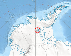
Goreme Col is found at these coordinates: 78°32′00″S 85°01′30″W / 78.53333°S 85.02500°W. It's about 2.94 kilometers (1.8 miles) northeast of Mount Mohl. It's also 8.15 kilometers (5.1 miles) east of Marts Peak and 8.66 kilometers (5.4 miles) southeast of Vanand Peak. Other nearby points include Mount Tuck, which is 4.65 kilometers (2.9 miles) southwest, and Prosenik Peak, which is 1.47 kilometers (0.9 miles) west by north.
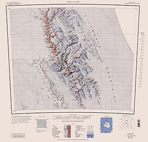
The area around Goreme Col was first mapped by the United States in 1961, and these maps were updated in 1988.
 | Selma Burke |
 | Pauline Powell Burns |
 | Frederick J. Brown |
 | Robert Blackburn |


