Gosper County, Nebraska facts for kids
Quick facts for kids
Gosper County
|
|
|---|---|

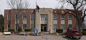
Gosper County Courthouse in Elwood
|
|

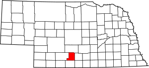
Location within the U.S. state of Nebraska
|
|
 Nebraska's location within the U.S. |
|
| Country | |
| State | |
| Founded | 1873 (authorized) 1881 (organized) |
| Named for | John J. Gosper |
| Seat | Elwood |
| Largest village | Elwood |
| Area | |
| • Total | 462.73 sq mi (1,198.5 km2) |
| • Land | 458.16 sq mi (1,186.6 km2) |
| • Water | 4.57 sq mi (11.8 km2) |
| Population
(2020)
|
|
| • Total | 1,893 |
| • Density | 4.13/sq mi (1.59/km2) |
| Time zone | UTC−6 (Central) |
| • Summer (DST) | UTC−5 (CDT) |
| Congressional district | 3rd |
Gosper County is a county located in the state of Nebraska in the United States. It's a place where people live, work, and go to school, just like a big neighborhood or district.
As of 2020, about 1,893 people live in Gosper County. The main town, or county seat, is Elwood. This is where the county government offices are located. The county was officially started in 1873 and got fully organized in 1881. It was named after John J. Gosper, who was an important person called the Secretary of State for Nebraska.
Gosper County is also part of a larger area around Lexington, which is a way to describe how towns and counties are connected for things like jobs and services.
If you look at Nebraska license plates, you might see the number 73. This number stands for Gosper County. It was given to the county because it had the 73rd largest number of registered vehicles when the license plate system began in 1922.
Contents
Geography
Gosper County covers a total area of about 463 square miles. Most of this area, about 458 square miles, is land. The rest, about 4.6 square miles, is water.
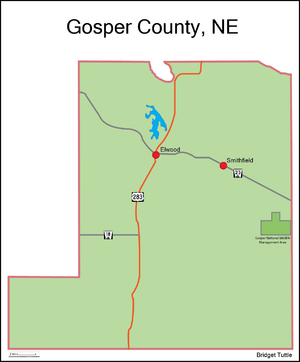
The Platte River is a major river that flows through the northern part of Gosper County.
Main Roads
These are the most important roads that go through Gosper County:
Neighboring Counties
Gosper County shares its borders with these other counties:
- Phelps County (to the east)
- Furnas County (to the south)
- Frontier County (to the west)
- Dawson County (to the north)
Special Areas
There are some special protected areas in Gosper County where nature is preserved or people can enjoy outdoor activities:
- Gosper National Wildlife Management Area
- Johnson Lake State Recreation Area
- Phillips Lake State Recreation Area
Population Information
| Historical population | |||
|---|---|---|---|
| Census | Pop. | %± | |
| 1880 | 1,673 | — | |
| 1890 | 4,816 | 187.9% | |
| 1900 | 5,301 | 10.1% | |
| 1910 | 4,933 | −6.9% | |
| 1920 | 4,669 | −5.4% | |
| 1930 | 4,287 | −8.2% | |
| 1940 | 3,687 | −14.0% | |
| 1950 | 2,734 | −25.8% | |
| 1960 | 2,489 | −9.0% | |
| 1970 | 2,178 | −12.5% | |
| 1980 | 2,140 | −1.7% | |
| 1990 | 1,928 | −9.9% | |
| 2000 | 2,143 | 11.2% | |
| 2010 | 2,044 | −4.6% | |
| 2020 | 1,893 | −7.4% | |
| US Decennial Census 1790–1960 1900–1990 1990–2000 2010–2020 |
|||
In the year 2000, there were 2,143 people living in Gosper County. These people lived in 863 different homes. Most of the people in the county were White.
About 29.9% of the homes had children under 18 living there. Most homes (69.1%) were married couples living together. The average home had about 2.42 people.
Looking at ages in 2000:
- About 23.8% of the people were under 18 years old.
- About 24% were between 25 and 44 years old.
- About 20.8% were 65 years old or older.
The average age in the county was 43 years old.
Communities
Villages
- Elwood (This is the county seat)
- Smithfield
Unincorporated Community
- Johnson Lake
See also
 In Spanish: Condado de Gosper para niños
 | Bayard Rustin |
 | Jeannette Carter |
 | Jeremiah A. Brown |


