Goulds, Florida facts for kids
Quick facts for kids
Goulds, Florida
|
|
|---|---|

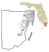
Location in Miami-Dade County and the state of Florida
|
|

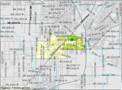
U.S. Census Bureau map showing CDP boundaries
|
|
| Country | |
| State | |
| County | |
| Area | |
| • Total | 2.93 sq mi (7.58 km2) |
| • Land | 2.91 sq mi (7.53 km2) |
| • Water | 0.02 sq mi (0.05 km2) |
| Elevation | 10 ft (3 m) |
| Population
(2020)
|
|
| • Total | 11,446 |
| • Density | 3,934.69/sq mi (1,519.21/km2) |
| Time zone | UTC-5 (Eastern (EST)) |
| • Summer (DST) | UTC-4 (EDT) |
| ZIP code |
33170
|
| Area code(s) | 305, 786, 645 |
| FIPS code | 12-26950 |
| GNIS feature ID | 0283239 |
Goulds is a community in Miami-Dade County, Florida, United States. It is also called a census-designated place (CDP). This means it is an area that the government counts for population, but it is not an official city.
Goulds started because of a stop on the Florida East Coast Railroad. The train station was near what is now Southwest 224th Street. The community got its name from Lyman Gould. He was a railroad worker who cut down trees for railroad ties. Goulds is part of the larger Miami metropolitan area in South Florida. In 2020, about 11,446 people lived there. This was an increase from 10,103 people in 2010.
Contents
History of Goulds, Florida
The area that is now Goulds was first settled in 1900. These early settlers were called homesteaders. They claimed land to live on and farm.
How Goulds Got Its Name
The community got its name in 1903. This was when the Florida East Coast Railway built a special train track called a siding. This siding was operated by a railroad employee named Lyman Goulds. At first, the place was known as "Gould's Siding." Later, the name was shortened to "Goulds."
Early Days and Challenges
Many buildings for packing goods were built along the Old Dixie Highway. In its early days, Goulds was a busy place with many workers. Most of the packing houses were destroyed by a strong windstorm (a tornado) in 1919. Then, the 1926 Miami Hurricane caused more damage. However, the community rebuilt these important buildings.
Cauley Square Village
Cauley Square is a historic village located in Goulds. It used to be a town that grew around the railway. Mary Ann Ballard bought the village in 1949 and helped restore it. Today, it is a popular place to visit.
Geography of Goulds, Florida
Goulds is located in southern Florida. It is about 20 miles (32 km) southwest of downtown Miami. It is also about 9 miles (14 km) northeast of Homestead.
Location and Borders
Goulds is at coordinates 25°33′39″N 80°23′0″W. To the north, it borders South Miami Heights. To the northeast, it borders Cutler Bay. To the south, it borders Princeton.
Area and Water
The total area of Goulds is about 2.9 square miles (7.5 square kilometers). A very small part of this area, about 0.02 square miles (0.05 square kilometers), is water.
Main Roads in Goulds
U.S. Route 1, also known as Dixie Highway, is the main road that goes through the Goulds community.
Population and People in Goulds
The word "demographics" means facts about the population of a place. This includes how many people live there and what groups they belong to.
| Historical population | |||
|---|---|---|---|
| Census | Pop. | %± | |
| 2000 | 7,453 | — | |
| 2010 | 10,103 | 35.6% | |
| 2020 | 11,446 | 13.3% | |
| U.S. Decennial Census | |||
Goulds Population Changes (2010 vs. 2020)
In 2010, there were 10,103 people living in Goulds. By 2020, the population had grown to 11,446 people.
Racial and Ethnic Makeup of Goulds (2020)
The table below shows the different racial and ethnic groups in Goulds. The U.S. Census counts Hispanic/Latino people as an ethnic group. They can be of any race.
| Race / Ethnicity (NH = Non-Hispanic) | Pop 2010 | Pop 2020 | % 2010 | % 2020 |
|---|---|---|---|---|
| White (NH) | 429 | 508 | 4.25% | 4.44% |
| Black or African American (NH) | 5,330 | 4,446 | 52.76% | 38.84% |
| Native American or Alaska Native (NH) | 4 | 9 | 0.04% | 0.08% |
| Asian (NH) | 60 | 71 | 0.59% | 0.62% |
| Pacific Islander or Native Hawaiian (NH) | 0 | 1 | 0.00% | 0.01% |
| Some other race (NH) | 14 | 60 | 0.14% | 0.52% |
| Mixed race or Multiracial (NH) | 122 | 165 | 1.21% | 1.44% |
| Hispanic or Latino (any race) | 4,144 | 6,186 | 41.02% | 54.05% |
| Total | 10,103 | 11,446 | 100.00% | 100.00% |
In 2020, there were 11,446 people living in Goulds. These people lived in 3,336 households. About 2,371 of these households were families.
Education in Goulds
The schools in Goulds are part of the Miami-Dade County Public Schools district. This district manages all the public schools in the area.
See also
 In Spanish: Goulds para niños
 | Bessie Coleman |
 | Spann Watson |
 | Jill E. Brown |
 | Sherman W. White |

