Graceville, Queensland facts for kids
Quick facts for kids GracevilleBrisbane, Queensland |
|||||||||||||||
|---|---|---|---|---|---|---|---|---|---|---|---|---|---|---|---|
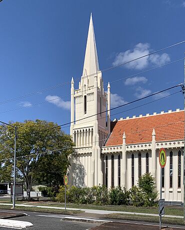
Graceville Uniting Church, 2019
|
|||||||||||||||
| Population | 4,764 (2021 census) | ||||||||||||||
| • Density | 2,270/km2 (5,900/sq mi) | ||||||||||||||
| Postcode(s) | 4075 | ||||||||||||||
| Elevation | 20 m (66 ft) | ||||||||||||||
| Area | 2.1 km2 (0.8 sq mi) | ||||||||||||||
| Time zone | AEST (UTC+10:00) | ||||||||||||||
| Location |
|
||||||||||||||
| LGA(s) | City of Brisbane (Tennyson Ward) |
||||||||||||||
| State electorate(s) | Miller | ||||||||||||||
| Federal Division(s) | Moreton | ||||||||||||||
|
|||||||||||||||
Graceville is a friendly suburb located in Brisbane, Queensland, Australia. In 2021, about 4,764 people lived here.
Contents
Exploring Graceville's Location
Graceville is about 7.8 kilometers (4.8 miles) south-west of the main city area of Brisbane. It's surrounded by water and other suburbs. The Brisbane River is to the north-east and west. Oxley Creek is to the east. Other nearby suburbs include Chelmer to the north and Sherwood to the south.
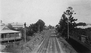
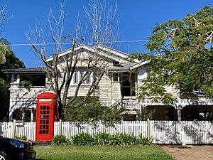
The heart of Graceville is around the Graceville railway station on the Ipswich railway line. Most of the homes here are in the classic Queenslander style. Important roads include Oxley Road, Graceville Avenue, and Honour Avenue. You can also find several parks like Simpson's Playground and Graceville Memorial Park.
A Look at Graceville's Past
Graceville got its name from its railway station. The station was named on February 4, 1875, after Grace Grimes. She was the daughter of Samuel Grimes, who was an important person in the Queensland Railways Department.
In 1879, the local government area of Yeerongpilly Division was created. Later, in 1891, parts of Yeerongpilly Division became Sherwood Division. This area then became the Shire of Sherwood in 1903, which included Graceville. In 1925, the Shire of Sherwood joined with the City of Brisbane.
Early Buildings and Churches
A Baptist chapel opened near Oxley Creek and the Brisbane River on May 22, 1864. This chapel was built on land given by John and Thomas Strong. It was also used by other church groups, like the Presbyterians. We don't know exactly when this chapel closed, and it's not there anymore.
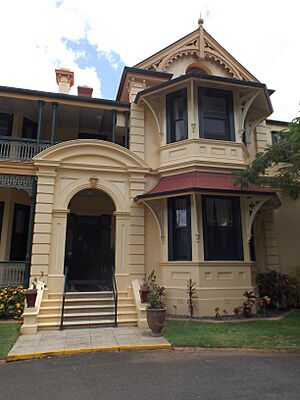
Graceville Baptist Church opened its doors on January 22, 1927. It was a building that could fit about 100 people. Graceville Uniting Church opened in 1930. It was designed by a local builder named Walter Taylor. This church is a well-known building in the suburb.
Christ the King Catholic Primary School started on January 25, 1937. It began with 60 students and four teachers from the Presentation Sisters. Graceville State School opened a bit earlier, on August 13, 1928.
Land Sales and Development
In the late 1800s and early 1900s, many pieces of land in Graceville were sold. For example, in December 1887, land in the "Graceville Park Estate" was advertised for sale. It was described as being "only a stone's throw from the Railway Station."
In December 1911, another 207 pieces of land in the "Graceville Estate" were sold. The advertisements said the area had "Cool, invigorating breeze" and "charming views." In 1926, the "Memorial Park Estate" and "Greenfield Estate" also had land for sale. These sales helped Graceville grow into the suburb it is today.
Who Lives in Graceville?
In 2021, Graceville had a population of 4,764 people. In 2011, there were 4,213 people living here. About 77.1% of people in Graceville were born in Australia. Other common birthplaces included England and New Zealand. Most people in Graceville speak English at home.
Historic Places in Graceville
Graceville has many places that are listed for their history. These are called heritage-listed sites. They include:
- 85 Bank Road: Beth-Eden
- 95 Bank Road: Glenrae
- 12 Churchill Street: Christ the King Roman Catholic Church
- 161 Graceville Avenue: 161 Graceville Avenue Graceville
- 327 Honour Avenue: Central Buildings
- 335 Honour Avenue: Concrete Block Residence
- 17 Kew Road: 17 Kew Road Graceville
- 110 Long Street: Graceville railway station
- 15 Magee Street: Brick War Service Home
- 27 Magee Street: Brick War Service Home
- 39 Magee Street: Brick War Service Home
- 9 Molonga Terrace: Glengarry
- 15 Molonga Terrace: The Gables
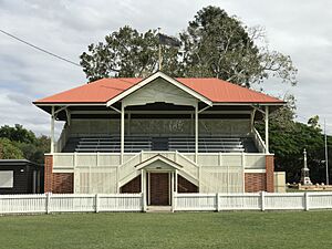
- 173 Oxley Road: Graceville Memorial Park
- 215 Oxley Road: Graceville Uniting Church
- 8 Rakeevan Road: 8 Rakeevan Road, Graceville
- 11 Rakeevan Road: Bulk store
- 27 Strong Avenue: Brick War Service Home
- 51 Strong Avenue: Brick War Service Home
- 98 Strong Avenue: Anzac Cottage
- 196 Verney Road East: Roslin Villa
- 16 Young Street: Sherwood Scout Hall
Schools in Graceville
Graceville has two primary schools:
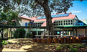
- Graceville State School is a government primary school for students from Prep to Year 6. It's located at 23 Acacia Avenue. In 2017, it had 761 students.
- Christ the King School is a Catholic primary school, also for Prep to Year 6 students. You can find it at 7 Randolph Street. In 2017, it had 267 students.
There are no high schools directly in Graceville. Students usually go to Corinda State High School in Corinda or Indooroopilly State High School in Indooroopilly.
What to Do in Graceville
Graceville has places for shopping and fun activities.
Shopping Areas
There are two main shopping spots:
- Graceville Riverside Village at 158 Graceville Avenue.
- Graceville Fiveways, where Oxley Avenue, Long Street East, and Park Terrace meet.
Parks and Sports
Graceville Memorial Oval is a special place. It has a memorial for soldiers who died in wars. It's also home to the Western Suburbs Cricket Club and Wests Taylor Bridge Rugby Club.
You can find many sports clubs in Graceville, including:
- Graceville Croquet Club
- Souths Graceville Lions Rugby League Club
- South West United Hockey Club
- West Taylor Bridge Rugby Club
- Rangers Netball Club
- Western Suburbs Cricket Club
- Graceville Amateur Swimming Club (based at Graceville State School)
 | Anna J. Cooper |
 | Mary McLeod Bethune |
 | Lillie Mae Bradford |


