Sherwood, Queensland facts for kids
Quick facts for kids SherwoodBrisbane, Queensland |
|||||||||||||||
|---|---|---|---|---|---|---|---|---|---|---|---|---|---|---|---|
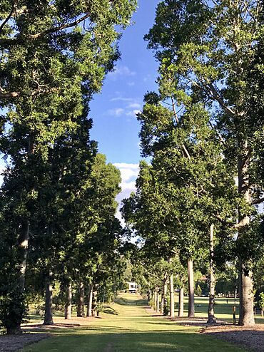
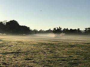
Sherwood Arboretum, 2018
|
|||||||||||||||
| Population | 6,082 (2021 census) | ||||||||||||||
| • Density | 2,530/km2 (6,600/sq mi) | ||||||||||||||
| Postcode(s) | 4075 | ||||||||||||||
| Area | 2.4 km2 (0.9 sq mi) | ||||||||||||||
| Time zone | AEST (UTC+10:00) | ||||||||||||||
| Location | 11.7 km (7 mi) SW of Brisbane CBD | ||||||||||||||
| LGA(s) | City of Brisbane (Tennyson Ward) |
||||||||||||||
| State electorate(s) |
|
||||||||||||||
| Federal Division(s) | Moreton | ||||||||||||||
|
|||||||||||||||
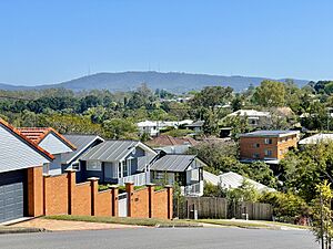
Sherwood is a suburb in the city of Brisbane, Queensland, Australia. It is a great place to live with parks, schools, and good transport. In 2021 census, Sherwood was home to 6,082 people.
Contents
What is Sherwood Like?
Sherwood is about 8 kilometers (5 miles) southwest of the main city centre. The Brisbane River forms its western border.
Roads and Railways in Sherwood
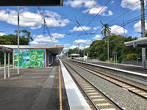
Oxley Road is the main road that runs through Sherwood. It connects the suburb from north to south. The Ipswich railway line also runs through Sherwood. You can catch a train at Sherwood railway station to travel around.
Homes and Shops in Sherwood
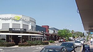
Most of the homes in Sherwood are single houses or smaller apartment buildings. There is a busy shopping area along Sherwood Road where you can find many stores.
A Look at Sherwood's Past
Sherwood has a long and interesting history. It started to grow many years ago.
Sherwood's First School
Sherwood State School first opened its doors on 25 March 1867. It was first called West Oxley State School. The school's first head teacher was Major William Jenyns Boyd. He was born in Paris in 1842 and moved to Australia in 1862.
A student named Oliver Radcliffe started at the school in 1868. He later became a teacher and then a school inspector. By 1932, he was the Chief Inspector for the Queensland Education Department. He visited schools all over Queensland!
How Sherwood Became Part of Brisbane
In 1879, the local area was called Yeerongpilly Division. Later, in 1891, a part of this area became the Sherwood Division. This division became a Shire in 1903. In 1925, the Shire of Sherwood joined with other areas to form the larger City of Brisbane.
Early Land Sales in Sherwood
In 1885, many blocks of land were offered for sale in Sherwood. An auctioneer named John F. Buckland tried to sell 268 blocks. Most of these blocks were near Oxley Road and Sherwood Road. However, only about 40 blocks were sold at that time. Three years later, in 1888, the remaining blocks were offered again.
Sherwood's Churches
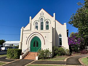
The Sherwood Methodist Church was built in 1914. It was designed by Walter Taylor. After different churches joined together in 1977, it became known as Sherwood Uniting Church. A special hall for Sunday School was opened there in 1918.
Floods in Sherwood
Sherwood has experienced big floods several times. Major floods happened in February 1931, January 2011, and February 2022.
Who Lives in Sherwood?
Knowing about the people who live in a place helps us understand it better.
Sherwood's Population in 2016
In 2016 census, Sherwood had 5,313 people. About 53% were female and 47% were male. The average age was 35 years old. This was a bit younger than the average age for all of Australia.
Most people (71.2%) living in Sherwood were born in Australia. Other countries where people were born include England (5.0%), New Zealand (2.5%), and India (1.9%). Most people (82.3%) spoke only English at home. Other languages spoken included Mandarin, Korean, and Spanish.
Sherwood's Population in 2021
By 2021 census, the population of Sherwood had grown to 6,082 people.
Important Places in Sherwood
Sherwood has many places that are important for its history and community. These are called heritage-listed sites.
Some of these special places include:
- John Herbert Memorial Vista at 57 Dewar Terrace
- Mayfield at 22 Ettie Street
- Hazelmere at 9 Hazelmere Parade
- Dunalister (which was once Sherwood Private Hospital) at 36 Lilly Street
- Sherwood State School at 464 Oxley Road
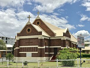
- St Matthew's Anglican Church at 481 Oxley Road
- The former Sherwood Presbyterian Church (now Sherwood Uniting Church) at 515 Oxley Road
- Berry & MacFarlane Monument at 533 Sherwood Road
- Sherwood Anglican Cemetery at 533 Sherwood Road
- Sherwood Uniting Church at 706 Sherwood Road
- Hives Park at 34 Thallon Street
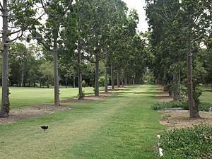
- Sherwood Arboretum at 39A Turner Street. This is a large botanical garden with a lake by the river. It was planned in the 1920s.
Learning in Sherwood
Education is very important in Sherwood.
Sherwood State School
Sherwood State School is a government primary school for students from Prep to Year 6. It is located at 464 Oxley Road. In 2018, the school had 586 students. Many of its old timber buildings have been kept and are still used.
High School Options
There isn't a high school right in Sherwood. The closest government high school is Corinda State High School. It is in the nearby suburb of Corinda.
What to Do in Sherwood
Sherwood has many places for people to gather, worship, and enjoy nature.
Churches in Sherwood
There are several churches in Sherwood:
- St Matthew's Anglican Church at 497 Oxley Road.
- Sherwood Uniting Church at 706 Sherwood Road.
- Sherwood Methodist Church at 405 Oxley Road. They have services in English and Mandarin.
- Sherwood Romanian Seventh-day Adventist Church at 551 Sherwood Road.
Parks and Green Spaces
Sherwood has several lovely parks:
- The Sherwood Arboretum is on the western side, next to the Brisbane River. It's a great place for a walk.
- Hives Park is on the southern end of the suburb. It has a building for Girl Guides.
- Thomas Street Park and Strickland Terrace Park are on the eastern side, near Oxley Creek.
- Stewart Franklin Park is a smaller park on the southern border.
Sports and Activities
The Sherwood Sharks swimming club uses the pool at Sherwood State School. This is a great way for kids to get active!
Getting Around Sherwood
Sherwood has good transport options for getting to other parts of Brisbane.
Train Services
The Sherwood railway station connects Sherwood to places like Ipswich and Springfield Central. It also links to the city centre.
Bus Services
Bus services run along Oxley Road. These buses connect Sherwood to the Centenary suburbs and Indooroopilly. There is also a "Great Circle Line" bus service that passes through the suburb.
 | Isaac Myers |
 | D. Hamilton Jackson |
 | A. Philip Randolph |


