Gragareth facts for kids
Quick facts for kids Gragareth |
|
|---|---|
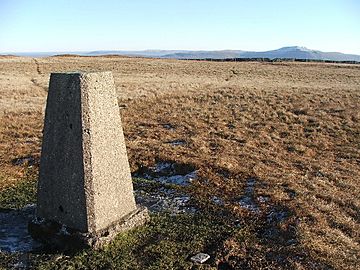
Gragareth trig point
|
|
| Highest point | |
| Elevation | 628 m (2,060 ft) |
| Prominence | 30 m (98 ft) |
| Parent peak | Great Coum |
| Listing | Hewitt, county top |
| Geography | |
| Location | Lancashire, England |
| Parent range | Yorkshire Dales (but summit is 200m outside border of county) |
| OS grid | SD687793 |
| Topo map | OS OL2 |
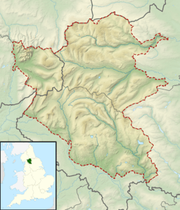
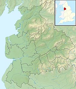
Gragareth is a mountain in England. It sits right on the edge between two areas: Lancashire and North Yorkshire. This mountain is special because its top, called the summit, is the highest point in the modern county of Lancashire.
Gragareth stands at 628 metres (2,060 ft) tall. Even though it's the highest in modern Lancashire, the traditional county of Lancashire used to include a taller mountain called the Old Man of Coniston. That one is 803 metres (2,635 ft) high and is found in the Lake District. Gragareth's summit is just outside the main county line, but it is inside the Yorkshire Dales National Park. The sides of the mountain have different names, like Leck Fell to the west and Ireby Fell to the south.
Contents
Exploring Gragareth
When you reach the top of Gragareth, you'll find a special marker called a trig point. This point helps mapmakers measure the land. From here, you can see amazing views all around! You might spot Morecambe Bay, the hills of the Lake District, and other mountains like the Howgill Fells and Ingleborough. You can also see the Forest of Bowland.
The Famous Wall
A long stone wall runs along the top of Gragareth. This wall marks the boundary between the counties. People believe it's one of the highest dry stone walls in the whole country! Long ago, this wall was the border between two historic areas: the West Riding of Yorkshire and Westmorland.
The Three Men of Gragareth
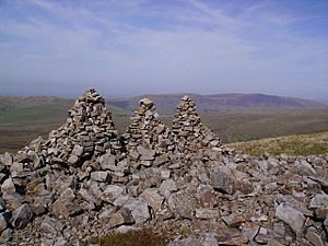
On the western side of the mountain, above a place called Leck Fell House, you'll find a group of tall stone piles. These are known as the Three Men of Gragareth. They are cairns, which are human-made stacks of stones.
Gragareth's Hidden Caves
Underneath Gragareth, there are several interesting caves. Some of these include Lost John's Cave, Rumbling Hole, and Ireby Fell Cavern. These caves are part of a larger network underground.
Walking on Gragareth
A famous walker named Alfred Wainwright wrote about a hike up Gragareth in his book, Walks in Limestone Country. His suggested path starts in the village of Ireby. Hikers follow a lane from Todgill Farm towards Leck Fell House. Then, it's a steep climb past the Three Men of Gragareth.
For the way down, Wainwright suggests following a long enclosed area. This area is bordered by the county line wall on one side and another wall marking the edge between Leck and Ireby parishes. The path goes down Ireby Fell, passing the entrance to Ireby Fell Cavern, and eventually leads back to Ireby village.
 | Selma Burke |
 | Pauline Powell Burns |
 | Frederick J. Brown |
 | Robert Blackburn |


