Greenbrier (Great Smoky Mountains) facts for kids
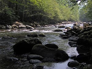
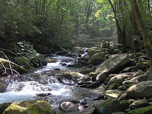
Greenbrier is a beautiful valley located in the northern Great Smoky Mountains in Tennessee. Today, it's a popular spot for outdoor fun. But long ago, Greenbrier was home to many small communities of people living in the Appalachian Mountains.
This valley sits along the Middle Fork of the Little Pigeon River. It stretches from a place called Porters Flat in the south to Emert's Cove in the north. The area also includes the land around the Middle Fork, from Grapeyard Ridge in the west to Snag Mountain in the east. Sometimes, people call it Big Greenbrier to tell it apart from Little Greenbrier, which is a few miles west.
Contents
Greenbrier's Landscape
The mountains around Greenbrier are some of the tallest in the Appalachian Mountains. To the east, you'll find the Guyot mountain range, which is over 6,000 feet (1,829 meters) high in many places. To the west is the Le Conte mountain range, with its highest point reaching 6,593 feet (2,009 meters).
A jagged ridge called "the Sawteeth" connects these two big mountains to the south. It has steep cliffs, like the famous one at Charlies Bunion. Greenbrier Pinnacle is a 7-mile (11 km) ridge that comes down from Old Black towards the Middle Fork valley. This ridge almost closes off Greenbrier Cove completely. Many small streams flow north from Greenbrier Pinnacle, creating narrow valleys with good land for farming.
The ground in Greenbrier is made of a type of rock called Roaring Fork Sandstone. This rock formed from ancient ocean sediments about 750 million years ago. As you go higher up the mountains, you find different rocks like Thunderhead sandstone.
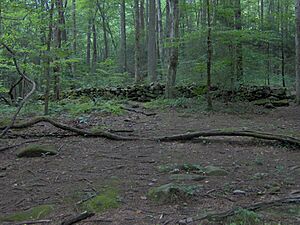
Just like other areas nearby, Greenbrier's valleys and stream beds are covered with many kinds of rocks. During the Ice Ages, the cold weather broke apart rocks on the high mountain slopes. Over time, these rocks were carried down to lower areas. The early settlers in Greenbrier used these rocks to build long rock walls instead of fences. You can still see these walls crisscrossing the area today.
Greenbrier's Past
Early Settlers
The name "greenbrier" comes from the thorny vines found all over the Southern Appalachians. We don't know exactly when this valley got its name, but people were calling it "Greenbrier" by the 1830s.
The Cherokee people were the first to live in the Greenbrier area. They might have had a seasonal camp at Porters Flat, which is at the southern end of Greenbrier. Even in the early 1900s, some Greenbrier residents called Porters Flat "Indian Nation," remembering its past as a Cherokee settlement.
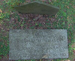
Around 1800, William Whaley (1788–1880) and his brother Middleton Whaley (1794–1855) were the first European-American settlers in Greenbrier. They came from South Carolina and crossed the Smokies at Dry Sluice Gap. William settled where Porters Creek meets the Middle Fork of the Little Pigeon River. Middleton settled further down the valley.
In 1818, the family of John Ownby (1781–1859), a veteran of the War of 1812, settled near the Whaleys. The Whaley and Ownby families grew quickly in the valley. In the early 1900s, a map of Greenbrier showed 26 homes, and 21 of them belonged to Whaleys or Ownbys!
More Families Arrive
The Middle Fork of the Little Pigeon River has many smaller streams flowing into it. Each stream created a deep hollow, making small, separate communities. So, Greenbrier wasn't just one big town. It was many small communities, often named after the streams they were on. Some of these included Copeland, Soak Ash, Webb Creek, Ramsey Creek, and Redwine Creek.
Charles Rayfield (1825–1891) settled near Laurel Creek and the Middle Fork before the Civil War. The Grapeyard Ridge Trail now goes through where many of his family members used to live. David Proffitt (1847–1909), who also fought in the war, settled further upstream around 1870.
Benjamin Christenberry Parton (1832–1916) and his wife Margaret came to Greenbrier in the 1850s. Parton, who survived a gunshot wound to the head during the Civil War, settled near Little Bird Branch. Parton and many of his family members are buried in a cemetery on a hill where his cabin once stood.
Daily Life in Greenbrier
Greenbrier was a very isolated community until the early 1900s. People mostly grew their own food to survive. Most farms were about 50 to 100 acres (0.2 to 0.4 square kilometers) and included some woodland. Families often lived in one-room log cabins. Later, modern-looking frame houses started to appear when sawmills arrived around 1900. Most farms had a barn, a place to store corn, a smokehouse, and a small fruit orchard. Some wealthier families even had their own mills to grind grain. Hunting and trapping were also important for food and income.
During the Civil War, most Greenbrier residents supported the Union, but they tried to stay out of the fighting. A small group of Confederate soldiers passed through Greenbrier and caused minor damage to farms of people known to support the Union.
After the war, a Greenbrier resident named Perry Shults claimed to have found gold and silver. He started a small mining operation. However, it was later discovered that Shults was making fake silver coins. He ran away when the Secret Service started investigating. No one knows for sure where his mine was, or if it even existed.
Most small communities in Greenbrier had at least one general store. Residents would trade things like chickens, eggs, and animal furs for clothes, salt, and medicine. As roads got better in the late 1800s, farmers could take extra crops like corn or potatoes to Knoxville. Some people also gathered ginseng, which was common in the Smokies, or made moonshine from their corn.
The 1900s and the Park
In the early 1900s, about 500 people lived in Greenbrier. There were three general stores, two churches, a school, a hotel, three blacksmith shops, and five grist mills. Men aged 21 and over helped maintain the roads six days a year. The main churches were Primitive Baptists and Missionary Baptists.
Around this time, logging companies started cutting down many trees in the Smokies. Greenbrier residents David Proffitt and Pinkney Whaley built a sawmill near Porters Flat. By 1916, they had helped log about 738 acres (3 square kilometers) of the Porters Creek area.
As more people started visiting the Smokies, Greenbrier residents began offering places to stay. In 1925, Kimsey and James West Whaley bought the old Greenbrier schoolhouse and turned it into a lodge. This was Hotel LeConte, and it operated until 1935. It was a good starting point for trips to nearby Mount Le Conte and Mount Guyot. You can still see its foundation today.
The growing number of tourists and heavy logging led to calls for protecting the Great Smoky Mountains. In 1926, a commission began buying land for a national park. The residents of Greenbrier had to move, but many simply moved to the other side of the park boundary, to Emert's Cove. Two former Greenbrier residents, Conley Huskey and Glenn Cardwell, later became mayor of Pittman Center, which is just two miles (3 km) north of Greenbrier.
Many members of the Parton family moved to Locust Ridge. The most famous member of this family is entertainer Dolly Parton (born 1946), who is the great-great-granddaughter of Benjamin Christenberry Parton. Descendants of other Greenbrier residents now run businesses along U.S. Route 321. One Whaley family was even displaced three times by land purchases for the park, a dam, and the Manhattan Project.
Many former Greenbrier residents became pastors, showing how important religion was to them. The Civilian Conservation Corps (CCC) also set up a camp in Greenbrier in 1933. This camp built many of the roads and trails in the area, providing jobs during the Great Depression.
Greenbrier Today
Today, Greenbrier is a recreation area within the national park. It has a ranger station and a partially paved road that leads to the Porters Creek and Ramsey Prong areas.
Hiking Trails
Several hiking trails start in the Greenbrier area:
- The Grapeyard Ridge Trail follows Rhododendron Creek. It passes the remains of the old CCC Camp David Chapman and several old homesites. You can also see the remains of a wrecked steam engine from the 1920s.
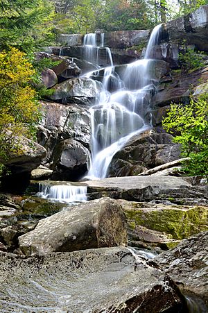
- The Ramsey Cascades Trail follows Ramsey Prong four miles (6 km) up Mount Guyot to Ramsey Cascades. This is a 65-foot (20-meter) waterfall. A side trail also leads to the top of Greenbrier Pinnacle.
- The Porters Creek Trail follows Porters Creek to Porters Flat. It passes the Messer Barn site before going to a backcountry campsite.
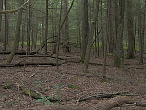
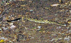
- The Old Settlers Trail is one of the longest trails in the park. It connects Greenbrier to the Cosby area. This trail was made by connecting old roads from different communities. You'll see many rock walls and old chimneys along the way. Timber rattlesnakes are sometimes seen on this trail.
Historical Sites
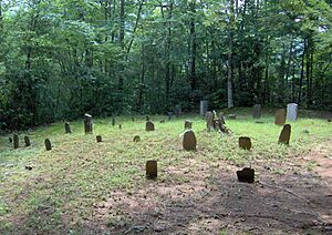
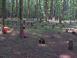
The Greenbrier area has many old chimneys and rock walls, which show where homes used to be. Most buildings were removed in the 1930s. However, a few are kept by the park service to show what pioneer life was like. The John Messer Barn and the Tyson McCarter Place are listed on the National Register of Historic Places. Plemmons Cemetery is one of the largest cemeteries in the park.
John Messer Barn
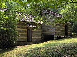
The John Messer Barn was built in 1875 by Pinkney Whaley. It's the only original building left from the old Greenbrier Cove community. It was added to the National Register in 1976. This barn is a special type called a "double-cantilever barn," which is mostly found in East Tennessee.
Smoky Mountains Hiking Club Cabin
The Smoky Mountains Hiking Club Cabin is next to the Messer Barn on the Porters Creek Trail. Members of the Smoky Mountains Hiking Club built this cabin between 1934 and 1936. It's one of the few buildings not built by the park service during the 1930s. The club used logs from old Whaley family buildings to construct the cabin around an existing chimney.
Tyson McCarter Place
The Tyson McCarter Place is near where the Old Settlers Trail crosses Webb Creek. It includes a barn, a corn crib, a smokehouse, and a springhouse, all built around 1876. Jacob Tyson McCarter bought the farm around 1900 and became an important person in the Webb Creek community. This area was added to the National Register of Historic Places in 1976.
Baxter Cabin
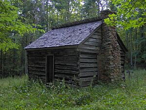
The Baxter/Jenkins Cabin is located near the Old Settlers Trail and the Maddron Bald Trail. Willis Baxter and his son, William, built it in 1889 as a wedding gift. This cabin is made of chestnut logs and measures 16 feet (4.9 meters) by 18 feet (5.5 meters). It had a wooden floor and a loft. There was also a small "tater hole" (like a tiny root cellar) near the fireplace. The cabin has doors on the front and back walls but no windows. An 8-foot (2.4-meter) by 18-foot (5.5-meter) kitchen used to be attached to the side but has been removed. The chimney is made of stone and mud.
 | Jackie Robinson |
 | Jack Johnson |
 | Althea Gibson |
 | Arthur Ashe |
 | Muhammad Ali |


