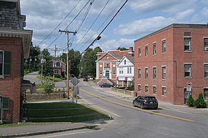
Greenville (CDP), New Hampshire facts for kids
Quick facts for kids
Greenville, New Hampshire
|
|
|---|---|

Main Street
|
|
| Country | United States |
| State | New Hampshire |
| County | Hillsborough |
| Town | Greenville |
| Area | |
| • Total | 3.43 sq mi (8.88 km2) |
| • Land | 3.43 sq mi (8.88 km2) |
| • Water | 0.00 sq mi (0.00 km2) |
| Elevation | 825 ft (251 m) |
| Population
(2020)
|
|
| • Total | 1,074 |
| • Density | 313.39/sq mi (121.01/km2) |
| Time zone | UTC-5 (Eastern (EST)) |
| • Summer (DST) | UTC-4 (EDT) |
| ZIP code |
03048
|
| Area code(s) | 603 |
| FIPS code | 33-31860 |
| GNIS feature ID | 2378066 |
Greenville is a small community in New Hampshire, United States. It's known as a "census-designated place" (CDP). This means it's a special area defined for counting people. Greenville is the main village in the larger town of Greenville.
In 2020, about 1,074 people lived in the CDP part of Greenville. The entire town of Greenville had a population of 1,974 people.
Contents
Exploring Greenville's Location
Greenville CDP is located in the northern part of the town of Greenville. The village itself sits on both sides of the Souhegan River. The CDP's edges follow the town lines to the north, east, and west.
To the south, the CDP border follows roads like New Hampshire Route 123 (River Street, Pleasant Street, and Mason Road) and Darling Hill Road. Any part of the town of Greenville south of these roads is not part of the CDP.
Main Roads in Greenville
New Hampshire Route 31 is the most important road in the CDP. It runs just east of the village center.
- Route 31 goes northeast about 8 miles (13 km) to Wilton.
- It also goes south about 13 miles (21 km) to Fitchburg, Massachusetts.
Route 123 heads west about 4 miles (6 km) to New Ipswich. It also goes southeast through Mason about 6 miles (10 km) to the Massachusetts border.
Route 45 starts from the village center and goes northwest through Temple. It reaches New Hampshire Route 101 about 6 miles (10 km) away. This spot is about 5 miles (8 km) east of Peterborough.
Land Area of Greenville
The Greenville CDP covers an area of about 8.9 square kilometers (3.4 square miles). All of this area is land.
Greenville's Population Over Time
| Historical population | |||
|---|---|---|---|
| Census | Pop. | %± | |
| 1950 | 1,179 | — | |
| 1960 | 1,251 | 6.1% | |
| 1970 | 1,332 | 6.5% | |
| 1980 | 1,447 | 8.6% | |
| 1990 | 1,135 | −21.6% | |
| 2000 | 1,131 | −0.4% | |
| 2010 | 1,108 | −2.0% | |
| 2020 | 1,074 | −3.1% | |
| U.S. Decennial Census | |||
In 2010, there were 1,108 people living in the CDP. These people lived in 457 households. About 259 of these were families.
Most people in Greenville CDP are white (97.1%). A small number are African American (1.0%), Native American (0.5%), or Asian (0.2%). About 2.4% of the population identified as Hispanic or Latino.
Households and Families
- About 30% of households had children under 18 living with them.
- About 38.5% were married couples living together.
- About 12.5% were households led by a woman without a husband present.
- About 35% of all households were made up of people living alone.
- About 14% of households had someone 65 years or older living alone.
The average household had about 2.42 people. The average family had about 3.16 people.
Age and Income
The median age in Greenville CDP was about 40.1 years old.
- About 23.6% of residents were under 18.
- About 12.7% were 65 years or older.
From 2011 to 2015, the average yearly income for a household was about $52,292. For a family, it was about $64,236. The average income per person was $23,252.
About 18.8% of the population lived below the poverty line. This included about 31.4% of people under 18 and 26.4% of people 65 or older.
See also
 In Spanish: Greenville (condado de Hillsborough) para niños
 | Tommie Smith |
 | Simone Manuel |
 | Shani Davis |
 | Simone Biles |
 | Alice Coachman |


