
Mason, New Hampshire facts for kids
Quick facts for kids
Mason, New Hampshire
|
|
|---|---|
|
Town
|
|

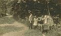
Uncle Sam's house
|
|

Location in Hillsborough County, New Hampshire
|
|
| Country | United States |
| State | New Hampshire |
| County | Hillsborough |
| Incorporated | 1768 |
| Area | |
| • Total | 24.0 sq mi (62.1 km2) |
| • Land | 23.9 sq mi (62.0 km2) |
| • Water | 0.04 sq mi (0.1 km2) 0.23% |
| Elevation | 745 ft (227 m) |
| Population
(2020)
|
|
| • Total | 1,448 |
| • Density | 61/sq mi (23.4/km2) |
| Time zone | UTC-5 (Eastern) |
| • Summer (DST) | UTC-4 (Eastern) |
| ZIP codes |
03048 (Mason)
03086 (Wilton) |
| Area code(s) | 603 |
| FIPS code | 33-46260 |
| GNIS feature ID | 0873661 |
Mason is a small town in New Hampshire, located in Hillsborough County. In 2020, about 1,448 people lived there. Mason shares the Russell-Abbott State Forest with the nearby town of Wilton.
Contents
Discover Mason's Past
Mason was first called "Number One." This name came from its place as the easternmost town along the border between the Province of New Hampshire and Massachusetts. This border was officially set in 1739.
How Mason Got Its Name
In 1749, the town received its own official document, called a charter, from colonial governor Benning Wentworth. Later, in 1768, Governor John Wentworth (Benning's nephew) named the town "Mason." He did this to honor Captain John Mason, who helped found New Hampshire.
Captain John Mason and Sir Ferdinando Gorges were given this land in 1622. They received it from the Council of New England. In 1629, they split the land. Gorges took the eastern part, which is now Maine. Mason kept the land that became New Hampshire.
Changes to Mason's Borders
Over time, Mason's size changed. In 1872, the town of Greenville was created from a part of Mason.
Famous People from Mason
Mason is known for a few interesting people:
- Samuel Wilson: His childhood home is in Mason. Many believe he was the inspiration for the famous American character, Uncle Sam. You can see a state historical marker at his old house today.
- Elizabeth Orton Jones: She was an author, illustrator, and teacher. People often called her "Twig." She wrote a lot about Mason's history. She also cared deeply about Andy's Summer Playhouse, a well-known youth theater in Mason.
- Pickity Place: This local cottage was built in 1759. It was the model for the grandmother's house in Elizabeth Orton Jones's 1948 illustrated version of "Little Red Riding Hood".
Exploring Mason's Geography
Mason covers about 62.1 square kilometers (24.0 square miles) of land. Only a tiny part, about 0.1 square kilometers (0.04 square miles), is water. This water makes up about 0.23% of the town's total area.
Rivers and Waterways
Several small streams flow through Mason. Spaulding Brook, Gould Mill Brook, and Wallace Brook flow east into the Nissitissit River. Walker Brook flows south into the Squannacook River in Massachusetts. Both the Nissitissit and Squannacook rivers eventually join the Nashua River. This means all the water in Mason flows into the larger Merrimack River system.
Highest Point in Mason
The highest point in Mason is about 1100 feet (335 meters) above sea level. It's an unnamed hill near the border with Greenville.
Neighboring Towns
Mason shares its borders with several other towns:
- To the north: Wilton
- To the northeast: Milford
- To the east: Brookline
- To the southeast: Townsend, Massachusetts
- To the southwest: Ashby, Massachusetts
- To the west: New Ipswich and Greenville
Main Roads in Mason
State routes 31, 123, and 124 help people travel through Mason.
Mason's Population Over Time
| Historical population | |||
|---|---|---|---|
| Census | Pop. | %± | |
| 1790 | 922 | — | |
| 1800 | 1,179 | 27.9% | |
| 1810 | 1,077 | −8.7% | |
| 1820 | 1,313 | 21.9% | |
| 1830 | 1,403 | 6.9% | |
| 1840 | 1,275 | −9.1% | |
| 1850 | 1,626 | 27.5% | |
| 1860 | 1,559 | −4.1% | |
| 1870 | 1,364 | −12.5% | |
| 1880 | 645 | −52.7% | |
| 1890 | 629 | −2.5% | |
| 1900 | 459 | −27.0% | |
| 1910 | 325 | −29.2% | |
| 1920 | 278 | −14.5% | |
| 1930 | 254 | −8.6% | |
| 1940 | 249 | −2.0% | |
| 1950 | 288 | 15.7% | |
| 1960 | 349 | 21.2% | |
| 1970 | 518 | 48.4% | |
| 1980 | 792 | 52.9% | |
| 1990 | 1,212 | 53.0% | |
| 2000 | 1,147 | −5.4% | |
| 2010 | 1,382 | 20.5% | |
| 2020 | 1,448 | 4.8% | |
| U.S. Decennial Census | |||

In 2000, there were 1,147 people living in Mason. These people made up 433 households and 328 families. The town had about 48 people per square mile (18.5 people per square kilometer). Most residents (98.08%) were White.
About 31.9% of households had children under 18. Most households (65.8%) were married couples. The average household had 2.65 people, and the average family had 3.02 people.
The population's age range was spread out. About 24.3% were under 18, and 8.5% were 65 or older. The average age in Mason was 40 years old.
The median income for a household in Mason was $60,433. For families, it was $61,908. About 3.4% of the population lived below the poverty line.
Public Buildings and Services


Mason is located just north of the Massachusetts border. The center of town is about 3 miles (4.8 kilometers) from the state line. In the town center, you'll find five important public buildings:
- The library
- The elementary school
- The meetinghouse
- The church
- The police station
These buildings are all located where Darling Hill, Old Ashby, Merriam Hill, Meetinghouse Hill, and Valley roads meet.
Students from Mason who are in middle or high school attend schools in Milford. Milford is northeast of Mason. The town's shared post office is located to the west, in Greenville. Down the hill from the town center, on Depot Road, are the Volunteer Fire and EMS Department and the Town Highway Department.
Notable People from Mason
- C. W. Anderson (1891–1971), an author and illustrator.
- John Boynton (1791–1868), who founded Worcester Polytechnic Institute.
- F. Ross Holland, Jr. (1927–2005), a historian known for his books about American lighthouses.
- Elizabeth Orton Jones (1910–2005), a children's book author and illustrator.
- Elizabeth Augusta Russell (1832–1911), a kind person who helped others and ran restaurants.
- Samuel Wilson (1766–1854), a meat-packer who might have inspired the "Uncle Sam" character.
- Walter A. Wood (1815–1892), a US congressman.
Images for kids
-
A Watering trough in Mason in 1909

See also
 In Spanish: Mason (Nuevo Hampshire) para niños
