Wilton (CDP), New Hampshire facts for kids
Quick facts for kids
Wilton, New Hampshire
|
|
|---|---|

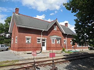
Wilton Station
|
|
| Country | United States |
| State | New Hampshire |
| County | Hillsborough |
| Towns | Wilton, Milford |
| Area | |
| • Total | 2.11 sq mi (5.46 km2) |
| • Land | 2.11 sq mi (5.46 km2) |
| • Water | 0.00 sq mi (0.00 km2) |
| Elevation | 380 ft (120 m) |
| Population
(2020)
|
|
| • Total | 1,324 |
| • Density | 628.08/sq mi (242.54/km2) |
| Time zone | UTC-5 (Eastern (EST)) |
| • Summer (DST) | UTC-4 (EDT) |
| ZIP codes | |
| Area code(s) | 603 |
| FIPS code | 33-85140 |
| GNIS feature ID | 2378096 |
Wilton is a small community in New Hampshire, United States. It is known as a census-designated place (CDP). This means it is a specific area identified by the U.S. Census Bureau for statistics. Wilton is the main village within the larger town of Wilton. It is located in Hillsborough County.
A small part of this community also reaches into the nearby town of Milford. In 2020, about 1,324 people lived in Wilton. This was an increase from 1,163 people in 2010.
Contents
Exploring Wilton's Location
Wilton is found in the northeastern part of the town of Wilton. It sits along the Souhegan River. Another stream, called Stony Brook, joins the Souhegan River here.
The community stretches west along Sand Hill Road. To the north, its border follows Curtis Farm Road, Dale Street, and Pead Hill Road. A small part of Wilton extends east into Milford. Here, it is bordered by the town of Lyndeborough to the north. The Souhegan River forms its southern border in this area.
Main Roads and Travel
Several important roads pass through Wilton. New Hampshire Route 101 runs along the southern edge of the community. This route can take you about 18 miles east to Bedford. If you head west, it's about 13 miles to Peterborough.
New Hampshire Route 31 goes right through the center of Wilton village. Traveling northwest on Route 31, you can reach Greenfield in about 10 miles. Going southwest, it's about 7 miles to Greenville. The city of Nashua is about 15 miles to the east. You can get there using Routes 101 and 101A.
Size of the Area
The Wilton community covers a total area of about 5.5 square kilometers (2.1 square miles). All of this area is land. There are no large bodies of water within the CDP boundaries.
Who Lives in Wilton?
| Historical population | |||
|---|---|---|---|
| Census | Pop. | %± | |
| 1950 | 1,615 | — | |
| 1960 | 1,425 | −11.8% | |
| 1970 | 1,161 | −18.5% | |
| 1980 | 1,310 | 12.8% | |
| 1990 | 1,165 | −11.1% | |
| 2000 | 1,236 | 6.1% | |
| 2010 | 1,163 | −5.9% | |
| 2020 | 1,324 | 13.8% | |
| U.S. Decennial Census | |||
Let's look at the people who call Wilton home. In 2010, there were 1,163 people living here. They lived in 455 households. A household is a group of people living together in one home.
Most people in Wilton are white. A small number of residents are African American, Native American, or Asian. Some people also identify with two or more races. About 2.2% of the population is of Hispanic or Latino background.
Families and Age Groups
Many households in Wilton have children under 18 living with them. About 46% of households are married couples living together. Some households are led by a single parent.
The average household size is about 2.56 people. The average family size is about 3.18 people.
About 27% of Wilton's residents are under 18 years old. Around 10% are 65 years or older. The median age in Wilton is about 36.5 years. This means half the people are younger than 36.5, and half are older.
See also
 In Spanish: Wilton (condado de Hillsborough) para niños
 | James B. Knighten |
 | Azellia White |
 | Willa Brown |


