
Greenfield, New Hampshire facts for kids
Quick facts for kids
Greenfield, New Hampshire
|
||
|---|---|---|

The former elementary school, listed on the New Hampshire State Register of Historic Places, now serves as the Town Office.
|
||
|
||

Location in Hillsborough County, New Hampshire
|
||
| Country | United States | |
| State | New Hampshire | |
| County | Hillsborough | |
| Incorporated | 1791 | |
| Area | ||
| • Total | 26.8 sq mi (69.3 km2) | |
| • Land | 26.2 sq mi (67.9 km2) | |
| • Water | 0.5 sq mi (1.4 km2) 2.04% | |
| Elevation | 840 ft (260 m) | |
| Population
(2020)
|
||
| • Total | 1,716 | |
| • Density | 66/sq mi (25.3/km2) | |
| Time zone | UTC-5 (Eastern) | |
| • Summer (DST) | UTC-4 (Eastern) | |
| ZIP code |
03047
|
|
| Area code(s) | 603 | |
| FIPS code | 33-31540 | |
| GNIS feature ID | 0873611 | |

Greenfield is a small town located in Hillsborough County, New Hampshire, United States. In 2020, about 1,716 people lived there. Greenfield is special because it's home to the Crotched Mountain Rehabilitation Center, a beautiful place called Greenfield State Park, and part of the famous Wapack Trail.
Contents
History of Greenfield
Greenfield was first settled in 1753 and was known as "Lyndeborough Addition." The Lynde family were some of the first people to live here.
Why Greenfield Got Its Name
The early settlers found it hard to get to the nearest church and school because of the big Monadnock hills. So, in 1791, they asked to form their own town. They chose the name "Greenfield" because the area had lots of flat, fertile land that was great for farming.
Crotched Mountain Center
In 1953, the Crotched Mountain Rehabilitation Center opened in Greenfield. It was started by Harry Gregg. This center helps people with different physical and brain challenges.
- It first helped people with conditions like polio and cerebral palsy.
- In 1961, a center for adults opened.
- In 1986, they added a center for adults who had brain injuries.
- Today, the center helps over 2,000 children and adults.
- In 2004, they built the first wheelchair-friendly tree house in New Hampshire, which is super cool!
The Yankee Siege Trebuchet
Greenfield is also home to something called the Yankee Siege. This is a very powerful trebuchet, which is like a giant catapult used in old times. It's known as one of the strongest trebuchets in the world!
- Since 2004, the Yankee Siege has taken part in the World Championship Punkin' Chunkin' Contest in Sussex County, Delaware.
- In 2008, it officially threw a pumpkin 1,897 feet (about 578 meters).
- There are even unofficial reports of it throwing pumpkins over 2,000 feet (about 610 meters)!
Geography of Greenfield
Greenfield covers about 26.7 square miles (69.3 square kilometers). Most of this area is land, about 26.2 square miles (67.9 square kilometers), and a small part, about 0.5 square miles (1.4 square kilometers), is water.
Rivers and Waterways
- The southeastern part of Greenfield has Stony Brook, which flows southeast into the Souhegan River.
- The western part of town, including the main center, is drained by the Contoocook River and a smaller stream called Otter Brook. The Contoocook River forms the northwestern edge of the town and flows through Powder Mill Pond.
- The northeastern corner of Greenfield is drained by Rand Brook, which flows into the South Branch of the Piscataquog River.
- All the water in Greenfield eventually flows into the Merrimack River.
Highest Point
The highest point in Greenfield is North Pack Monadnock. This mountain is about 2,276 feet (694 meters) above sea level. It's the northernmost peak of the Wapack Range.
Neighboring Towns
Greenfield shares its borders with several other towns:
- To the north: Bennington, New Hampshire
- To the northeast: Francestown, New Hampshire
- To the east: Lyndeborough, New Hampshire
- To the south: Temple, New Hampshire
- To the southwest: Peterborough, New Hampshire
- To the west: Hancock, New Hampshire
Population of Greenfield
| Historical population | |||
|---|---|---|---|
| Census | Pop. | %± | |
| 1800 | 934 | — | |
| 1810 | 980 | 4.9% | |
| 1820 | 974 | −0.6% | |
| 1830 | 946 | −2.9% | |
| 1840 | 834 | −11.8% | |
| 1850 | 716 | −14.1% | |
| 1860 | 692 | −3.4% | |
| 1870 | 527 | −23.8% | |
| 1880 | 649 | 23.1% | |
| 1890 | 607 | −6.5% | |
| 1900 | 605 | −0.3% | |
| 1910 | 574 | −5.1% | |
| 1920 | 417 | −27.4% | |
| 1930 | 394 | −5.5% | |
| 1940 | 407 | 3.3% | |
| 1950 | 430 | 5.7% | |
| 1960 | 538 | 25.1% | |
| 1970 | 1,058 | 96.7% | |
| 1980 | 972 | −8.1% | |
| 1990 | 1,519 | 56.3% | |
| 2000 | 1,657 | 9.1% | |
| 2010 | 1,749 | 5.6% | |
| 2020 | 1,716 | −1.9% | |
| U.S. Decennial Census | |||
In 2000, there were 1,657 people living in Greenfield. The population has grown over the years. About 38.9% of the households had children under 18 living with them. The average age of people in Greenfield was 34 years old.
Images for kids
-
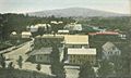
A bird's-eye view of Greenfield in 1907.
-
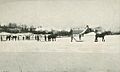
People harvesting ice from Zephyr Lake around 1907.
-
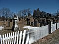
The town graveyard in Greenfield.
-
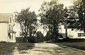
Bennington Road around 1912.
-
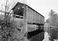
The old Hancock-Greenfield Bridge over the Contoocook River.


.jpg)
See also
 In Spanish: Greenfield (Nuevo Hampshire) para niños
