Hagerman Pass facts for kids
Quick facts for kids Hagerman Pass |
|
|---|---|

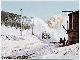
A train in Hagerman Pass, 1899
|
|
| Elevation | 11,925 ft (3,635 m) |
| Traversed by | Unpaved road |
| Location | Lake–Pitkin county border, Colorado, U.S. |
| Range | Sawatch Range |
| Coordinates | 39°15′54″N 106°29′02″W / 39.26500°N 106.48389°W |
| Topo map | USGS Homestake Reservoir |
Hagerman Pass is a high mountain pass in the Rocky Mountains of central Colorado, United States. It sits at an elevation of 11,925 feet (3,635 meters). This pass crosses the continental divide, which is like a giant natural line that separates rivers flowing to different oceans.
Hagerman Pass connects the headwaters of the Arkansas River on the east side with the upper valley of the Fryingpan River on the west. The Fryingpan River flows into the larger Colorado River.
Contents
Exploring Hagerman Pass: A Mountain Adventure
What is Hagerman Pass?
Hagerman Pass is a famous mountain pass in the Sawatch Range of Colorado. It is located west of the town of Leadville. The pass is a key point where the continental divide crosses the mountains. This means water on one side flows east, and water on the other side flows west.
How Hagerman Pass Got Its Name
The pass is named after J. J. Hagerman. He was an important person who built the Colorado Midland Railroad. This railroad was very important for transportation in the mountains long ago.
The Railroad and Its Tunnels
The Colorado Midland Railroad once crossed the Continental Divide near Hagerman Pass. It did this by using tunnels. The first tunnel was the Hagerman Tunnel, built in 1877. Later, a new tunnel called the Busk-Ivanhoe Tunnel was built in 1893. This second tunnel was at a lower elevation, making it easier for trains to pass through.
Today, the Busk-Ivanhoe Tunnel is no longer used by trains. Instead, it works as a water diversion tunnel. This means it moves water from Ivanhoe Lake on the west side of the pass into the Arkansas River basin.
Powering the West: The Shoshone Line
In 1909, an important electric line was built over the pass. This was the Shoshone Transmission Line. It connected a power generating station near Glenwood Springs to the cities of Leadville and Denver. This historic power line has been updated many times over the years. It is still used today to bring electricity to homes and businesses.
Traveling Hagerman Pass Today
Today, Hagerman Pass is crossed by an unpaved road. This road is not suitable for all vehicles. You will need a four-wheel drive vehicle, a bicycle, an ATV, or you can travel on foot. Regular two-wheel drive cars might find it hard to get through. This is because there are some stream crossings and rocky parts.
The pass is usually open from late May. It stays open until the first heavy snow arrives in the middle or end of autumn. Sometimes, fallen trees can block the road.
 | Aurelia Browder |
 | Nannie Helen Burroughs |
 | Michelle Alexander |

