Haledon, New Jersey facts for kids
Quick facts for kids
Haledon, New Jersey
|
||
|---|---|---|
|
Borough
|
||
|
||
|
||
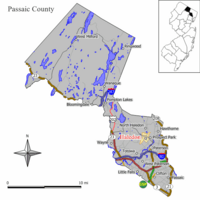
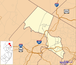
Map of Haledon in Passaic County. Inset: Location of Passaic County highlighted in the State of New Jersey.
|
||
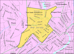
Census Bureau map of Haledon, New Jersey
|
||
| Country | ||
| State | ||
| County | ||
| Incorporated | May 21, 1908 | |
| Government | ||
| • Type | Borough | |
| • Body | Borough Council | |
| Area | ||
| • Total | 1.22 sq mi (3.15 km2) | |
| • Land | 1.22 sq mi (3.15 km2) | |
| • Water | 0.00 sq mi (0.00 km2) 0.08% | |
| Area rank | 484th of 565 in state 15th of 16 in county |
|
| Elevation | 217 ft (66 m) | |
| Population
(2020)
|
||
| • Total | 9,052 | |
| • Estimate
(2023)
|
8,834 | |
| • Rank | 262nd of 565 in state 13th of 16 in county |
|
| • Density | 7,450.2/sq mi (2,876.5/km2) | |
| • Density rank | 60th of 565 in state 5th of 16 in county |
|
| Time zone | UTC−05:00 (Eastern (EST)) | |
| • Summer (DST) | UTC−04:00 (Eastern (EDT)) | |
| ZIP Codes |
07508, 07538
|
|
| Area code(s) | 973 | |
| FIPS code | 3403129070 | |
| GNIS feature ID | 0885240 | |
| Website | ||
Haledon is a small town, called a borough, in Passaic County, New Jersey. In 2020, about 9,052 people lived there. This was an increase from 8,318 people in 2010.
Haledon became an official borough on April 8, 1908. This happened after people voted for it on May 21, 1908. Before that, it was part of a larger area called Manchester Township.
Contents
History of Haledon
Haledon grew up next to the busy industrial city of Paterson, New Jersey. Early settlers were farmers from Dutch families like the Van Ripers and Berdans. Before the Civil War, other families like the Roes and Leonards joined them. These families helped start St. Mary's Episcopal Church and local businesses.
Haledon's Growth as a Suburb
After the Civil War, Haledon became a "streetcar suburb" for Paterson. This meant people could live in Haledon and easily travel to work in Paterson by trolley. The main part of town was called Haledon. The area around a large pond was known as Oldham.
In 1871, the Paterson and Haledon Horse Rail Road Company built trolley tracks. By 1888, these tracks were electric. Many owners of the trolley company also started the Cedar Cliff Land Company. This company bought a lot of land in Haledon. Many street names in Haledon are named after these important business people.
Homes for Workers and Wealthy Families
The lower, flat parts of Haledon were divided into small lots. These were 25 feet by 100 feet, like city lots. The hillsides were planned for larger Victorian "villas." Important people like Vice President Garret A. Hobart built homes there. Today, William Paterson University is on the site of his former home.
Haledon mostly became a place for working-class families. The Cedar Cliff Land Company advertised these small lots to immigrants. Many of these immigrants were skilled workers in Paterson's silk factories. They wanted to escape the crowded city but still be close to their jobs. The company even opened the Cedar Cliff Silk Mill in Haledon.
A Socialist Mayor and the Silk Strike
In 1908, Haledon officially became a borough. In 1912, Socialist William Bruekmann was elected mayor. He was popular with the immigrant silk workers.
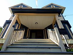
During the important 1913 Paterson silk strike, workers were not allowed to hold meetings in Paterson. So, Haledon's mayor let them meet in Haledon. The Pietro and Maria Botto House was a perfect spot. It was on a hillside with open space, like a natural outdoor theater. Thousands of people gathered there to hear famous labor leaders speak. These leaders included Big Bill Haywood and Elizabeth Gurley Flynn.
Today, the Botto House is a National Historic Landmark. It is also home to the American Labor Museum. This museum shares the story of Italian immigrants and the 1913 Paterson Silk Strike.
Geography of Haledon
Haledon covers about 1.156 square miles (2.993 square kilometers). Most of this area is land. A small part is water, including a stream called Molly Ann Brook. This brook flows into the Passaic River.
Haledon borders several other towns in Passaic County. These include North Haledon, Paterson, Prospect Park, Totowa, and Wayne.
Population Data
| Historical population | |||
|---|---|---|---|
| Census | Pop. | %± | |
| 1910 | 2,560 | — | |
| 1920 | 3,435 | 34.2% | |
| 1930 | 4,812 | 40.1% | |
| 1940 | 5,303 | 10.2% | |
| 1950 | 6,204 | 17.0% | |
| 1960 | 6,161 | −0.7% | |
| 1970 | 6,767 | 9.8% | |
| 1980 | 6,607 | −2.4% | |
| 1990 | 6,951 | 5.2% | |
| 2000 | 8,252 | 18.7% | |
| 2010 | 8,318 | 0.8% | |
| 2020 | 9,052 | 8.8% | |
| 2023 (est.) | 8,834 | 6.2% | |
| Population sources: 1910–1920 1910 1910–1930 1940–2000 2000 2010 2020 |
|||
In 2010, Haledon had 8,318 people living in 2,778 households. About 39% of households had children under 18. The average household had almost 3 people.
The population was made up of different groups. About 62% were White, 11% Black or African American, and 6% Asian. About 41% of the population was Hispanic or Latino. The median age in Haledon was about 33.7 years old.
Education in Haledon
Students in Haledon attend schools run by the Haledon School District. This district serves students from pre-kindergarten up to eighth grade. All these students go to Haledon Public School. In the 2021-22 school year, there were 1,020 students and 96 teachers. This means there were about 10.6 students for every teacher.
For high school, students from Haledon go to Manchester Regional High School. This school is also located in Haledon. It serves students from Haledon, North Haledon, and Prospect Park. In 2021-22, the high school had 748 students. There were about 11.4 students per teacher.
Transportation
Haledon has about 17.73 miles of roads. Most of these roads are managed by the town itself.
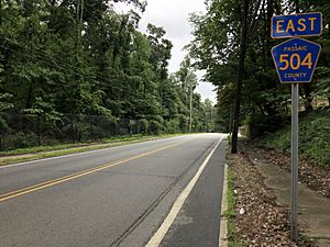
The main road through Haledon is County Route 504. It goes through the borough, following Pompton Road and Haledon Avenue.
NJ Transit provides local bus services in Haledon. These buses include routes 703, 744, and 748.
Notable People from Haledon
Many interesting people have lived in or are connected to Haledon:
- Bruce Baumgartner (born 1960) is a famous wrestler. He won two Olympic gold medals and three World Championships. He holds the record for the most World or Olympic medals won by an American wrestler.
- Bennie Borgmann (1900–1978) was an early professional basketball player. He was added to the Basketball Hall of Fame in 1961.
- Jennie Tuttle Hobart (1849–1941) was the wife of former U.S. Vice President Garret Hobart.
- Bruce Huther (born 1954) was an NFL linebacker. He won Super Bowl XII with the Dallas Cowboys.
- Alex Morales (born 1997) is a college basketball player for the Wagner Seahawks.
Points of Interest
- The Pietro and Maria Botto House is a special place. It is listed on the National Register of Historic Places. It is now the American Labor Museum. The museum teaches about Italian immigration and the 1913 Paterson Silk Strike.
- The Kossuth Street School was built in 1894. It was added to the National Register of Historic Places in 1980.
See also
 In Spanish: Haledon para niños


