
Hardee County, Florida facts for kids
Quick facts for kids
Hardee County
|
||
|---|---|---|

Hardee County Courthouse
|
||
|
||

Location within the U.S. state of Florida
|
||
 Florida's location within the U.S. |
||
| Country | ||
| State | ||
| Founded | April 23, 1921 | |
| Named for | Cary A. Hardee | |
| Seat | Wauchula | |
| Largest city | Wauchula | |
| Area | ||
| • Total | 638 sq mi (1,650 km2) | |
| • Land | 638 sq mi (1,650 km2) | |
| • Water | 0.6 sq mi (2 km2) 0.1%% | |
| Population
(2020)
|
||
| • Total | 25,327 | |
| • Density | 43/sq mi (17/km2) | |
| Time zone | UTC−5 (Eastern) | |
| • Summer (DST) | UTC−4 (EDT) | |
| Congressional district | 17th | |

Hardee County is a county located in the Florida Heartland area of Central Florida. It is in the U.S. state of Florida. In 2020, about 25,327 people lived there. The main town and county seat is Wauchula. Hardee County is part of the Wauchula, FL Micropolitan Statistical Area. This means it's a small city area that is important for its region.
Contents
History of Hardee County
Hardee County was created on April 23, 1921. The Florida Legislature (which is like Florida's law-making group) divided "old DeSoto County" into five new counties. These were Hardee, DeSoto, Charlotte, Highlands, and Glades counties.
The county is named after Cary A. Hardee. He was the Governor of Florida from 1921 to 1925. He signed the law that created Hardee County.
Early Settlements and Conflicts
People started settling in what is now Hardee County in April 1849. This began with the Kennedy-Darling Indian-trading post on Paynes Creek. Sadly, on July 17, 1849, two clerks, George Payne and Dempsey Whidden, were killed by Native Americans. Another clerk, William McCullough, and his wife Nancy were hurt, and the trading post was burned.
Because of this attack, the U.S. Army built forts across Florida. One of these, Fort Chokonikla, was started on October 26, 1849. However, it was left empty in July 1850 because many people got sick.
During the Seminole Wars, two other forts, Fort Green and Fort Hartsuff, were set up in the area. Fort Hartsuff later became the town of Wauchula, which is now the county seat.
Growth and Development
In 1886, the Florida Southern Railway arrived. This brought many new settlers to Hardee County. People found jobs working for the railroad, in stores, farming, ranching, and teaching.
By the early 1900s, the county seat of Wauchula became an official town in 1902. The first bank opened there in 1904.
A group called "Divisionists" started working in 1907 to create new counties from "old DeSoto County." After 15 years, their efforts paid off. The Florida Legislature divided DeSoto County into five parts, creating the 638-square-mile Hardee County.
On August 13, 2004, Hurricane Charley passed directly through Hardee County. Winds in downtown Wauchula reached about 149 miles per hour (240 km/h). Most buildings in the county were damaged, and many were completely destroyed.
Geography of Hardee County
Hardee County covers about 638 square miles (1,652 square kilometers). Most of this area is land, with only a tiny part (0.1%) being water.
Bone Valley and Phosphate Mining
Hardee County is located in a region known as "Bone Valley." This area has most of North America's phosphate deposits. Phosphate is a mineral used to make fertilizers for farming. Mining for phosphate has been happening here since the late 1800s.
The Mosaic Company operates the only phosphate mines in Hardee County. They have mines near Fort Green and Ona, FL.
There is some debate about phosphate mining. Some people are concerned about changing farmland into open pit mines. After mining, the land is restored. This process creates new lakes and wetlands.
Rules for restoring mined land include making safe slopes, ensuring good water quality, replanting plants, and bringing wetlands back to how they were before mining.
People who are against mining say it can harm the environment. They worry about increased radiation levels, poorer water quality, and making land less suitable for farming.
Those who support mining say it is very important for America's food supply and economy. They also believe that restored mine land can be better for the environment than farmland.
Adjacent counties
Hardee County shares borders with these other counties:
- Polk County, Florida - to the north
- Highlands County, Florida - to the east
- DeSoto County, Florida - to the south
- Manatee County, Florida - to the west
- Hillsborough County, Florida - to the northwest
Population Information
| Historical population | |||
|---|---|---|---|
| Census | Pop. | %± | |
| 1930 | 10,348 | — | |
| 1940 | 10,158 | −1.8% | |
| 1950 | 10,073 | −0.8% | |
| 1960 | 12,370 | 22.8% | |
| 1970 | 14,889 | 20.4% | |
| 1980 | 19,379 | 30.2% | |
| 1990 | 19,499 | 0.6% | |
| 2000 | 26,938 | 38.2% | |
| 2010 | 27,731 | 2.9% | |
| 2020 | 25,327 | −8.7% | |
| 2023 (est.) | 25,760 | −7.1% | |
| U.S. Decennial Census 1790-1960 1900-1990 1990-2000 2010-2019 |
|||
| Race | Pop 2010 | Pop 2020 | % 2010 | % 2020 |
|---|---|---|---|---|
| White (NH) | 13,315 | 11,873 | 48.01% | 46.88% |
| Black or African American (NH) | 1,877 | 2,111 | 6.77% | 8.33% |
| Native American (NH) | 91 | 55 | 0.33% | 0.22% |
| Asian (NH) | 294 | 165 | 1.06% | 0.65% |
| Pacific Islander (NH) | 8 | 3 | 0.03% | 0.01% |
| Some Other Race (NH) | 6 | 35 | 0.02% | 0.14% |
| Mixed/Multi-Racial (NH) | 245 | 481 | 0.88% | 1.9% |
| Hispanic or Latino | 11,895 | 10,604 | 42.89% | 41.87% |
| Total | 27,731 | 25,327 |
In 2020, there were 25,327 people living in Hardee County. There were 7,991 households and 5,838 families.
In 2000, about 27.6% of the population was under 18 years old. The average age was 33 years. For every 100 females, there were about 119 males.
Libraries in Hardee County
Hardee County is part of the Heartland Library Cooperative. This group helps libraries in Hardee and nearby counties like Glades, Highlands, Okeechobee, and DeSoto. The library system has seven branches, and one is in Wauchula.
The Hardee County Public Library started in the mid-1980s. Local residents wanted a bigger library for the growing county. In 1984, the county leaders agreed to create the library. In 1997, the library joined the Heartland Library Cooperative. This gave them more books and resources.
In 2004, Hurricane Charley badly damaged the library building. It closed for repairs in 2006 and reopened in January 2007. The library grew from 5,800 square feet in 1984 to 15,680 square feet in 2007. It lends out about 71,251 items each year.
Besides books, the library has old local newspapers on microfilm. It also has Wauchula City Directories from the 1970s and 1980s. A library card is free for people living in Hardee County and other counties in the Heartland Library Cooperative.
Communities in Hardee County
Cities
Town
Census-designated places
Other unincorporated communities
- Crewsville
- Lake Dale
- Oak Grove
- Popash
- Sweetwater Ranch
- Village of Charlie Creek
Transportation
Airports
- Wauchula Municipal Airport
Major highways
 U.S. Route 17
 State Road 62
 State Road 64
 State Road 66
 State Road 636
Education in Hardee County
The Hardee County School District has nine schools. They serve about 5,300 students. The district has five elementary schools, one junior high school, one high school, one alternative school, and one adult/community school.
Hardee Senior High and Hardee Junior High are in Wauchula. The younger schools are in Bowling Green, Hilltop, North Wauchula, Wauchula, and Zolfo Springs.
The school district is very diverse, with 70% of students being from minority groups. Also, 47.9% of students come from families with lower incomes. The high school graduation rate in Hardee County is 91%, which is higher than Florida's state average of 87.3%.
South Florida State College is a public college that serves Hardee, Highlands, and DeSoto Counties. Its campus in Hardee County is located in Bowling Green.
Images for kids
-
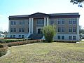
The Hardee County Courthouse

See also
 In Spanish: Condado de Hardee para niños
