Hato Mayor del Rey facts for kids
Quick facts for kids
Hato Mayor del Rey
|
||
|---|---|---|
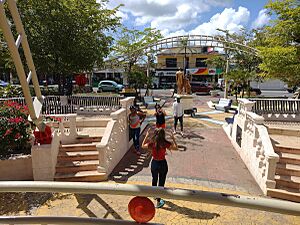
Mercedes de la Rocha Plaza |
||
|
||
| Country | ||
| Province | Hato Mayor | |
| Founded | 1520 | |
| Municipality since | 1843 | |
| Area | ||
| • Total | 659.65 km2 (254.69 sq mi) | |
| Elevation | 102 m (335 ft) | |
| Population
(2012)
|
||
| • Total | 70,141 | |
| • Density | 106.3306/km2 (275.395/sq mi) | |
| • Urban | 61,576 | |
| Distance to – Santo Domingo |
110 km |
|
| Municipalities | 3 | |
| Climate | Am | |
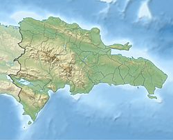
Hato Mayor del Rey is an important city in the Dominican Republic. It is the capital of the Hato Mayor Province. This city is surrounded by other towns and provinces. To the north are El Valle and Sabana de la Mar. To the south is the San Pedro de Macorís Province. The El Seibo Province is to the east, and Bayaguana, Monte Plata is to the west.
Hato Mayor del Rey is about 27 kilometers (17 miles) from San Pedro de Macorís. It is also about 110 kilometers (68 miles) from Santo Domingo, the capital city of the Dominican Republic. In 2012, about 70,141 people lived here. The city is divided into three main areas called municipal districts: Yerba Buena, Guayabo Dulce, and Mata Palacio.
Contents
What's in a Name?
The name Hato Mayor del Rey means "Great Herd of the King" in English. This name comes from a long time ago, in the 1500s. During that time, Hato Mayor del Rey was one of the biggest places for raising cattle on the island of Hispaniola. These cattle were raised for King Charles I.
A Look Back in Time
Hato Mayor del Rey was started around the year 1520. A person named Francisco Dávila created it as land for cattle farming and growing crops. Francisco Dávila was an important official in Hispaniola. He set up a special land ownership system called the Majorat of Dávila in 1554. The lands of Hato Mayor del Rey were part of this special land.
Over many years, Hato Mayor del Rey was passed down through different families. In 1746, Don Antonio Coca y Vevers Landeche, who managed the Dávila lands, officially founded Hato Mayor del Rey as a village. He also built a small church, called a hermitage. This church was dedicated to Our Lady of Mercy. It helped encourage people living nearby to practice Catholicism.
Until 1843, Hato Mayor del Rey was part of the community of El Seibo. But in July 1843, it became its own independent community. This happened because of a decision by the Haitian forces who were in charge at that time. However, its independent status was lost in 1845. It became a military outpost of El Seibo again.
Later, on October 13, 1848, the Dominican President Manuel Jiménes declared Hato Mayor del Rey an independent town once more. During a time called the Annexation, Hato Mayor del Rey was used as a military base. Its job was to protect El Seibo.
In 1888, a woman named María de las Mercedes de la Rocha y Landeche and her husband donated a very large piece of land to the City Council of Hato Mayor del Rey. This was a significant gift to the community.
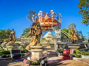
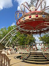
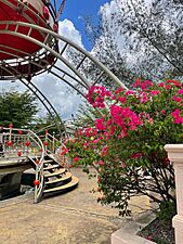
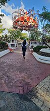
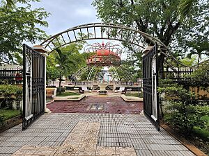
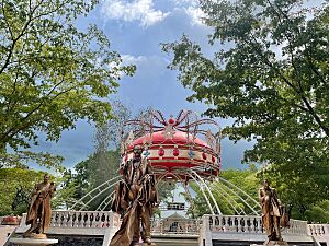
Hato Mayor del Rey Park
The city has a beautiful central park. It's a popular spot for people to relax and enjoy the outdoors.
Weather and Climate
Hato Mayor del Rey has a tropical monsoon climate. This means the weather is hot and humid all year round. There are two main seasons. One season is a bit drier and less uncomfortable. This lasts from December to March. The other season is wetter and even hotter. This runs from April to November.
| Climate data for Hato Mayor del Rey (1961-1990) | |||||||||||||
|---|---|---|---|---|---|---|---|---|---|---|---|---|---|
| Month | Jan | Feb | Mar | Apr | May | Jun | Jul | Aug | Sep | Oct | Nov | Dec | Year |
| Record high °C (°F) | 35.0 (95.0) |
37.2 (99.0) |
38.0 (100.4) |
39.0 (102.2) |
37.8 (100.0) |
37.4 (99.3) |
37.6 (99.7) |
39.0 (102.2) |
38.0 (100.4) |
37.6 (99.7) |
36.0 (96.8) |
35.5 (95.9) |
39.0 (102.2) |
| Mean daily maximum °C (°F) | 30.2 (86.4) |
30.6 (87.1) |
31.5 (88.7) |
31.9 (89.4) |
32.4 (90.3) |
33.1 (91.6) |
33.6 (92.5) |
33.5 (92.3) |
33.1 (91.6) |
32.6 (90.7) |
31.2 (88.2) |
30.1 (86.2) |
32.0 (89.6) |
| Mean daily minimum °C (°F) | 17.6 (63.7) |
17.5 (63.5) |
18.3 (64.9) |
19.1 (66.4) |
20.6 (69.1) |
21.4 (70.5) |
21.4 (70.5) |
21.3 (70.3) |
21.1 (70.0) |
20.7 (69.3) |
19.8 (67.6) |
18.6 (65.5) |
19.8 (67.6) |
| Record low °C (°F) | 12.0 (53.6) |
11.9 (53.4) |
12.1 (53.8) |
13.3 (55.9) |
14.5 (58.1) |
14.8 (58.6) |
15.4 (59.7) |
16.9 (62.4) |
16.9 (62.4) |
16.6 (61.9) |
14.4 (57.9) |
12.9 (55.2) |
11.9 (53.4) |
| Average rainfall mm (inches) | 51.5 (2.03) |
42.0 (1.65) |
59.7 (2.35) |
116.5 (4.59) |
216.3 (8.52) |
187.9 (7.40) |
120.0 (4.72) |
187.2 (7.37) |
209.5 (8.25) |
219.0 (8.62) |
110.6 (4.35) |
62.0 (2.44) |
1,582.2 (62.29) |
| Average rainy days (≥ 1.0 mm) | 5.4 | 4.9 | 5.4 | 6.7 | 12.2 | 9.9 | 8.9 | 10.8 | 12.7 | 12.6 | 8.1 | 6.9 | 104.5 |
| Source: NOAA | |||||||||||||
Famous People from Hato Mayor del Rey
- Antonio Bastardo – a professional major league baseball pitcher who played for teams like the Philadelphia Phillies.
See also
 In Spanish: Hato Mayor para niños
 | Isaac Myers |
 | D. Hamilton Jackson |
 | A. Philip Randolph |


