Hato Rey Central facts for kids
Quick facts for kids
Hato Rey Central
|
|
|---|---|
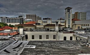
Polytechnic University of Puerto Rico and the Milla de Oro in the background.
|
|
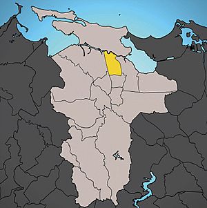
Location of Hato Rey Central shown in yellow.
|
|
| Commonwealth | |
| Municipality | |
| Area | |
| • Total | 1.04 sq mi (2.7 km2) |
| • Land | 1.03 sq mi (2.7 km2) |
| • Water | 0.01 sq mi (0.03 km2) |
| Elevation | 23 ft (7 m) |
| Population
(2010)
|
|
| • Total | 16,640 |
| • Density | 16,155.3/sq mi (6,237.6/km2) |
| 2010 census | |
| ZIP code |
00917
|
Hato Rey Central is a busy neighborhood, also called a "barrio," in San Juan, Puerto Rico. It's one of 18 such areas in the city. This barrio is quite lively, with about 16,640 people living in an area of just over one square mile.
Hato Rey Central used to be part of a different town called Rio Piedras. In 1951, Rio Piedras joined with San Juan. That's how Hato Rey Central became a part of San Juan.
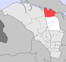
This barrio is surrounded by other parts of San Juan. To the west, you'll find Hato Rey Norte. To the south is the barrio of Universidad. On the east side, it borders Oriente. To the north, it touches Santurce. A waterway called the Caño Martín Peña separates Hato Rey Central from Santurce.
Contents
Population in Hato Rey Central
| Historical population | |||
|---|---|---|---|
| Census | Pop. | %± | |
| 1950 | 27,327 | — | |
| 1960 | 28,745 | 5.2% | |
| 1970 | 28,327 | −1.5% | |
| 1980 | 23,246 | −17.9% | |
| 1990 | 22,504 | −3.2% | |
| 2000 | 20,867 | −7.3% | |
| 2010 | 16,640 | −20.3% | |
| U.S. Decennial Census 1900 (N/A) 1910-1930 1930-1950 1980-2000 2010 |
|||
In 2010, the population of Hato Rey Central was 16,640 people. This means there were about 16,155 residents for every square mile, making it a very populated area.
Sub-Districts of Hato Rey Central
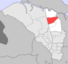
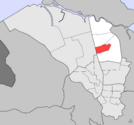
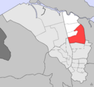
Hato Rey Central is divided into four smaller areas called "subbarrios." These are like smaller neighborhoods within the main barrio, listed from north to south:
- Las Monjas
- Ciudad Nueva
- Floral Park
- Quintana
Important Places and Landmarks
Hato Rey Central has several interesting places to visit:
- Martín Peña Bridge: This bridge connects Hato Rey Central with Santurce. It has a special Art Deco design, which is a cool style of architecture.
- Milla de Oro: This area is known as the "Golden Mile." It's the main business district of San Juan, where many important offices and banks are located.
- Polytechnic University of Puerto Rico: The main campus of this university is found here. It's a place where many students go to learn and study.
Getting Around Hato Rey Central
Even though the main train stations aren't directly inside Hato Rey Central, they are very close by. The Tren Urbano (Urban Train) has stations like Piñero, Domenech, Roosevelt, and Hato Rey just steps away. This makes it easy for people to travel around the city. The area is also served by the Metropolitan Bus Authority (AMA), which provides bus services.
Images for kids
See also
 In Spanish: Hato Rey Central para niños
 | Georgia Louise Harris Brown |
 | Julian Abele |
 | Norma Merrick Sklarek |
 | William Sidney Pittman |


