Hay River (Canada) facts for kids
Quick facts for kids Hay River |
|
|---|---|

|
|
| Country | Canada |
| Physical characteristics | |
| Main source | Northern Alberta 720 metres (2,360 ft) 58°05′06″N 119°01′19″W / 58.08496°N 119.02201°W |
| River mouth | Great Slave Lake at Hay River 156 metres (512 ft) 60°51′41″N 115°43′58″W / 60.86134°N 115.73290°W |
| Length | 702 kilometres (436 mi) |
| Basin features | |
| Basin size | 48,200 square kilometres (18,600 sq mi) |
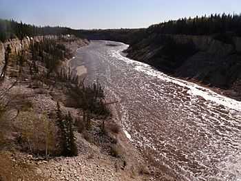
The Hay River is a big river in northern Alberta and southern Northwest Territories, Canada. In the South Slavey language, it is called Kátå’odehche.
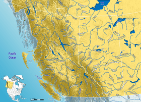
This river starts in a wet, boggy area called muskeg in northwestern Alberta. It then flows west into British Columbia. After that, it turns north and goes back into Alberta. From there, it flows north-northeast towards the Northwest Territories.
The Hay River passes over two main waterfalls: the Alexandra Falls and Louise Falls. It then flows through the town of Hay River. Finally, it empties into the Great Slave Lake. From this lake, its water travels to the Arctic Ocean through the Mackenzie River.
The Hay River is about 702 kilometres (436 mi) long. Its drainage area is 48,200 square kilometres (18,600 sq mi). This means that all the rain and melted snow from this large area flows into the Hay River.
Smaller Rivers Joining the Hay River
Many smaller rivers and streams flow into the Hay River. These are called tributaries. Some of the main tributaries include:
- The Chinchaga River
- The Meander River
- The Steen River
- The Melvin River
- The Little Hay River
The Hay River also flows through the Hay-Zama Lakes. Rainbow Lake is actually a wider part of the river itself.
Communities Along the River
Several towns and communities are located in the Hay River basin. In Alberta, these include:
- Rainbow Lake
- Zama City
- Steen River
- Indian Cabins (called Dzêtú in South Slavey)
In the Northwest Territories, communities include:
- Enterprise
- The town of Hay River
There are also two First Nations communities in the river basin:
At the border between Alberta and the Northwest Territories, the river's annual discharge is about 3,630,000 cubic decametres (2,940,000 acre⋅ft). This is the amount of water that flows past that point each year.
See also
In Spanish: Río Hay para niños
 | Roy Wilkins |
 | John Lewis |
 | Linda Carol Brown |


