Henrys Fork (Snake River tributary) facts for kids
Quick facts for kids Henrys Fork |
|
|---|---|
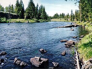
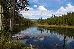
Henrys Fork in eastern Idaho
|
|
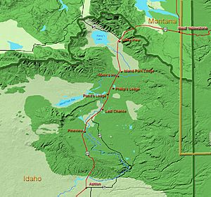
Henrys Fork upper drainage
|
|
|
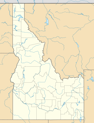
Location of the mouth of Henrys Fork in Idaho
|
|
| Country | United States |
| State | Idaho |
| Counties | Fremont County, Idaho, Madison County, Idaho |
| Physical characteristics | |
| Main source | near Island Park, Fremont County, Idaho 6,397 ft (1,950 m) 44°29′34″N 111°16′58″W / 44.49278°N 111.28278°W |
| River mouth | Snake River southwest of Rexburg, Madison County, Idaho 4,800 ft (1,500 m) 43°45′10″N 111°57′28″W / 43.75278°N 111.95778°W |
| Length | 127 mi (204 km) |
| Basin features | |
| Basin size | 3,212 sq mi (8,320 km2) |
The Henrys Fork is a river in southeastern Idaho, United States. It is about 127 miles (204 km) long. This river is a tributary, which means it flows into a larger river, the Snake River. Sometimes, people call it the North Fork of the Snake River.
The area of land that drains into the Henrys Fork is called its drainage basin. This basin covers about 3,212 square miles (8,320 km2). The Teton River is another important river that flows into the Henrys Fork. A lot of water flows through the Henrys Fork. On average, about 2,096 cubic feet per second (59.4 m3/s) of water passes by Rexburg each second!
The river got its name from Andrew Henry. He was a fur trader who explored the area in 1810. He built a small fort, called Fort Henry, near what is now St. Anthony. This was one of the first American fur trading posts west of the Continental Divide. However, he left the fort the next spring.
Journey of the River
The Henrys Fork starts near Island Park in Fremont County, Idaho. It flows from Henrys Lake, which is a beautiful natural lake. During summer, some water is taken from the lake for irrigation to help farms grow crops.
Near the lake, at a place called Big Springs, a huge amount of cool water flows into the river every day. It's about 500,000 US gallons (1,900 m3) of water at a constant 52 °F (11 °C) temperature! This fresh water is very important for the river's health.
The river then flows south through a high, flat area called a plateau. It goes through the Caribou-Targhee National Forest. The river also passes through the Island Park Reservoir, which is a large lake created by a dam.
After the reservoir, the river flows through a canyon. This canyon then opens up into a wide, flat meadow. This area is part of the Island Park Caldera, which is a huge bowl-shaped area formed by an ancient volcano. The river flows slowly through this meadow, past the town of Island Park. It also goes through Harriman State Park, known as the "Railroad Ranch."
As the river leaves the caldera, it speeds up. It flows over two amazing waterfalls: Upper Mesa Falls and Lower Mesa Falls. These are beautiful and powerful waterfalls! After the falls, the river comes out of the mountains onto the flat Snake River Plain near Ashton.
The Henrys Fork then flows southwest across the plain, past St. Anthony. It splits into many smaller channels, forming a wide delta north of Rexburg. Finally, it meets the Teton River from the east. About 10 miles (16 km) southwest of Rexburg, the Henrys Fork joins the larger Snake River.
Wildlife and Fishing
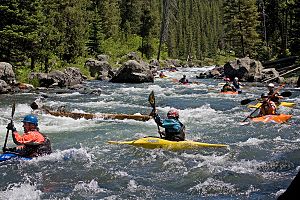
The Henrys Fork is famous for its amazing fishing, especially for rainbow trout. Many people come here to fish, and it's known as one of the best places in Idaho for trout. The part of the river between Henrys Lake and Big Springs is a very important area where trout lay their eggs. Because of this, fishing is not allowed in that section to protect the fish.
The Island Park Reservoir is also used to store water for irrigation. This helps farmers grow crops in the Snake River Plain. The river's healthy environment supports many fish and other wildlife.
See also
 In Spanish: Henrys Fork para niños
 | Selma Burke |
 | Pauline Powell Burns |
 | Frederick J. Brown |
 | Robert Blackburn |


