Island Park, Idaho facts for kids
Quick facts for kids
Island Park, Idaho
|
|
|---|---|

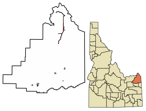
Location of Island Park in Fremont County, Idaho.
|
|
| Country | United States |
| State | Idaho |
| County | Fremont |
| Area | |
| • Total | 6.19 sq mi (16.03 km2) |
| • Land | 6.08 sq mi (15.75 km2) |
| • Water | 0.11 sq mi (0.28 km2) |
| Elevation | 6,359 ft (1,938 m) |
| Population
(2010)
|
|
| • Total | 286 |
| • Estimate
(2019)
|
266 |
| • Density | 43.74/sq mi (16.89/km2) |
| Time zone | UTC-7 (Mountain (MST)) |
| • Summer (DST) | UTC-6 (MDT) |
| ZIP codes |
83429, 83433
|
| Area code(s) | 208 |
| FIPS code | 16-40600 |
| GNIS feature ID | 2410121 |
Island Park is a small city located in Fremont County, Idaho, United States. In 2010, the city had a population of 286 people, which was an increase from 215 people in 2000.
The city was officially formed in 1947 by people who owned lodges and resorts along U.S. Route 20. They wanted to create a city to help their businesses grow and follow state rules better. Island Park is very narrow, only about 500 feet (150 m) wide in most places. It is also very long, stretching for 33 miles (53 km), and claims to have the longest "Main Street" in the world!
Island Park is also part of the larger Rexburg area, known as the Rexburg Micropolitan Statistical Area.
Contents
Exploring Island Park's Geography
City Location and Elevation
Island Park is located at a high elevation of about 6,293 feet (1,918 m) above sea level. This makes it the highest city in all of Idaho.
The United States Census Bureau states that the city covers a total area of about 6.77 square miles (17.53 km2). Most of this area, 6.64 square miles (17.20 km2), is land, and a smaller part, 0.13 square miles (0.34 km2), is water.
Regional Landscape and Calderas
The area around Island Park was known by this name long before the city was officially formed. Much of what we call Island Park today sits on a huge crater, or caldera, called the Henry's Fork Caldera. This caldera was formed by the same powerful hotspot that created the older Island Park Caldera and the even more famous Yellowstone Caldera.

About one-third of the Island Park area is north of the Henry's Fork Caldera. This part extends across Henry's Lake Flat and towards the Idaho/Montana border. Henry's Lake Flat is a flat valley surrounded by tall mountains. Henrys Lake is located at the northwest end of these flats.
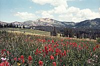
Some of the tall mountains in the area include Mount Jefferson, which is 10,203 feet (3,110 m) high, and Targhee Peak, which reaches 10,240 feet (3,121 m). However, the most famous peak in Island Park is the 9,886-foot (3,013 m) Sawtell Peak. This peak is known for its beautiful shape, which some say looks like the profile of a napping Native American chief. It's also been called Chief Rains in the Face. Sawtell Peak has an FAA radar dome on top and can be seen from almost anywhere in Island Park.
Even though the Henry's Fork Caldera is smaller than the Island Park Caldera or the Yellowstone Caldera, it's still one of the largest calderas in the world. It's also the only large caldera in the Yellowstone region that you can clearly see. Its floor is mostly flat and circular, about 20-mile (32 km) wide, and slopes slightly to the southeast. The caldera floor is around 6,000 feet (1,830 m) high, with its rim usually several hundred feet taller. The Henry's Lake Flat area, north of the caldera, is a bit higher, with Henry's Lake itself at about 6,500 feet (1,980 m).
Forests, Rivers, and Water Features
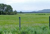
The Island Park area is mostly covered by forests, with many open meadows and grasslands. It's generally flat, but surrounded by forested hills and tall mountains to the north. The Henrys Fork of the Snake River flows through Island Park. Its source is at Henry's Lake and Big Springs (Idaho).
The Henry's Fork is held back by Island Park Dam, forming the Island Park Reservoir. The southern bank of this reservoir is actually the northern slope of the caldera. The Henry's Fork then flows through the caldera and creates the beautiful Upper and Lower Mesa Falls.

Island Park has a very special and unique geography. It's mostly flat and gets a lot of rain and snow. Other nearby areas like Teton Valley, Jackson Hole, or Centennial Valley are at the same 6,000 feet (1,830 m) elevation. However, these areas are often dry grasslands or even deserts, getting less than 12 inches (30 cm) of rain each year. Island Park, on the other hand, is full of forests and green spaces, with many streams, ponds, lakes, and meadows. It receives over 30 inches (76 cm) of precipitation annually, and some parts get over 50 inches (127 cm). This means Island Park gets three times more rain and snow than nearby places at the same elevation!
This abundant precipitation in Island Park falls onto the relatively flat caldera floor. Here, it forms many winding streams, ponds, marshes, and meadows. It also falls on the higher areas to the east, near the Yellowstone Park border. The water then soaks through the volcanic ground and emerges as some of the largest springs in the world. Big Springs, Buffalo River Springs, and Warm River Springs are all "1st Magnitude springs." They create the clear, winding streams that the area is famous for.
Island Park's Population and People
| Historical population | |||
|---|---|---|---|
| Census | Pop. | %± | |
| 1930 | 50 | — | |
| 1960 | 53 | — | |
| 1970 | 136 | 156.6% | |
| 1980 | 154 | 13.2% | |
| 1990 | 159 | 3.2% | |
| 2000 | 215 | 35.2% | |
| 2010 | 286 | 33.0% | |
| 2020 | 193 | −32.5% | |
| source: | |||
Population Details from 2010
According to the census from 2010, there were 286 people living in Island Park. These people lived in 122 households, and 74 of those were families. The city had about 43.1 inhabitants per square mile (16.6/km2) people per square mile. There were also 692 housing units, which means many homes are likely used for vacations or seasonal stays.
Most of the people in the city, 96.9%, were White. A small number were Native American (0.7%), and 1.7% were from other races. About 6.6% of the population identified as Hispanic or Latino.
In terms of households, 19.7% had children under 18 living there. More than half, 55.7%, were married couples. About 39.3% of households were not families, meaning they were individuals living alone or unrelated people living together. The average household had 2.28 people, and the average family had 2.97 people.
The average age of people in Island Park was 45 years old. About 19.2% of residents were under 18, and 15.7% were 65 or older. The population was fairly balanced, with 53.5% male and 46.5% female.
Island Park's Climate
Island Park experiences a humid continental climate, which is like a mix of warm summers and very cold winters. It's also close to a subarctic climate. Summer days are usually warm, but nights can get quite cool, around 40 degrees Fahrenheit (4 degrees Celsius). Winters are extremely cold, with a huge amount of snowfall, averaging about 215 inches (550 cm) each year.
Island Park holds the record for Idaho's lowest recorded temperature: a freezing −60 °F (−51 °C) on January 18, 1943.
| Climate data for Island Park Dam, Idaho, 1991–2020 normals, extremes 1937–present | |||||||||||||
|---|---|---|---|---|---|---|---|---|---|---|---|---|---|
| Month | Jan | Feb | Mar | Apr | May | Jun | Jul | Aug | Sep | Oct | Nov | Dec | Year |
| Record high °F (°C) | 49 (9) |
55 (13) |
62 (17) |
76 (24) |
84 (29) |
91 (33) |
97 (36) |
96 (36) |
91 (33) |
82 (28) |
68 (20) |
56 (13) |
97 (36) |
| Mean maximum °F (°C) | 40.7 (4.8) |
43.8 (6.6) |
53.3 (11.8) |
64.5 (18.1) |
75.2 (24.0) |
81.8 (27.7) |
87.7 (30.9) |
87.8 (31.0) |
82.8 (28.2) |
70.9 (21.6) |
54.4 (12.4) |
40.7 (4.8) |
87.8 (31.0) |
| Mean daily maximum °F (°C) | 26.5 (−3.1) |
29.7 (−1.3) |
38.6 (3.7) |
47.4 (8.6) |
59.2 (15.1) |
67.3 (19.6) |
77.1 (25.1) |
77.2 (25.1) |
68.0 (20.0) |
51.3 (10.7) |
35.6 (2.0) |
25.5 (−3.6) |
50.3 (10.2) |
| Daily mean °F (°C) | 16.2 (−8.8) |
18.6 (−7.4) |
26.5 (−3.1) |
35.3 (1.8) |
45.4 (7.4) |
52.6 (11.4) |
60.0 (15.6) |
58.6 (14.8) |
50.1 (10.1) |
37.7 (3.2) |
25.0 (−3.9) |
16.0 (−8.9) |
36.8 (2.7) |
| Mean daily minimum °F (°C) | 5.9 (−14.5) |
7.5 (−13.6) |
14.5 (−9.7) |
23.1 (−4.9) |
31.5 (−0.3) |
37.8 (3.2) |
42.8 (6.0) |
40.0 (4.4) |
32.2 (0.1) |
24.1 (−4.4) |
14.3 (−9.8) |
6.4 (−14.2) |
23.3 (−4.8) |
| Mean minimum °F (°C) | −22.7 (−30.4) |
−19.2 (−28.4) |
−9.8 (−23.2) |
6.1 (−14.4) |
20.1 (−6.6) |
27.3 (−2.6) |
32.9 (0.5) |
29.5 (−1.4) |
21.4 (−5.9) |
9.0 (−12.8) |
−8.9 (−22.7) |
−19.3 (−28.5) |
−28.1 (−33.4) |
| Record low °F (°C) | −60 (−51) |
−54 (−48) |
−36 (−38) |
−18 (−28) |
7 (−14) |
20 (−7) |
25 (−4) |
17 (−8) |
8 (−13) |
−17 (−27) |
−34 (−37) |
−51 (−46) |
−60 (−51) |
| Average precipitation inches (mm) | 3.53 (90) |
2.64 (67) |
2.05 (52) |
2.37 (60) |
2.99 (76) |
2.63 (67) |
1.17 (30) |
1.14 (29) |
1.66 (42) |
2.09 (53) |
2.54 (65) |
4.01 (102) |
28.82 (733) |
| Average snowfall inches (cm) | 54.2 (138) |
36.1 (92) |
27.1 (69) |
17.7 (45) |
2.7 (6.9) |
0.3 (0.76) |
0.0 (0.0) |
0.0 (0.0) |
0.2 (0.51) |
7.9 (20) |
26.7 (68) |
61.4 (156) |
234.3 (596.17) |
| Average extreme snow depth inches (cm) | 44.2 (112) |
51.9 (132) |
52.1 (132) |
37.1 (94) |
10.3 (26) |
0.0 (0.0) |
0.0 (0.0) |
0.0 (0.0) |
0.1 (0.25) |
3.7 (9.4) |
12.6 (32) |
33.7 (86) |
52.6 (134) |
| Average precipitation days (≥ 0.01 in) | 12.9 | 10.1 | 9.2 | 8.4 | 8.4 | 8.7 | 5.0 | 5.3 | 5.2 | 6.2 | 8.5 | 13.3 | 101.2 |
| Average snowy days (≥ 0.1 in) | 13.0 | 10.0 | 7.9 | 5.3 | 1.1 | 0.2 | 0.0 | 0.0 | 0.2 | 2.4 | 7.6 | 13.5 | 61.2 |
| Source 1: NOAA | |||||||||||||
| Source 2: National Weather Service | |||||||||||||
Communities in Island Park
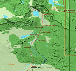
The city of Island Park includes several smaller communities that were once separate. These include:
- Flat Rock (also known as Macks Inn)
- Lake
- Last Chance
- Staley Springs
Getting Around Island Park
Airport Access
Island Park is served by Henry's Lake Airport. This airport is not directly inside the city limits but is located just west and south of the northern part of the city.
Roads and Highways
Island Park is currently connected by one U.S. Highway and one state highway. In the past, it was also served by other highways.
- Current Highways
 US 20: This highway runs north-south through most of the city.
 SH 87: This highway starts in the northern part of the city and goes northwest towards Montana.
- Former Highways
 US 191 (1926–1981): The old path of this highway followed what is now US-20 in this part of Idaho. In 1981, after Interstate 15 was completed, US-191 was changed and no longer enters Idaho.
- Invalid type: SH 1970: This highway used to run along South Big Springs Loop, from US-20 in the Flat Rock area (also called Macks Inn) east to Henrys Fork. This route is no longer an official highway.
|
See also
 In Spanish: Island Park (Idaho) para niños
 | Roy Wilkins |
 | John Lewis |
 | Linda Carol Brown |


