High Spy facts for kids
Quick facts for kids High Spy |
|
|---|---|

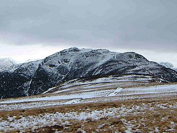
High Spy from the fell of Maiden Moor
2 km to the north |
|
| Highest point | |
| Elevation | 653 m (2,142 ft) |
| Prominence | c. 148 metres (486 feet) |
| Parent peak | Dale Head |
| Listing | Wainwright, Hewitt, Nuttall |
| Naming | |
| English translation | High Look Out |
| Language of name | Old English |
| Geography | |
| Location | Cumbria, England |
| Parent range | Lake District, North Western Fells |
| OS grid | NY234162 |
| Topo map | OS Landranger 89, 90 OS Explore Outdoor Leisure 4 |
| Listed summits of High Spy | ||||
| Name | Grid ref | Height | Status | |
|---|---|---|---|---|
| High Spy North Top | NY236171 | 634 m (2080 ft) | Nuttall | |

High Spy is a mountain, or "fell," in the English Lake District. It sits on a ridge that separates the Newlands Valley from Borrowdale. This mountain is about eight kilometers (five miles) south of the town of Keswick.
Exploring High Spy's Features
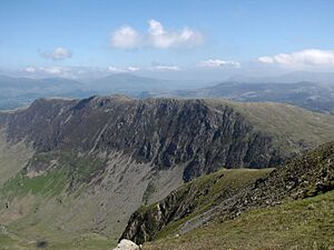
This fell reaches a height of 653 meters (2142 feet). It has steep cliffs on its east and west sides. These cliffs drop sharply into the valleys below. High Spy is a unique mountain. It rises 148 meters (486 feet) above the land connecting it to the higher fell of Dale Head. This means it just misses being called a Marilyn by only two meters.
The rocks of High Spy are made from ancient volcanic material. The name "High Spy" might mean "high lookout post." This could refer to an old fort that was once in the area. In the past, it was also known as Scawdel Fell and Lobstone Band. These names are still used on maps for other parts of the fell.

The top of High Spy has a large stone pile called a cairn. Sometimes, this cairn gets damaged, but other hikers always rebuild it. The very top of the fell is quite flat for about 2.5 kilometers (1.6 miles). The impressive Eel Crags drop straight down on the Newlands side of the fell. These cliffs are popular with rock climbers because the rock is very good for climbing.
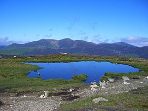
High Spy North Top is almost a kilometer north of the main summit. It is 634 meters (2080 feet) high. It is also listed as a Nuttall. From here, you can get a great view of Derwent Water. About 600 meters (650 yards) north of the main summit, there is a small, unnamed mountain lake called a tarn.
Hiking Up High Spy
Many people climb High Spy as part of the Newlands Horseshoe ridge walk. But you can also climb it directly. This is true even though it has steep cliffs on both its Newlands and Borrowdale sides.
From Borrowdale, a path starts from Rosthwaite. It climbs through the old Rigg Head Quarries. This path leads to the col, which is a low point connecting High Spy to Dale Head. From there, you go up the south ridge to the summit. You will pass a small, unnamed tarn just before the top.
From this side, you can also start from Grange. You can use an old drove road to get past the Blea Crag cliffs. Then you can approach the summit. There is also a scrambling route that starts from Grange. It goes through Hollows Farm and then directly up the rocky path of Nitting Haws.
From Little Town in the Newlands valley, an old mine road zigzags up to the col between High Spy and Dale Head. From there, you can reach the top by the south ridge.
Mining History
The route from Little Town passes the Castlenook lead mine. This mine is at the bottom of the fell on the Newlands side. The Company of Mines Royal used to own this mine. It started producing lead in the 1860s. The mine continued to operate until 1918. It closed because it became cheaper to import lead from other places. You can also see signs of old mine tunnels higher up the steep slope.
 | John T. Biggers |
 | Thomas Blackshear |
 | Mark Bradford |
 | Beverly Buchanan |


