Hirado, Nagasaki facts for kids
Quick facts for kids
Hirado
平戸市
|
|||||||||||
|---|---|---|---|---|---|---|---|---|---|---|---|
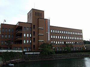
Hirado City Hall
|
|||||||||||
|
|||||||||||
 |
|||||||||||
| Country | Japan | ||||||||||
| Region | Kyushu | ||||||||||
| Prefecture | Nagasaki | ||||||||||
| Area | |||||||||||
| • Total | 235.12 km2 (90.78 sq mi) | ||||||||||
| Population
(June 1, 2024)
|
|||||||||||
| • Total | 28,172 | ||||||||||
| • Density | 119.820/km2 (310.332/sq mi) | ||||||||||
| Time zone | UTC+09:00 (JST) | ||||||||||
| City hall address | 1508-3 Iwanoue, Hirado-shi, Nagasaki-ken 859-5192 | ||||||||||
| Climate | Cfa | ||||||||||
|
|||||||||||
Hirado (平戸市, Hirado-shi) is a city in Nagasaki Prefecture, Japan. As of June 1, 2024, about 28,172 people live there. The city covers an area of 235.12 square kilometers.
Contents
Geography of Hirado
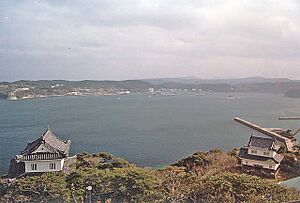
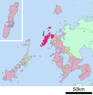
Hirado City is in the northern part of Nagasaki Prefecture. It includes the northwestern tip of the Kitamatsuura Peninsula. It also has several islands. These include Hirado Island, Ikitsuki Island, Takushima Island, and Matoyama-Oshima Island.
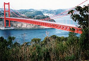
Hirado Island is connected to the mainland of Kyushu by the Hirado Bridge. Ikitsuki Island is connected to Hirado Island by the Ikitsuki Bridge. Hirado Island is the westernmost point in Japan that you can reach by land.
Neighboring Cities
Hirado is close to these cities in Nagasaki Prefecture:
- Matsuura
- Sasebo
Hirado's Climate
Hirado has a humid subtropical climate. This means it has hot summers and cool winters. It rains a lot throughout the year, especially in summer. Even though it's not very far north, Hirado sometimes gets snow in winter. This happens when cold air from Siberia mixes with humidity from the Sea of Japan.
| Climate data for Hirado (1991−2020 normals, extremes 1940−present) | |||||||||||||
|---|---|---|---|---|---|---|---|---|---|---|---|---|---|
| Month | Jan | Feb | Mar | Apr | May | Jun | Jul | Aug | Sep | Oct | Nov | Dec | Year |
| Record high °C (°F) | 18.7 (65.7) |
20.4 (68.7) |
22.3 (72.1) |
25.7 (78.3) |
29.3 (84.7) |
30.7 (87.3) |
34.4 (93.9) |
35.1 (95.2) |
34.0 (93.2) |
30.1 (86.2) |
25.0 (77.0) |
23.1 (73.6) |
35.1 (95.2) |
| Mean daily maximum °C (°F) | 9.6 (49.3) |
10.6 (51.1) |
13.5 (56.3) |
17.7 (63.9) |
21.6 (70.9) |
24.1 (75.4) |
27.8 (82.0) |
29.6 (85.3) |
26.3 (79.3) |
22.1 (71.8) |
17.2 (63.0) |
12.1 (53.8) |
19.3 (66.8) |
| Daily mean °C (°F) | 7.0 (44.6) |
7.6 (45.7) |
10.3 (50.5) |
14.2 (57.6) |
18.0 (64.4) |
21.1 (70.0) |
25.1 (77.2) |
26.5 (79.7) |
23.5 (74.3) |
19.2 (66.6) |
14.2 (57.6) |
9.3 (48.7) |
16.3 (61.4) |
| Mean daily minimum °C (°F) | 4.4 (39.9) |
4.7 (40.5) |
7.1 (44.8) |
11.0 (51.8) |
15.0 (59.0) |
18.9 (66.0) |
23.2 (73.8) |
24.2 (75.6) |
21.2 (70.2) |
16.4 (61.5) |
11.1 (52.0) |
6.4 (43.5) |
13.6 (56.6) |
| Record low °C (°F) | −5.7 (21.7) |
−5.8 (21.6) |
−4.0 (24.8) |
1.8 (35.2) |
7.3 (45.1) |
12.4 (54.3) |
16.1 (61.0) |
17.0 (62.6) |
13.6 (56.5) |
5.9 (42.6) |
1.7 (35.1) |
−3.6 (25.5) |
−5.8 (21.6) |
| Average precipitation mm (inches) | 84.9 (3.34) |
93.6 (3.69) |
148.7 (5.85) |
189.0 (7.44) |
198.4 (7.81) |
319.0 (12.56) |
345.7 (13.61) |
289.1 (11.38) |
223.5 (8.80) |
116.6 (4.59) |
112.3 (4.42) |
85.3 (3.36) |
2,206.1 (86.85) |
| Average snowfall cm (inches) | 0 (0) |
1 (0.4) |
0 (0) |
0 (0) |
0 (0) |
0 (0) |
0 (0) |
0 (0) |
0 (0) |
0 (0) |
0 (0) |
0 (0) |
1 (0.4) |
| Average rainy days | 8.6 | 8.3 | 9.9 | 9.6 | 8.8 | 12.1 | 11.9 | 9.9 | 9.6 | 6.7 | 8.1 | 8.0 | 111.5 |
| Average snowy days | 0 | 0.2 | 0 | 0 | 0 | 0 | 0 | 0 | 0 | 0 | 0.1 | 0 | 0.3 |
| Average relative humidity (%) | 65 | 65 | 69 | 74 | 79 | 87 | 89 | 85 | 81 | 72 | 69 | 65 | 75 |
| Mean monthly sunshine hours | 94.0 | 115.8 | 157.7 | 179.0 | 194.3 | 125.3 | 146.9 | 196.7 | 158.9 | 174.6 | 132.8 | 104.6 | 1,780.6 |
| Source: Japan Meteorological Agency | |||||||||||||
Population Changes in Hirado
The population of Hirado has changed over many years. Here's how it has looked according to Japanese census data:
| Historical population | ||
|---|---|---|
| Year | Pop. | ±% |
| 1940 | 53,473 | — |
| 1950 | 69,121 | +29.3% |
| 1960 | 67,880 | −1.8% |
| 1970 | 55,661 | −18.0% |
| 1980 | 50,849 | −8.6% |
| 1990 | 46,572 | −8.4% |
| 2000 | 41,586 | −10.7% |
| 2010 | 34,905 | −16.1% |
| 2020 | 29,365 | −15.9% |
History of Hirado
Hirado has been an important port for a very long time. Ships traveling between Japan and other parts of East Asia have stopped here since ancient times.
Early Trade and Foreigners
During the Kamakura period and Muromachi period, a local family called the Matsuura clan controlled trade with Korea and China. Later, during the Sengoku period and early Edo period, Hirado became even more important for foreign trade.
Portuguese traders arrived in Japan in 1543. They stayed in Hirado for a few years before moving to Nagasaki in 1571. The English and Dutch also came to Japan in the early 1600s.
Dutch and English Trading Posts
In 1609, the Dutch Dutch East India Company (VOC) was given permission to trade in Japan. In 1613, the British ship Clove arrived. Its captain, John Saris, got permission to set up a trading house for the British East India Company in Hirado.
However, the British company found it hard to make money. They couldn't get enough Japanese raw silk to sell in China. So, in 1623, the British closed their trading post. This left the Dutch as the only European traders in Hirado.
Moving the Dutch Trading Post
The Dutch trading center in Hirado was quite large. In 1637 and 1639, the Dutch built stone warehouses. They put the dates on the buildings. However, the Japanese government (the Tokugawa shogunate) did not like the use of Christian year dates.
The shogunate ordered these buildings to be destroyed. This was part of Japan's strict sakoku policy, which meant closing the country off from most foreign contact. This incident was used as a reason to force the Dutch traders to move. They had to leave Hirado and go to Dejima, a small artificial island in Nagasaki. The last Dutch leader in Hirado, François Caron, managed this move in 1641.
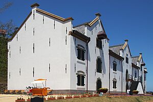
Today, the stone warehouse from 1639 that was torn down has been rebuilt. You can see it in its original form.
Hirado Castle and Modern Hirado
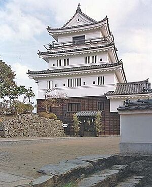
During the Edo period, Hirado was the center of the Hirado Domain. Hirado Castle is now a famous historical site.
In 1889, many villages and towns in the area were created. Hirado Town and Hirado Village merged in 1925. Over the years, other towns and villages joined together. On January 1, 1955, Hirado Town merged with several villages to form the city of Hirado. The city grew even more on October 1, 2005, when it merged with the towns of Tabira, Ikitsuki, and the village of Ōshima.
Today, Hirado's economy mainly relies on farming, fishing, and making food products.
Hirado's Economy
The main parts of Hirado's economy are:
- Commercial fishing
- Agriculture (farming)
- Tourism
Education in Hirado
Hirado has many schools for young people. There are 15 public elementary schools and eight public junior high schools. The Nagasaki Prefectural Board of Education runs three public high schools in the city.
Transportation in Hirado
Railways
![]() Matsuura Railway - Nishi-Kyūshū Line
Matsuura Railway - Nishi-Kyūshū Line
- Higashi-Tabira - Naka-Tabira - Tabira-Hiradoguchi - Nishi-Tabira
Highways
 Nishi-Kyūshū Expressway
 National Route 204
 National Route 383
Sister Cities of Hirado
Hirado has special connections with other cities around the world. These are called sister cities or friendship cities.
 Zentsūji, Kagawa, Japan (sister city)
 Nan'an, Fujian, China (friendship city)
 Noordwijk, South Holland, Netherlands (sister city)
Places to Visit in Hirado
- Hirado Castle
- Hirado Dutch Trading Post, a National Historic Site
- Matsura Historical Museum
Famous People from Hirado
- William Adams (1564–1620): An English navigator who lived in Hirado. He was an important advisor to the Japanese government.
- Richard Cocks (1565–1624): A merchant from the British East India Company.
- Koxinga (1624–1662): A famous general from the Ming dynasty in China. He was born in Hirado.
- Kazuya Maekawa (1968–): A former football player and current coach.
- Inagaki Manjiro (1861–1908): A diplomat born in Hirado.
- Ryusaku Yanagimoto (1894–1942): A captain in the Japanese Navy during World War II.
- Zheng Zhilong (1604–1661): A Chinese merchant and pirate, and Koxinga's father.
See also
 In Spanish: Hirado (Nagasaki) para niños


