Hope, Alaska facts for kids
Quick facts for kids
Hope, Alaska
|
|
|---|---|

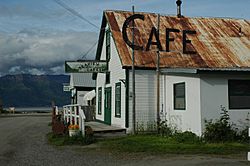
Hope, a former gold-mining town, is now a popular weekend retreat for Anchorage residents.
|
|

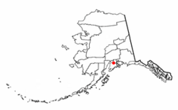
Location of Hope, Alaska
|
|
| Country | United States |
| State | Alaska |
| Borough | Kenai Peninsula |
| Area | |
| • Total | 51.79 sq mi (134.14 km2) |
| • Land | 51.72 sq mi (133.96 km2) |
| • Water | 0.07 sq mi (0.18 km2) |
| Elevation | 43 ft (13 m) |
| Population
(2020)
|
|
| • Total | 161 |
| • Density | 3.11/sq mi (1.20/km2) |
| Time zone | UTC-9 (Alaska (AKST)) |
| • Summer (DST) | UTC-8 (AKDT) |
| ZIP code |
99605
|
| Area code(s) | 907 |
| FIPS code | 02-33580 |
| GNIS feature ID | 1422645 |
Hope is a small community in Alaska, located in the Kenai Peninsula Borough. It is about 17 miles (27 km)* south of Anchorage.
Hope is known as a census-designated place (CDP). This means it's a special area defined by the government for counting people. In 2020, about 161 people lived there. The historic part of Hope, which shows its past as a mining town, was added to the National Register of Historic Places in 1972.
Contents
Exploring Hope's Location
Hope is found at 60°55′10″N 149°38′31″W / 60.91944°N 149.64194°W. It sits on the northern tip of the Kenai Peninsula. You can find it on the south shore of the Turnagain Arm, which is part of Cook Inlet.
The community is at the end of the 17-mile (27 km) Hope Highway. This road is northwest of the main Seward Highway. It's also near where Resurrection Creek flows into the water.
Weather in Hope
Hope has a cool, dry climate. Winters are cold, with temperatures usually between 14 to 27 °F (−10 to −3 °C). Summers are mild, ranging from 45 to 65 °F (7 to 18 °C). The area gets about 20 inches (510 mm) of rain each year.
| Climate data for Hope | |||||||||||||
|---|---|---|---|---|---|---|---|---|---|---|---|---|---|
| Month | Jan | Feb | Mar | Apr | May | Jun | Jul | Aug | Sep | Oct | Nov | Dec | Year |
| Record high °F (°C) | 49 (9) |
56 (13) |
58 (14) |
71 (22) |
77 (25) |
82 (28) |
81 (27) |
80 (27) |
73 (23) |
61 (16) |
50 (10) |
52 (11) |
82 (28) |
| Mean daily maximum °F (°C) | 25.1 (−3.8) |
27.7 (−2.4) |
34.7 (1.5) |
45 (7) |
56.7 (13.7) |
63.1 (17.3) |
66 (19) |
63.7 (17.6) |
55.3 (12.9) |
42 (6) |
29 (−2) |
25.7 (−3.5) |
44.5 (6.9) |
| Mean daily minimum °F (°C) | 11.6 (−11.3) |
12.4 (−10.9) |
17.5 (−8.1) |
26.8 (−2.9) |
35.1 (1.7) |
43 (6) |
48.2 (9.0) |
46.2 (7.9) |
38.7 (3.7) |
28.2 (−2.1) |
17 (−8) |
12.5 (−10.8) |
28.1 (−2.2) |
| Record low °F (°C) | −31 (−35) |
−22 (−30) |
−15 (−26) |
−2 (−19) |
21 (−6) |
30 (−1) |
35 (2) |
30 (−1) |
18 (−8) |
−2 (−19) |
−17 (−27) |
−23 (−31) |
−31 (−35) |
| Average precipitation inches (mm) | 1.84 (47) |
1.54 (39) |
1.24 (31) |
0.79 (20) |
0.68 (17) |
1.05 (27) |
2 (51) |
2.64 (67) |
3.17 (81) |
2.59 (66) |
2.24 (57) |
2.39 (61) |
22.17 (563) |
| Average snowfall inches (cm) | 11.5 (29) |
12.2 (31) |
9.7 (25) |
2.6 (6.6) |
0 (0) |
0 (0) |
0 (0) |
0 (0) |
0 (0) |
4.2 (11) |
15.5 (39) |
18.6 (47) |
74.4 (189) |
| Average precipitation days | 8 | 6 | 6 | 5 | 5 | 6 | 9 | 9 | 12 | 9 | 10 | 9 | 94 |
Hope's Size
The entire area of Hope, as a CDP, covers about 51.8 square miles (134.1 km2) (134 square kilometres (51.8 sq mi)). Most of this land is dry, with only a small amount of water. The community itself is in the valley of Resurrection Creek. It stretches east and west to the tops of the nearby ridges.
Hope's Past: A Gold Rush Town
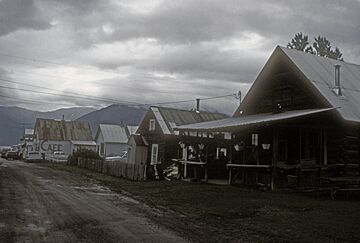
Hope was first known as "Hope City." It started as a mining camp in 1896, when people came looking for gold in Resurrection Creek. The first post office opened in 1897.
In 1964, a big earthquake, known as the Good Friday earthquake, damaged parts of the town. Despite this, Hope has rebuilt and kept its unique history.
Community Life
Hope has two community groups that help organize local activities. The Hope Community Library opened in 1987. It is located in the old Hope schoolhouse, which was built in 1938.
Who Lives in Hope?
| Historical population | |||
|---|---|---|---|
| Census | Pop. | %± | |
| 1920 | 44 | — | |
| 1930 | 15 | −65.9% | |
| 1940 | 71 | 373.3% | |
| 1950 | 63 | −11.3% | |
| 1960 | 44 | −30.2% | |
| 1970 | 51 | 15.9% | |
| 1980 | 103 | 102.0% | |
| 1990 | 161 | 56.3% | |
| 2000 | 137 | −14.9% | |
| 2010 | 192 | 40.1% | |
| 2020 | 161 | −16.1% | |
| U.S. Decennial Census | |||
Hope first appeared in the U.S. Census in 1920. In 1980, it became a census-designated place (CDP).
In 2000, there were 137 people living in Hope. Most residents were White (91.97%). A small number were Native American, Asian, Black, or of two or more races. About 2.19% of the population was Hispanic or Latino.
The average age in Hope in 2000 was 47 years old. Many adults were between 45 and 64 years old. There were slightly more males than females. The average household had about 1.78 people.
Services and Daily Life
Many homes in Hope use their own water wells and septic tank systems. Some homes are used only during certain seasons. The local school has its own water system. The borough provides a place for residents to drop off their trash. Electricity comes from Chugach Electric Association.
Hope has one school, which teaches about 14 students. For medical help, people go to Central Peninsula General Hospital in Soldotna or hospitals in Anchorage. Hope is considered a "highway village" and has volunteer emergency services.
Jobs and Getting Around
The school and local shops are the main places to work in Hope. Many people enjoy looking for gold as a hobby. This includes gold panning, using metal detectors, and dredging. Some commercial gold mining still happens today. There is also a small sawmill used by the community. A few residents have permits for commercial fishing.
Hope can be reached by the Seward Highway. The state-owned Hope Airport has a gravel runway. You can fly to Anchorage, which is about 20 miles (32 km)* away by air. By highway, Anchorage is about 88 miles (142 km)*. Kenai is another nearby town, about 60 miles (97 km)* by air or 104 miles (167 km)* by highway. Both Anchorage and Kenai offer more transportation options.
See also
 In Spanish: Hope (Alaska) para niños
 | Precious Adams |
 | Lauren Anderson |
 | Janet Collins |


