
Wallkill, Orange County, New York facts for kids
Quick facts for kids
Wallkill, New York
|
|
|---|---|

Route 211 looking towards Wallkill from Middletown
|
|

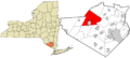
Location in Orange County and the state of New York
|
|

Wallkill, New York
Location in New York
|
|
| Country | United States |
| State | New York |
| County | Orange |
| Established | 1772 |
| Area | |
| • Total | 62.8 sq mi (163 km2) |
| • Land | 62.2 sq mi (161 km2) |
| • Water | 0.6 sq mi (2 km2) 0.92% |
| Population
(2020)
|
|
| • Total | 30,486 |
| • Density | 485.4/sq mi (187.43/km2) |
Wallkill is a town located in Orange County, New York, United States. In 2020, about 30,486 people lived here.
The town is in the middle of Orange County. Important roads like Interstate 84 and New York State Route 17 cross paths in the southern part of Wallkill. Other routes like U.S. Route 6, 17K, 211, and 302 also pass through the town.
Contents
A Look Back in Time
The idea for the town of Wallkill started in 1724 with a special land grant. However, it took many years for people to actually move there and build homes.
The town was officially created in 1772. Later, some of its land was used to form Ulster County. During the American Revolution, Wallkill was famous for making gunpowder. Factories in Phillipsburgh and Craigville, run by Henry Wisner and Moses Phillips, produced gunpowder for American soldiers.
Exploring Wallkill's Geography
Wallkill covers about 62.8 square miles (162.7 square kilometers). Most of this area, 62.2 square miles (161.1 square kilometers), is land. The rest, about 0.6 square miles (1.6 square kilometers), is water.
Wallkill shares borders with several other towns:
- To the east: Hamptonburgh and Montgomery
- To the north: Crawford
- To the west: Mamakating and Mount Hope
- To the south: Wawayanda and Goshen
The city of Middletown is almost completely surrounded by the town of Wallkill.
Communities and Places in Wallkill

Wallkill is home to many smaller communities and interesting places:
- Baileyville – A small village near Howells, located on NY-211.
- Circleville – A village in the northern part of town on NY-302.
- Crystal Run – A village south of Michigan Corners, close to Interstate 84.
- East Middletown – A village in the southeastern part of town.
- Fair Oaks – A village in the northern part of town on NY-17.
- Highland Lake – A small lake near the western border of the town.
- Highland Lakes State Park – A state park in the northern part of the town.
- Howells – A village in the northwestern part of town, north of Baileyville.
- Maple Glen – A village near the western border.
- Mechanicstown – A village and a special census area in the southeastern part of town.
- Michigan Corners – A village near Scotchtown in the eastern part of town on NY-211.
- Middletown – A city almost entirely surrounded by Wallkill.
- Milburn – A village near Highland Lakes State Park.
- Phillipsburg – A village in the southeastern part of town, by the Wallkill River and NY-17.
- Pilgrim Corners – A village bordering the western side of Middletown on NY-211.
- Rockville – A village in the northern part of town.
- Scotchtown – A village and a special census area in the eastern part of town.
- Silver Lake – A small lake east of Middletown.
- Stony Ford – A place near the eastern town line at the Wallkill River.
- Van Burenville – A village in the northwestern part of town near Mount Hope.
- Washington Heights – A village and a special census area in the northwestern part of town.
People and Population
| Historical population | |||
|---|---|---|---|
| Census | Pop. | %± | |
| 1790 | 2,571 | — | |
| 1820 | 4,887 | — | |
| 1830 | 4,056 | −17.0% | |
| 1840 | 4,268 | 5.2% | |
| 1850 | 4,942 | 15.8% | |
| 1860 | 6,603 | 33.6% | |
| 1870 | 9,477 | 43.5% | |
| 1880 | 11,486 | 21.2% | |
| 1890 | 2,755 | −76.0% | |
| 1900 | 2,725 | −1.1% | |
| 1910 | 2,578 | −5.4% | |
| 1920 | 2,598 | 0.8% | |
| 1930 | 3,835 | 47.6% | |
| 1940 | 4,753 | 23.9% | |
| 1950 | 5,947 | 25.1% | |
| 1960 | 8,176 | 37.5% | |
| 1970 | 11,518 | 40.9% | |
| 1980 | 20,481 | 77.8% | |
| 1990 | 23,016 | 12.4% | |
| 2000 | 24,659 | 7.1% | |
| 2010 | 27,426 | 11.2% | |
| 2020 | 30,486 | 11.2% | |
| U.S. Decennial Census | |||
In 2010, the town's population was 27,426 people. The community was made up of different groups:
- 57.8% White (not Hispanic)
- 22.5% Hispanic
- 16.0% African-American
- 3.2% Asian
- 0.5% Native American
In 2000, there were 24,659 people living in Wallkill. About 36.5% of homes had children under 18 living there. The average age in the town was 36 years old.
Economy and Shopping
Wallkill is a busy place for shopping and businesses. It was home to the very first Lloyd's Supercenter. Today, you can find many stores, shopping centers, and restaurants, especially along Route 211.
The large Galleria at Crystal Run mall is in Wallkill. There is also a big Super Wal-Mart store. This Wal-Mart replaced an older mall called Orange Plaza, which was the first mall built in the area.
Fun and Culture
Every summer, the town of Wallkill hosts the Orange County Fair. It's a big event with lots of activities and entertainment for everyone.
Parks and Recreation
Town of Wallkill Golf Club
The people who live in Wallkill own an 18-hole golf course. It was designed by a landscape architect named Steve Esposito. It's a great place for residents to enjoy a game of golf.
Public Services
Police Department
The Wallkill Police Department is a full-time police force. It is led by Chief Robert Hertman. The department works to keep the community safe. It includes many officers, detectives, dispatchers, and other staff.
Fire Departments
Wallkill is divided into seven different fire districts. These districts have their own fire departments that respond to emergencies. They include:
- Circleville
- Howells
- Mechanicstown
- Silver Lake
- Pocatello
- Washington Heights
- Bloomingburg
Education
The Wallkill Central School District is in charge of the schools in the area. It operates five schools:
- Three elementary schools
- One middle school
- One high school
These schools help educate the children and young people of Wallkill.
Images for kids
-
Location of Wallkill in Orange County, New York.
See also
 In Spanish: Wallkill (condado de Orange, Nueva York) para niños
