Huntley, Illinois facts for kids
Quick facts for kids
Huntley, Illinois
|
|||
|---|---|---|---|

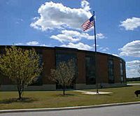
Huntley High School
|
|||
|
|||
| Etymology: Thomas Stillwell Huntley | |||
| Motto(s):
The Friendly Village with Country Charm
|
|||

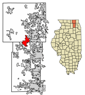
Location of Huntley in Kane and McHenry Counties, Illinois
|
|||

Location of Illinois in the United States
|
|||
| Country | United States | ||
| State | Illinois | ||
| Counties | Kane, McHenry | ||
| Townships | Grafton, Hampshire, Rutland | ||
| Founded | 1851 | ||
| Incorporated | 1872 | ||
| Government | |||
| • Type | Council–manager | ||
| Area | |||
| • Total | 14.35 sq mi (37.17 km2) | ||
| • Land | 14.29 sq mi (37.01 km2) | ||
| • Water | 0.06 sq mi (0.16 km2) | ||
| Elevation | 873 ft (266 m) | ||
| Population
(2021)
|
|||
| • Total | 28,008 (2,021) | ||
| • Density | 1,941.35/sq mi (749.55/km2) | ||
| Time zone | UTC-6 (CST) | ||
| • Summer (DST) | UTC-5 (CDT) | ||
| ZIP Code(s) |
60142
|
||
| Area code(s) | 847, 224 | ||
| FIPS code | 17-36750 | ||
| GNIS feature ID | 2398562 | ||
Huntley is a village in Illinois, United States. It is located in both McHenry and Kane counties. In 2021, about 28,000 people lived there. Huntley is also part of the larger Chicago metropolitan area.
Contents
Where is Huntley Located?
Huntley is in the southern part of McHenry County and the northern part of Kane County. It is about 48 miles (77 km) northwest of downtown Chicago. It is also about 45 miles (72 km) east of Rockford.
Nearby Towns
Huntley has several neighboring communities:
- Lake in the Hills is to the northeast.
- Algonquin is to the east.
- Gilberts is to the southeast.
- Pingree Grove is to the south.
- Hampshire is to the southwest.
- The area of Union is to the northwest.
How Big is Huntley?
In 2010, Huntley covered a total area of about 14.1 square miles (36.5 square kilometers). Most of this area, about 14.07 square miles (36.4 square kilometers), is land. Only a small part, about 0.032 square miles (0.083 square kilometers), is water.
Huntley's Population
The number of people living in Huntley has grown a lot over the years. Here's how the population has changed:
| Historical population | |||
|---|---|---|---|
| Census | Pop. | %± | |
| 1880 | 505 | — | |
| 1890 | 550 | 8.9% | |
| 1910 | 773 | — | |
| 1920 | 720 | −6.9% | |
| 1930 | 670 | −6.9% | |
| 1940 | 674 | 0.6% | |
| 1950 | 830 | 23.1% | |
| 1960 | 1,143 | 37.7% | |
| 1970 | 1,432 | 25.3% | |
| 1980 | 1,646 | 14.9% | |
| 1990 | 2,453 | 49.0% | |
| 2000 | 5,730 | 133.6% | |
| 2010 | 24,291 | 323.9% | |
| 2020 | 27,740 | 14.2% | |
| U.S. Decennial Census 2010 2020 |
|||
Who Lives in Huntley?
The table below shows the different groups of people living in Huntley. It helps us understand the mix of cultures and backgrounds in the village.
| Race / Ethnicity (NH = Non-Hispanic) | Pop 2000 | Pop 2010 | Pop 2020 | % 2000 | % 2010 | % 2020 |
|---|---|---|---|---|---|---|
| White alone (NH) | 5,293 | 20,524 | 22,223 | 92.37% | 84.49% | 80.11% |
| Black or African American alone (NH) | 22 | 293 | 450 | 0.38% | 1.21% | 1.62% |
| Native American or Alaska Native alone (NH) | 3 | 40 | 24 | 0.05% | 0.16% | 0.09% |
| Asian alone (NH) | 120 | 1,254 | 1,516 | 2.09% | 5.16% | 5.47% |
| Pacific Islander alone (NH) | 0 | 1 | 1 | 0.00% | 0.00% | 0.00% |
| Other race alone (NH) | 1 | 25 | 60 | 0.02% | 0.10% | 0.22% |
| Mixed race or Multiracial (NH) | 46 | 292 | 883 | 0.80% | 1.20% | 3.18% |
| Hispanic or Latino (any race) | 245 | 1,862 | 2,583 | 4.28% | 7.67% | 9.31% |
| Total | 5,730 | 24,291 | 27,740 | 100.00% | 100.00% | 100.00% |
Huntley's Economy
Huntley's economy has grown a lot recently. Many new businesses and large storage buildings (distribution warehouses) have been built, especially along Illinois Route 47. The town still has a charming small downtown area. Here you can find various restaurants and unique small shops.
Getting Around Huntley
Huntley has several ways to get around, making it easy for people and goods to travel.
Major Roads
- Interstate 90 (I-90): The village is located along the "Golden Corridor" of I-90, also known as the Northwest Tollway. This major highway connects Huntley directly to other cities. A special exit was completed in 2013, making it easier to get on and off I-90 from Illinois Route 47.
- Illinois Route 47: This is the main north-south road in Huntley. It handles over 20,000 vehicles every day. In 2011, it was made wider, from two lanes to five. Some parts near I-90 even have six lanes. Route 47 connects Huntley to Woodstock in the north and Pingree Grove and Elburn in the south.
- East-West Routes: Algonquin Road and Main Street/Huntley-Dundee Road are the main east-west roads. Algonquin Road is a four-lane divided highway that links Route 47 to eastern suburbs like Algonquin. Main Street connects to towns like Marengo and Hampshire to the west. Huntley-Dundee Road connects to the Carpentersville-Dundee area to the east.
- Other Important Streets: Other key roads include Ruth Road, Reed Road, Kreutzer Road, Haligus Road, Del Webb Boulevard, and Church Street. Del Webb Boulevard is important for the Sun City neighborhood.
Railroads
Huntley is located along a branch of the Chicago & Northwestern Railroad. This means many local businesses are near the railway. This makes it easy to transport goods to places like Elgin, Rockford, Chicago, and beyond.
Future Transportation
There have been ideas for a passenger train station in Huntley. This could be part of a plan to connect Chicago to Rockford with passenger rail service.
Walking and Biking
Even though the village is spread out, it's considered quite walkable and very bike-friendly. There are wide paths for walking and biking along most major roads.
Local News
If you want to know what's happening in Huntley, here are some local newspapers:
- Northwest Herald – A daily newspaper from Crystal Lake that covers the wider McHenry County area.
- Northwest Herald MyHometown – The special Huntley homepage for the Northwest Herald.
- Daily Herald – A daily newspaper from Arlington Heights that serves cities in five counties, including McHenry and Kane.
- Huntley Farmside – A weekly newspaper.
- Sun Day – A newspaper published every two weeks or weekly, serving the communities of Sun City and Edgewater in Elgin.
- The Voice — A monthly newspaper created by students in Huntley High School's journalism program.
See also
 In Spanish: Huntley (Illinois) para niños
 | Bessie Coleman |
 | Spann Watson |
 | Jill E. Brown |
 | Sherman W. White |


