Hurricane Genevieve (2014) facts for kids
| Typhoon (JMA scale) | |
|---|---|
| Category 5 super typhoon (SSHWS) | |
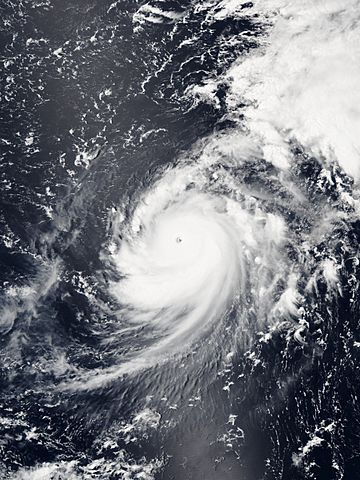
Genevieve at peak intensity on August 8
|
|
| Formed | July 25, 2014 |
| Dissipated | August 14, 2014 |
| Highest winds | 10-minute sustained: 205 km/h (125 mph) 1-minute sustained: 260 km/h (160 mph) |
| Lowest pressure | 915 hPa (mbar); 27.02 inHg |
| Fatalities | None reported |
| Damage | None |
| Areas affected | None |
| Part of the 2014 Pacific hurricane and typhoon seasons | |
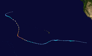
Hurricane Genevieve, also called Typhoon Genevieve, was a very strong storm that lasted a long time in 2014. It was one of the strongest storms of its year in the Pacific Ocean. Genevieve was special because it traveled across all three parts of the North Pacific Ocean where these storms form. This had only happened once before, with Hurricane Dora in 1999.
Genevieve started as a tropical wave far southeast of Hawaii on July 25. But it quickly got weaker because of strong winds high up in the sky, called wind shear. It briefly reformed near Hawaii on July 29 before weakening again on July 31.
Several days later, on August 2, Genevieve became a storm once more. The conditions were better for it to grow stronger. Genevieve quickly became a hurricane on August 6. It then became a major hurricane on August 7. Soon after, it crossed the International Date Line. This meant it moved into the Western Pacific Ocean. Here, the Japan Meteorological Agency (JMA) called it a typhoon.
Genevieve reached its strongest point as a Category 5 typhoon on August 7 and 8. After that, it started to weaken as conditions got worse. The storm quickly became a severe tropical storm by August 10. By August 12, the JMA said Genevieve was just a tropical depression. The storm finally disappeared on August 14.
Contents
How Genevieve Formed and Grew
Starting Out and Coming Back
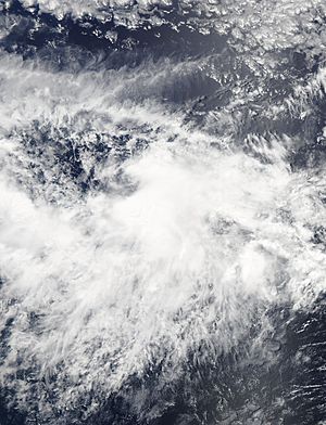
Weather experts began watching a tropical wave off the coast of Central America on July 17. By July 22, thunderstorms grew stronger. A low-pressure area started to get more organized. On July 25, satellites showed more thunderstorms forming. The National Hurricane Center (NHC) then named it Tropical Storm Genevieve. A few hours later, its winds reached 45 mph (75 km/h).
Soon after, strong wind shear made Genevieve weaker. Its center became separated from its thunderstorms. The NHC then said Genevieve was just a tropical depression on July 26. It moved into the area watched by the Central Pacific Hurricane Center (CPHC). By July 28, Genevieve became a leftover swirl of clouds. However, experts thought it might grow stronger again.
About 36 hours later, Genevieve reformed into a tropical depression. This happened southeast of the main Hawaiian Islands. On July 30, it briefly became more organized. But by the end of the day, strong winds and dry air made it weaker again. By July 31, Genevieve was once more just a leftover swirl of clouds.
Getting Stronger and Reaching Peak Power
The leftover parts of Genevieve kept moving west. They entered an area with better conditions for storms to grow. On August 2, Genevieve reformed into a tropical depression. It got its thunderstorms back and started blowing air out better. By the same day, Genevieve became a tropical storm again. It moved west, guided by a high-pressure area to its north. But just six hours later, the CPHC said Genevieve was a tropical depression again.
Thunderstorms near its center grew and shrank several times. But Genevieve did not get stronger. After moving south-southwest, Genevieve turned west-northwest on August 4. It continued to track around the high-pressure area to its north.
Even with some wind shear, thunderstorms soon wrapped around the storm's center. By August 5, the CPHC upgraded it to a tropical storm. The wind shear quickly went away. This caused Genevieve to quickly get much stronger. By August 6, Genevieve became a Category 1 hurricane. It also developed a clear central dense overcast and well-organized bands of clouds around its new eye.
Genevieve passed over very warm ocean waters. This made it get stronger even faster that evening. Based on satellite estimates and a very clear eye, the CPHC upgraded Genevieve to a Category 4 hurricane. This happened early on August 7.
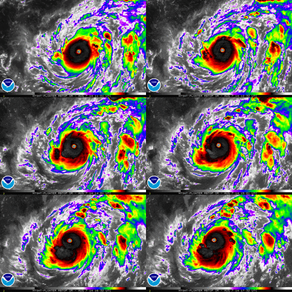
Genevieve crossed the International Date Line on August 7. This meant it entered the area watched by the Japan Meteorological Agency (JMA). The JMA called Genevieve a typhoon. Its winds were about 115 mph (185 km/h). The Joint Typhoon Warning Center (JTWC) also called Genevieve a super typhoon. Just six hours later, the JTWC said Genevieve reached Category 5 status. Its winds were 160 mph (260 km/h). Satellite images showed a large eyewall. Genevieve stayed in a good environment with low wind shear. The JMA said the typhoon reached its strongest point late on August 7. Its winds were 125 mph (205 km/h).
Getting Weaker and Disappearing
On the morning of August 8, Genevieve started to move north. It was moving along the edge of a high-pressure area. By noon, the clouds around Genevieve looked more broken. This showed that Genevieve was starting to weaken. The JTWC then said Genevieve was just a typhoon late that day.
Early on August 9, Genevieve moved faster to the north-northeast. It started to face stronger wind shear and sinking air. The eye of the typhoon became filled with clouds. The strongest thunderstorms around its center also got warmer. The storm then moved north-northwest in the afternoon. Its dense cloud cover became smaller and less even.
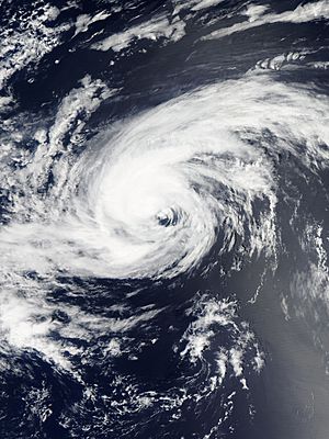
Genevieve briefly formed a small eye again on August 10. Its thunderstorms were more organized. But the eye soon disappeared. The storm started to stretch out. It was in a complex environment with different wind patterns. These patterns caused strong winds and moderate wind shear over the storm. But the typhoon's fast speed helped to balance these issues.
Moving northwest, Genevieve crossed 30°N at noon. It started to move over cold ocean waters (less than 79°F or 26°C). These temperatures do not support tropical cyclones. At the same time, a trough caused more sinking air. This cut off the storm's core from tropical moisture. Soon, the strong thunderstorms around the typhoon's center quickly disappeared. Dry air surrounded the storm.
Late on August 10, the JMA said Genevieve was a severe tropical storm. The JTWC downgraded it to a tropical storm early the next day. Dry air, cool ocean temperatures, and a weak link to tropical moisture caused almost all the thunderstorms to disappear. This process sped up as other wind patterns broke down. With many bad conditions, Genevieve weakened to a tropical storm at noon. It started to move west-northwest and slowed down. As most of its thunderstorms were gone, the JTWC downgraded Genevieve to a tropical depression. They stopped giving warnings late that day.
The JMA downgraded Genevieve to a tropical depression on August 12. The storm drifted west and then northwest very slowly. It then sped up to the northeast late on August 13. The JMA reported that Genevieve had disappeared as a tropical depression before noon on August 14. However, the Ocean Prediction Center said the leftover parts of Genevieve crossed the International Date Line again. They entered the Central North Pacific Ocean late that day. They were finally absorbed by another storm before noon on August 15.
Related pages
See also
 In Spanish: Huracán Genevieve (2014) para niños


