Jamaica Plain facts for kids
Quick facts for kids
Jamaica Plain
|
|
|---|---|
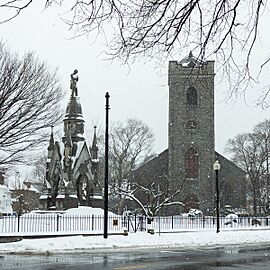
Soldier's Monument and First Unitarian Universalist Church in Jamaica Plain
|
|
| Nickname(s):
JP
|
|
| Country | United States |
| State | Massachusetts |
| County | Suffolk |
| Neighborhood of | Boston |
| Annexed by Boston | 1874 |
| Population
(2020)
|
41,012 |
| Time zone | UTC−5 (Eastern) |
| Area code(s) | 617/857 |
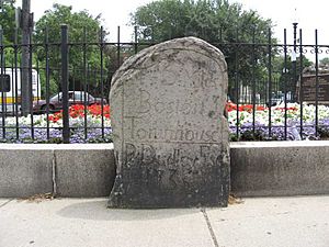
Jamaica Plain is a lively neighborhood in Boston, Massachusetts, USA. It covers about 4.4 square miles (11.4 km²). This area was first settled by Puritans who were looking for farmland. It was originally part of Roxbury.
Later, in 1851, it became part of a new town called West Roxbury. Then, in 1874, West Roxbury joined Boston, and Jamaica Plain became a Boston neighborhood. In the 1800s, it became one of America's first "streetcar suburbs." This meant people could live here and easily travel to the city by streetcar. It is also home to a big part of Boston's famous Emerald Necklace of parks, designed by Frederick Law Olmsted.
In 2020, about 41,012 people lived in Jamaica Plain.
Contents
Exploring Jamaica Plain's Past
Early Beginnings: Colonial Times
Boston and Roxbury were founded in 1630. Soon after, families like William Heath's settled in what is now Jamaica Plain. They built farms along Stony Brook. This brook flowed from south to north, ending near the Charles River. John Polley bought a farm in 1659 near where the Soldier's Monument stands today. Joseph Weld also received a large piece of land. His family lived there for many generations. This land is now part of the Arnold Arboretum.
The name "Jamaica" appeared on maps in the late 1650s. No one is completely sure where the name came from. One idea is that it relates to "Jamaica rum" and the Triangle Trade. Another idea is that "Jamaica" is an English version of the name of Kuchamakin, a Native American chief. It might also honor the British victory in taking the island of Jamaica from Spain in 1655. Until the mid-1800s, some maps called the area "Jamaica Plains."
In 1676, John Ruggles and Hugh Thomas gave land for the first school. John Eliot also gave land to support the school. It was named the Eliot School in his honor and still exists today.
During the 1700s, farms in Jamaica Plain started selling their crops to the growing city of Boston. Rich people also bought land here to build large country homes. In 1740, Benjamin Faneuil bought land. In 1752, Commodore Joshua Loring built his home here. The governor, Francis Bernard, also had a summer home near Jamaica Pond.
The community's first church was built in 1769. It was the only church in Jamaica Plain for 70 years. This church became one of the first Unitarian churches. It is still on the same site today, known as the First Church in Jamaica Plain. The original wooden building was replaced by a stone one in 1854.
Local Minutemen from the Third Parish fought in the American Revolution at Lexington and Bunker Hill. Their bravery is remembered on a plaque near the Civil War Monument. In 1775, General Washington stationed troops here. They protected the road to Dedham, where American weapons were stored.
After the Revolution, many loyalists (people who supported the British) left. New wealthy Bostonians moved in. In 1777, John Hancock bought an estate near the pond. The Loring-Greenough House, once owned by a loyalist, was bought by Ann Doane. She later married David S. Greenough. Samuel Adams bought the former Peacock Tavern. James Perkins, who made his money in the China trade, built his home, Pinebank, overlooking Jamaica Pond in 1802.
Growth and Change: From Revolution to Joining Boston
The early 1800s saw more changes. An aqueduct (a water channel) was built to bring water from Jamaica Pond to Boston. Carriages and later "omnibuses" (like early buses) carried people to Roxbury and Boston. In 1834, the first train line, the Boston and Providence Rail Road, reached Jamaica Plain. This made it easier for people to live here and work in Boston. Special low "commuter" fares were offered.
Green Street became a busy area for local craftspeople and builders. Centre Street also became a main shopping street. During the 1840s, more people moved to Jamaica Plain. Small factories, like chemical and soap factories, opened along the Stony Brook. They used the running water and easy transportation. New churches were also built for the growing and diverse population.
By 1850, Jamaica Plain was no longer mainly a farming area. Many residents were now business people, professionals, or Irish immigrants. To avoid higher taxes from a growing Roxbury, the large estate owners helped Jamaica Plain break away. In 1851, it became part of the new town of West Roxbury.
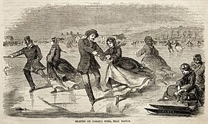
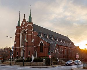
Ice was harvested from Jamaica Pond each winter and sold in Boston. Ships even used it as ballast (weight) when traveling to places like San Francisco. The train line added more tracks as more people used it. Many new residents were Irish and Catholic. So, St Thomas Aquinas Church was built on South Street, with a school following in 1873.
Jamaica Plain changed a lot in one generation. In 1873, residents voted to join Boston. West Roxbury had grown from 2,700 people in 1850 to 9,000 in 1875. Many new residents wanted the better services that Boston could provide, like improved streets and sewer systems.
Becoming a Boston Neighborhood
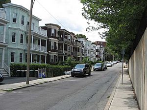
After joining Boston, Jamaica Plain grew even faster. The "triple decker" house, a common sight in New England, became popular in the 1870s and 1890s. These are multi-family homes with three floors. The first brick commercial building was built in 1875. A police station was built in 1873. The Eliot School became Jamaica Plain High School after the annexation.
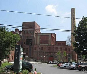
The Stony Brook valley was the industrial heart of Jamaica Plain. In 1871, the Haffenreffer brewery opened there. It used water from the Stony Brook and hired many German immigrants. The Boylston Schul Verein German social club also opened nearby. The B.F. Sturtevant Company opened a factory for industrial fans in 1878. It employed 500 people. After a big fire in 1901, the company moved away.
The growth of businesses and homes near Stony Brook led to calls to control the brook. It often flooded. By 1908, the brook was put into an underground tunnel. It was largely forgotten until the new Stony Brook Orange Line station was built.
Breweries were big employers. The Highland Spring Brewery opened in 1867. Other breweries like Eblana and Park breweries opened in the 1880s. They hired many German and Irish immigrants. Most breweries closed during Prohibition (when alcohol was illegal). Some buildings found other uses. The Haffenreffer brewery stayed open until 1964. Today, its old building houses businesses like the Boston Beer Company (which makes Samuel Adams beer).
The Moxie soft drink company moved to Heath Street after Prohibition. Moxie was invented in 1876 and was once more popular than Coca-Cola. But it lost market share during the Great Depression. The plant closed in 1953.
Jamaica Plain's housing grew with its businesses. Sumner Hill became home to business owners. Other areas like Parley Vale and Moss Hill Road were developed for wealthier families. Land off South Street was developed for working-class families, especially Irish immigrants. By the early 1900s, most of Jamaica Plain was built up with homes and businesses.
Early 1900s: New Industries and Community Life
In 1900, Thomas Gustave Plant built a shoe factory for his Queen Quality Shoe Company. It was said to be the largest women's shoe factory in the world, with 5,000 workers. To keep workers happy, the company offered a park, recreation rooms, a gym, and sports teams. Shoes were made there until the 1950s. The building burned down in 1976 and is now a supermarket.
Jamaica Plain had many immigrants in 1900. Many Irish settled in areas like Heath Street and Forest Hills. They worked in labor and domestic jobs. Germans made up 14% of the population, living in Hyde Square and Egleston Square. They were skilled workers and managers. Many Canadians also moved here, often working in white-collar jobs. Italians arrived after 1910. New technologies brought more jobs. The Randall-Faichney Company made car parts. The Holtzer-Cabot Company made electric motors and even electric cars.
Religion was important. As more Catholics moved in, new churches were built. Our Lady of Lourdes opened in 1896, and Blessed Sacrament in 1917. St Andrews followed. Each church had an elementary school. St Thomas parish even added a high school in 1927. Protestant churches also had strong communities.
Community groups brought people together. The Jamaica Plain Carnival Association managed the 4th of July parade and fireworks. The Jamaica Plain Businessmen's Association promoted local businesses. The Jamaica Plain Citizen's Association worked for better roads, playgrounds, and schools. The Tuesday Club formed for women in 1897 and still meets at the Loring Greenough house.
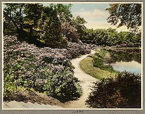
In the late 1800s, Boston's Emerald Necklace of parks was designed by Frederick Law Olmsted. Much of it is in or near Jamaica Plain. Olmsted Park, Jamaica Pond, the Arnold Arboretum, and Franklin Park have been enjoyed by many generations. Jamaica Pond was once lined with estates, which were removed to create the park. Fishing and ice skating were popular. The Arboretum was developed on land donated by Benjamin Bussey and supported by James Arnold. It is now owned by Boston and managed by Harvard University.
A big building project was raising the train line above ground in the 1890s. This was done to prevent accidents at street crossings. An embankment (raised bank) was built. This cut through Jamaica Plain from north to south. Over time, properties near the embankment became less valuable.
Community Action and Renewal
In the early 1970s, there was a plan to build a major highway, I-95, right through Jamaica Plain. This would have split the community in half. Many residents protested, along with people from Roxbury and Hyde Park. They held an annual festival called "Wake Up The Earth" to show their opposition. The highway project had already torn down hundreds of homes and businesses. But then-Governor Francis W. Sargent stopped the project. In the 1980s, the Southwest Corridor was built instead. It created a parkway, a bike path, and a place for the Wake Up The Earth festivals. The Orange Line subway now runs underground beneath it.
By 1970, parts of Jamaica Plain were struggling. The highway plan and a decision by banks to limit mortgage lending (called "redlining") led to problems. Homes became run-down, and some were abandoned. Urban Edge, a non-profit group, even had to ask volunteers to live in empty properties to stop vandalism and fires.
Activists started the Jamaica Plain Community Investment Plan. People promised to put their savings in a local bank that would invest in Jamaica Plain mortgages. This plan raised a lot of money. In 1975, a contract was signed with the Jamaica Plain Cooperative Bank.
In 1974, community groups formed the Jamaica Plain Banking and Mortgage Committee. They worked with other Boston neighborhoods to create the Boston Anti-Redlining Coalition (BARC). This group fought to make banks show where they were lending money. They also started a "Greenlining campaign" to encourage investment in the neighborhood.
In 1975, a new rule was made requiring state-chartered banks to share their lending information. Studies showed that banks were indeed limiting investment in Jamaica Plain. Later that year, the Jamaica Plain Banking & Mortgage Committee helped pass the Federal Home Mortgage Disclosure Act of 1975. This law made banks across the U.S. share their lending data.
After this, real estate prices became stable, and mortgage money became available. The Southwest Corridor Coalition created a plan to redevelop the area. They removed the old elevated train line and replaced it with an underground line. The Southwest Corridor park was built along the old train route.
Changes also happened to the streetcar service. The Arborway line, which had run since 1903, was considered for bus service. In 1977, trolley service was stopped at Heath Street. Buses took over the rest of the route. This decision is still debated by citizen groups today.
Modern Jamaica Plain
In the 1980s, low rents attracted many students, especially from art schools and Northeastern University. The neighborhood also became home to a large lesbian and gay community. Artists living here led to new galleries, bookstores, and arts centers. Many first-time homebuyers could afford homes here.
A strong music scene developed in the mid-1980s and continues today. In the 1990s, revitalization continued. Non-profit housing groups bought old houses and empty lots to create affordable housing. The old Plant Shoe Factory became JP Plaza, a shopping center. New health centers were also built. The city also named "Main Streets" districts (Hyde/Jackson Square, Egleston Square, and Centre/South) to help local businesses.
People and Culture
By the early 2000s, Jamaica Plain attracted many college-educated professionals, political activists, and artists. Groups like Grassroots International, Urbano Project, and Bikes Not Bombs are active here.
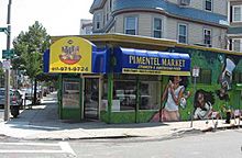
Hyde, Jackson, and Egleston Squares have many Spanish-speaking residents, mostly from the Dominican Republic, but also from Puerto Rico and Cuba. In 2010, Jamaica Plain's population was about 53.6% White, 22% Hispanic or Latino, 13.5% Black, and 7.9% Asian.
In 2016, the area between Jackson Square and Hyde Square was officially named the "Latin Quarter." This area has many Latin-owned businesses and is a center for local festivals and activist groups. The newspaper El Mundo is based in Hyde Square.
The end of redlining and the redevelopment of the Southwest Corridor led to gentrification (when an area becomes more expensive and attracts wealthier residents) starting in the 1990s. Real estate prices increased a lot. Many old buildings are being turned into condominiums.
The Footlight Club, the oldest community theater group in the US, is based in Eliot Hall in Jamaica Plain.
Exploring Jamaica Plain's Geography
Unique Sub-neighborhoods
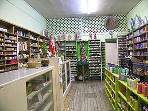
Jamaica Plain has many smaller, distinct areas. Some names are old and not used as much today.
- Brookside: Near Boylston, Green, Washington Streets, and the Southwest Corridor Park.
- Egleston Square: Where Columbus Avenue and Washington Street meet, bordering Roxbury.
- Forest Hills: Near the Arborway, Morton Street, Walk Hill Street, South Street, and Forest Hills Cemetery.
- Hyde Square: Around Centre, Day, and Perkins Streets.
- Jackson Square: Where Columbus Avenue and Centre Street meet. It has an MBTA Orange Line station.
- Jamaica Hills: Northwest of the Arnold Arboretum, including Moss Hill.
- Parkside: Near Washington Street, Egleston Square, Morton Street, and Franklin Park.
- Pondside: Near Centre Street, Perkins Street, and the Jamaicaway.
- South Street: Follows the street from the Monument to Forest Hills.
- Stonybrook: A neighborhood with an active association, with specific boundaries around Washington Street and Forest Hills Street.
- Sumner Hill: Near Seaverns Avenue, Everett Street, Sedgwick Street, and Newbern Street.
- Sunnyside: Near Centre Street, Day Street, Round Hill Street, and Gay Head Street.
- The Monument: Overlaps with Pondside, around Centre and South Streets.
- Woodbourne: South of Forest Hills, near Walk Hill Street.
Green Spaces and Parks
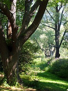
Jamaica Plain is known as one of Boston's greenest neighborhoods. It has many parts of the famous Emerald Necklace park system, designed by Frederick Law Olmsted:
- Olmsted Park: Stretches from Route 9 south to Perkins Street. It includes Leverett Pond, Willow Pond, and Ward's Pond.
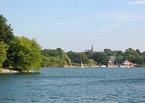
- Jamaica Pond: This is Boston's largest and deepest freshwater pond, covering 60 acres (24 ha).
- Arnold Arboretum: A world-famous plant collection managed by Harvard University. It covers 265 acres (107 ha) and includes Peters' Hill, the highest point in Jamaica Plain at 235 feet (72 m).
- Franklin Park: The largest park in Boston, covering 527 acres (213 ha). It is home to the Franklin Park Zoo, White Stadium, and a golf course.
These parks are connected by scenic parkways like the Arborway, the Jamaicaway, and the Riverway. The area also includes Forest Hills Cemetery, a large "garden cemetery" with 275 acres (111 ha) of green space.
Climate in Jamaica Plain
| Climate data for Jamaica Plain, Massachusetts (1991–2020 normals, extremes 1962–present) | |||||||||||||
|---|---|---|---|---|---|---|---|---|---|---|---|---|---|
| Month | Jan | Feb | Mar | Apr | May | Jun | Jul | Aug | Sep | Oct | Nov | Dec | Year |
| Record high °F (°C) | 72 (22) |
74 (23) |
89 (32) |
95 (35) |
99 (37) |
100 (38) |
103 (39) |
100 (38) |
101 (38) |
92 (33) |
79 (26) |
78 (26) |
103 (39) |
| Mean maximum °F (°C) | 57.2 (14.0) |
59.8 (15.4) |
68.6 (20.3) |
81.3 (27.4) |
89.9 (32.2) |
92.7 (33.7) |
96.3 (35.7) |
93.9 (34.4) |
89.8 (32.1) |
79.9 (26.6) |
70.7 (21.5) |
61.9 (16.6) |
97.5 (36.4) |
| Mean daily maximum °F (°C) | 37.0 (2.8) |
39.6 (4.2) |
46.6 (8.1) |
58.8 (14.9) |
69.4 (20.8) |
78.8 (26.0) |
84.7 (29.3) |
83.1 (28.4) |
75.5 (24.2) |
63.7 (17.6) |
52.6 (11.4) |
42.4 (5.8) |
61.0 (16.1) |
| Daily mean °F (°C) | 28.2 (−2.1) |
30.3 (−0.9) |
37.5 (3.1) |
48.5 (9.2) |
58.8 (14.9) |
68.4 (20.2) |
74.4 (23.6) |
72.8 (22.7) |
65.2 (18.4) |
53.3 (11.8) |
43.4 (6.3) |
34.0 (1.1) |
51.2 (10.7) |
| Mean daily minimum °F (°C) | 19.4 (−7.0) |
21.0 (−6.1) |
28.4 (−2.0) |
38.1 (3.4) |
48.2 (9.0) |
57.9 (14.4) |
64.0 (17.8) |
62.5 (16.9) |
54.9 (12.7) |
43.0 (6.1) |
34.2 (1.2) |
25.7 (−3.5) |
41.4 (5.2) |
| Mean minimum °F (°C) | 2.2 (−16.6) |
3.3 (−15.9) |
12.5 (−10.8) |
26.1 (−3.3) |
35.7 (2.1) |
45.3 (7.4) |
53.8 (12.1) |
52.0 (11.1) |
40.7 (4.8) |
29.5 (−1.4) |
20.1 (−6.6) |
11.1 (−11.6) |
−0.6 (−18.1) |
| Record low °F (°C) | −10 (−23) |
−11 (−24) |
0 (−18) |
16 (−9) |
24 (−4) |
38 (3) |
44 (7) |
37 (3) |
32 (0) |
20 (−7) |
6 (−14) |
−10 (−23) |
−11 (−24) |
| Average precipitation inches (mm) | 3.87 (98) |
3.59 (91) |
4.49 (114) |
4.32 (110) |
3.64 (92) |
4.18 (106) |
3.49 (89) |
3.72 (94) |
3.96 (101) |
5.03 (128) |
3.99 (101) |
5.08 (129) |
49.36 (1,253) |
| Source 1: NOAA | |||||||||||||
| Source 2: National Weather Service | |||||||||||||
Education in Jamaica Plain
Schools for All Ages
Students in Jamaica Plain attend Boston Public Schools (BPS). BPS places students based on their preferences and certain priorities. The English High School, located in Jamaica Plain, is one of the oldest public high schools in America.
The Roman Catholic Archdiocese of Boston also runs Catholic schools. In 2009, Our Lady of Lourdes School, the last Catholic school in Jamaica Plain, faced closure. It needed to raise $500,000 to stay open for another year.
Private schools in the area include the British School of Boston and Showa Boston Institute for Language and Culture.
Getting Around Jamaica Plain
Public Transportation Options
Jamaica Plain has good public transportation. The Massachusetts Bay Transportation Authority (MBTA) provides bus and train services.
Major roads include Centre Street, the Jamaicaway (part of old US 1), the Arborway (MA 203), Washington Street, South Street, and South Huntington Avenue.
The Green Line's E branch streetcar ends at Heath Street. Bus service continues along South Huntington Avenue, Centre Street, and South Street to the Forest Hills Station. The E branch used to go all the way to Arborway station.
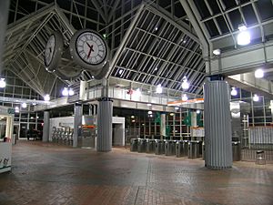
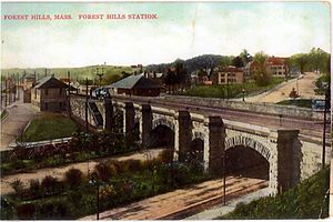
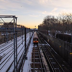
The Orange Line subway runs underground through Jamaica Plain. It has stops at Jackson Square, Stony Brook, Green Street, and Forest Hills. Buses connect Jamaica Plain to nearby towns and other parts of Boston. The 39 bus is a main route and one of Boston's busiest. Forest Hills Station is a major hub and is close to the Arnold Arboretum and Forest Hills Cemetery.
The E branch trolley service was stopped from Heath Street to Forest Hills in the mid-1980s. Some residents want it back, seeing it as a way to reconnect with the city. Others feel the #39 bus and Orange Line already cover the area.
Train and Car Travel
The Needham Line of the Commuter Rail stops at Forest Hills Station. Other train lines are easy to reach by taking the Orange Line subway to Ruggles and Back Bay.
There are a few public parking lots in Jamaica Plain. On-street parking is usually free. Many streets near Orange Line stations have "resident permit only" parking during the day. This stops commuters from parking on residential streets.
Biking Around Jamaica Plain
Two main bike paths serve Jamaica Plain. The Pierre Lallement Bicycle Path runs along the Southwest Corridor Park from Forest Hills to Back Bay. There are also bike paths through the Emerald Necklace parks, along the Jamaicaway and Riverway.
Famous People from Jamaica Plain
Many notable people have lived in or been connected to Jamaica Plain:
- Robert Bacon (1860–1919), a former United States Secretary of State.
- Emily Greene Balch (1867–1961), a Nobel Peace Prize winner and founder of the Women's International League for Peace and Freedom.
- Baruj Benacerraf (1920–2011), a Nobel Prize-winning immunologist.
- Harold Hitz Burton (1888–1964), a former Mayor of Cleveland and Supreme Court Justice.
- John F. Collins (1919–1995), a former Mayor of Boston.
- James Michael Curley (1874–1958), a well-known former Mayor of Boston and Governor of Massachusetts.
- James Dole (1877–1958), who founded the Dole Food Company, known for pineapples.
- George Dorr (1853–1944), a preservationist who helped create Acadia National Park.
- William Heath (1737–1814), a farmer and Major General in the Continental Army during the Revolution.
- Joshua Loring (1716–1781), a British Naval officer.
- Joey McIntyre (1972– ), an entertainer and member of the pop group New Kids On The Block.
- Francis Parkman (1823–1892), a famous historian.
- Andrew James Peters (1872–1938), a former Mayor of Boston.
- Sylvia Plath (1932–1963), a well-known poet and novelist.
- Joe Rogan (1967– ), a comedian and podcaster.
- Jeremy Strong (1978–), an actor who lived here as a child.
- Maurice Joseph Tobin (1901–1953), a former Mayor of Boston and United States Secretary of Labor.


