John H. Chafee National Wildlife Refuge facts for kids
Quick facts for kids John H. Chafee National Wildlife Refuge |
|
|---|---|
|
IUCN Category IV (Habitat/Species Management Area)
|
|
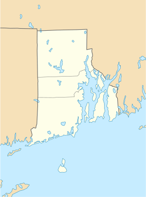
| Location | Washington County, Rhode Island, United States |
| Nearest city | Narragansett, Rhode Island |
| Area | 544 acres (2.20 km2) |
| Established | 1988 |
| Governing body | U.S. Fish and Wildlife Service |
| Website | John H. Chafee National Wildlife Refuge |
The John H. Chafee National Wildlife Refuge is a special protected area in the United States. It's like a safe home for animals and plants. You can find it along the Narrow River on the southern coast of Rhode Island.
Contents
Nature and Wildlife at Chafee Refuge
The land around the Chafee Refuge, especially near the Narrow River (also called Pettaquamscutt Cove), is a very important spot for birds. It's even called an Important Bird Area because so many different birds live or visit here. Most of this important bird area is private land or open water. However, parts of it are protected by the Chafee Refuge and other groups like the Audubon Society.
Plants of the Refuge
The John H. Chafee National Wildlife Refuge has many different types of land. Most of it is made up of forests on higher ground and wetlands. You'll also find areas of wet scrubland.
A common feature in the refuge is the salt marsh, which is a type of wetland with salty water. Here, you can see special plants like Saltmeadow cordgrass (also called salt hay), salt-marsh cordgrass, and spike grass. Other plants like saltwort and sealavender also grow well in this salty environment.
Animals of the Refuge
The refuge is a key place for wildlife, especially birds. It's home to the largest group of American black ducks in Rhode Island. Protecting these migratory birds was the main reason this refuge was created.
Many other waterfowl (birds that live on water) also use the Pettaquamscutt Cove area. These include mallards, gadwalls, American wigeons, Canada geese, and buffleheads.
You can also spot various salt-marsh and shorebirds. Look for the saltmarsh sparrow, seaside sparrow, willet, and clapper rail. Other birds like the greater yellowlegs, lesser yellowlegs, semipalmated plover, and least sandpiper visit the shores.
In areas where the marsh meets the forest, you might see mimic thrushes, red-winged blackbirds, common yellowthroats, and song sparrows. The open water and tide creeks are home to birds like the least tern, common tern, and belted kingfisher.
Fish and Shellfish
The Narrow River, which is next to the refuge, is very important for fish. A study in 1998 found 75 different types of fish that use the river at some point in their lives. The river also has the biggest run of alewife fish in the state. In 2002, a report noted that 28 fish species and 5 shellfish species use the lower part of the river near the refuge.
History and Management
The refuge was first created on November 5, 1988. It was originally called the Pettaquamscutt Cove National Wildlife Refuge. In 1999, it was renamed the John H. Chafee National Wildlife Refuge. This was done to honor John Chafee, a Senator who helped create the refuge.
The U.S. Fish and Wildlife Service (FWS) manages the refuge. It's part of a group of five National Wildlife Refuges in Rhode Island. This group is called the Rhode Island National Wildlife Refuge Complex. The other refuges in this complex are Block Island NWR, Ninigret NWR, Sachuest Point NWR, and Trustom Pond NWR.
Refuge Size and Public Use
In 2006, the refuge was about 368 acres. In 2009, it grew even larger when 120 more acres were added. This happened through a deal between the State of Rhode Island and the FWS. Now, the total size of the refuge is 544 acres.
In 2002, the FWS estimated that about 5,000 people visited the Chafee Refuge each year. However, they noted that not all parts of the refuge boundary are marked, and public use isn't fully tracked.
Visitors can enjoy watching wildlife at the refuge. Waterfowl hunting is allowed, but only if you access the area by boat. You can also go fishing from the shoreline, canoeing, and kayaking. These activities are only allowed from specific access points.
 | Shirley Ann Jackson |
 | Garett Morgan |
 | J. Ernest Wilkins Jr. |
 | Elijah McCoy |


