Jollys Lookout, Queensland facts for kids
Quick facts for kids Jollys LookoutQueensland |
|||||||||||||||
|---|---|---|---|---|---|---|---|---|---|---|---|---|---|---|---|

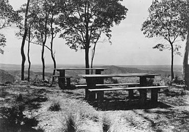
View from Jollys Lookout in the Mount Nebo area, ~1935
|
|||||||||||||||
| Population | 73 (2021 census) | ||||||||||||||
| • Density | 20.3/km2 (53/sq mi) | ||||||||||||||
| Postcode(s) | 4520 | ||||||||||||||
| Area | 3.6 km2 (1.4 sq mi) | ||||||||||||||
| Time zone | AEST (UTC+10:00) | ||||||||||||||
| Location |
|
||||||||||||||
| LGA(s) | City of Moreton Bay | ||||||||||||||
| State electorate(s) | Pine Rivers | ||||||||||||||
| Federal Division(s) | Ryan | ||||||||||||||
|
|||||||||||||||
Jollys Lookout is a small, quiet area in the City of Moreton Bay, Queensland, Australia. It's mostly a rural place, meaning it has more open land and fewer buildings than a city. In 2021, about 73 people lived here.
Contents
Where is Jollys Lookout?
Jollys Lookout is located along Mount Nebo Road. This road connects The Gap in Brisbane to Mount Nebo. It's a scenic drive!
Nature and Land Around
A part of Jollys Lookout, in its north-western corner, is inside the D'Aguilar National Park. This park is a protected area of nature. The rest of Jollys Lookout is on the side of the Annand Range hills. Here, you'll find a mix of homes with big yards and undeveloped land. There's also a small area where animals graze on natural plants.
How Jollys Lookout Got Its Name
This place is named after a popular viewing spot, or "lookout," that offers amazing views. The lookout itself was named after William Jolly. He was the mayor of Brisbane and visited this spot around 1927.
People Living Here
In 2016, about 76 people called Jollys Lookout home. By 2021, the population was 73 people.
What to See and Do
The main attraction here is the Jollys Lookout itself. You can get to this lookout from Mount Nebo Road. It's a great spot to enjoy the views of the surrounding area.
 | George Robert Carruthers |
 | Patricia Bath |
 | Jan Ernst Matzeliger |
 | Alexander Miles |


