
Kedron, Queensland facts for kids
Quick facts for kids KedronBrisbane, Queensland |
|||||||||||||||
|---|---|---|---|---|---|---|---|---|---|---|---|---|---|---|---|

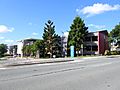
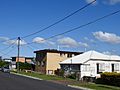
Typical housing in Seventh Avenue, 2021
|
|||||||||||||||

Kedron
Location in Queensland
|
|||||||||||||||
| Population | 9,907 (2021 census) | ||||||||||||||
| • Density | 2,830/km2 (7,300/sq mi) | ||||||||||||||
| Postcode(s) | 4031 | ||||||||||||||
| Elevation | 27 m (89 ft) | ||||||||||||||
| Area | 3.5 km2 (1.4 sq mi) | ||||||||||||||
| Time zone | AEST (UTC+10:00) | ||||||||||||||
| Location | 8.2 km (5 mi) N of Brisbane CBD | ||||||||||||||
| LGA(s) | City of Brisbane (Marchant Ward; Northgate Ward) |
||||||||||||||
| State electorate(s) | Stafford | ||||||||||||||
| Federal Division(s) | Lilley | ||||||||||||||
|
|||||||||||||||
Kedron is a suburb located in the northern part of Brisbane, Queensland, Australia. It's known for being the home of the Queensland Fire and Emergency Services headquarters. In 2021, about 9,907 people lived in Kedron.
Contents
Exploring Kedron's Location
Kedron is a suburb in Brisbane's inner north. It's built around Gympie Road and Kedron Brook, a local creek. You'll find it close to the large Westfield Chermside shopping centre. Kedron shares its borders with other suburbs like Stafford, Chermside, and Wavell Heights. Even though there's another suburb called Upper Kedron, it's actually quite far away, about 15 kilometres from Kedron.
Kedron's Past: A Journey Through Time
.jpg)
Kedron's story began in 1838 when German missionaries settled nearby in an area called German Station (now Nundah). They were given a large piece of land next to a creek. They named this creek Kedron Brook, after the Kidron Valley near Jerusalem. This is where the suburb of Kedron gets its name!
The first land in Kedron was sold in 1857. Early settlers like Alexander and Amelia Barron arrived in 1856. Their family members, James and Claude Barron, worked as blacksmiths in the area.
Early Settlers and Important Buildings
In 1862, Alfred Lutwyche, who was Queensland's first judge, bought land here. He built a home called Kedron Lodge. This old house is now a heritage-listed building, meaning it's protected for its historical importance.
Henry Craig settled on land where Lutwyche Cemetery is today. He planted the big bunya pines you can still see along Gympie Road. The cemetery, first called Kedron Brook Cemetery, was opened in 1878. It was later renamed Lutwyche Cemetery to honour Alfred Lutwyche.
The first church in Kedron, St. Andrew's Church of England, was built in 1866.
Gold Rush and Local Businesses
When gold was found in Gympie in 1868, a bridge was built over Kedron Brook. This helped create a new route north, which became known as Gympie Road. That same year, the Edinburgh Castle Hotel was built. It has been rebuilt a few times since then.
Another hotel, the Kedron Park Hotel, opened in 1881. In 1887, the Kedron Tannery was started by Michael Gallagher's family. It became very successful across Australia. Paul Maggs also built the Edinburgh Tannery in 1889.
Kedron Park and Racecourse
A special area called Kedron Park was set aside next to Kedron Brook. It used to have the Kedron Park Racecourse. Horse races were held there, but it closed in 1931. Later, in 1955, the land was used for schools. Today, the Queensland State Emergency Service is located there.
Kedron Gets Its Name
In 1891, John and Abigail King opened a general store. John King became the first postmaster for the area and suggested the name "Kedron" for the locality. The name became official in 1901.
Churches and Transport
The Presbyterian Church was established in 1913. In 1914, the tram service was extended to the Kedron Park Hotel, making it easier for people to travel. It was extended even further in 1925.
The Catholic Church was officially opened in 1923 by Archbishop James Duhig. The Methodist Church also started in 1925.

The Church of Christ started in Kedron in 1929, with volunteers helping to build the first church. This church was later moved to make way for a new building in 1959.
Schools Open in Kedron
Kedron State School welcomed its first students in October 1926. St Anthony's and St Therese's Catholic School opened in 1930, run by the Missionary Franciscan Sisters.

A special landmark in Kedron is the War Memorial in Lutwyche Cemetery. It has over 100 gravestones for servicemen, many of whom died in World War II.
More schools opened in 1956: Kedron State High School, Padua College (for boys), and Mount Alvernia College (for girls). St James' Anglican Church opened in 1960 but later closed. The Brisbane Cantonese Christian Church now uses that building.
Kedron's Population: Who Lives Here?
In 2021, Kedron had a population of 9,907 people. The average age of people in Kedron was 34 years old. Most people (76.1%) living in Kedron were born in Australia. Other common birthplaces included New Zealand, England, and India. About 84.7% of people spoke only English at home. Other languages spoken included Italian, Mandarin, and Tagalog.
Historic Places in Kedron
Kedron has several places that are listed for their historical importance. These include:
- 12 Childers Street: Pill Residence
- 21 Dawn Street: Craigie Knowe
- 217 Gympie Road: Church of Christ & Ministry Centre
- 418 Gympie Road: Lutwyche Cemetery & Sexton's Residence
- 418 Gympie Road: former Tram Shelter
- 9 Ninth Avenue: former Kedron Uniting Church
- 16 Ninth Avenue: Kedron State School B & C Blocks
- 5 Sixth Avenue: Derrington
- 41 Turner Road: former Kedron Shire Quarry Face & Stone Crusher
- 66 Turner Road: St Theresa and St Anthony's Parish Hall
- 77 Turner Road: St Anthony's Catholic School
- 100 Turner Road: Franciscan Friary (former) & fence (part of Padua College)
- 115 Turner Road: former Delamore (part of Mount Alvernia secondary girls' school)
Schools in Kedron
Kedron has several schools for different age groups:
- Kedron State School: This is a government primary school for students from Prep to Year 6. It's located on Leckie Road.
- St Anthony's School: A Catholic primary school for Prep to Year 6 students, located on Somerset Road.
- Padua College: This is a Catholic school for boys, covering primary (Year 5) and secondary (Years 7–12). You can find it on Turner Road.
- Kedron State High School: A government secondary school for both boys and girls, from Year 7 to Year 12. It's located on Park Road.
- Mount Alvernia College: A Catholic secondary school for girls, from Year 7 to Year 12. It's on Cremorne Road.
Community Places and Services
- Brisbane North Church of Christ: Located at 217 Gympie Road.
- The Brisbane Cantonese Christian Church: Found at 20 Tenth Avenue. This church offers Christian services in both English and Cantonese.
Images for kids
-
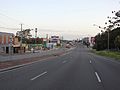
Gympie Road, looking south (2021).
-
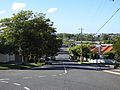
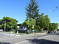
Turner Road, looking north (2021).
-
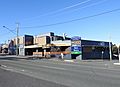
Edinburgh Castle Hotel, Gympie Road (2021).
-
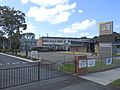
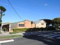
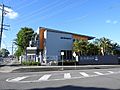
Emergency Services Centre, Queensland Government, Kedron Park Road (2021).
-
Housing style common to the area (2021).
-
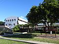
Kedron State High School, Park Road (2021).
-
Kedron State School, Leckie Road, with Tenth Avenue (2021).
-
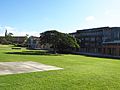
Padua College halls facing Turner Road (2021).
-
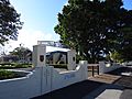
Padua College entrance gate, 80 Turner Road (2021).
-
Greccio offices, Padua College, Turner Road (2021).
-
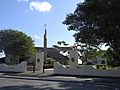
Padua College entrance gate, with Saint Therese Catholic Church, Turner Road (2021).
-
Saint Theresa Catholic Church, Turner Road (2021).
-
Saint Anthony's Catholic Primary School, on Somerset Street, intersecting Turner Road (2021).
-
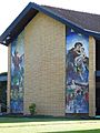
Mount Alvernia College (educating young women in the Franciscan tradition), Catholic secondary school on Cremorne Road (2021).
-
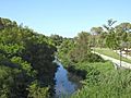
Kedron Brook stream, looking downstream from Gympie Road (2021).
-
Kedron Scout Den, Tenth Avenue (2021).
-
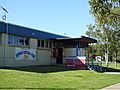
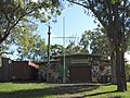
Kedron Football Club, Sixth Avenue (2021).
-
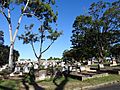
Lutwyche Cemetery, Kedron (2021).


