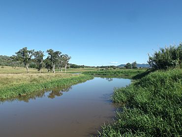
Kents Lagoon, Queensland facts for kids
Quick facts for kids Kents LagoonQueensland |
|||||||||||||||
|---|---|---|---|---|---|---|---|---|---|---|---|---|---|---|---|

Kents Lagoon, 2015
|
|||||||||||||||
| Population | 60 (2021 census) | ||||||||||||||
| • Density | 6.1/km2 (16/sq mi) | ||||||||||||||
| Postcode(s) | 4309 | ||||||||||||||
| Area | 9.8 km2 (3.8 sq mi) | ||||||||||||||
| Time zone | AEST (UTC+10:00) | ||||||||||||||
| Location |
|
||||||||||||||
| LGA(s) | Scenic Rim Region | ||||||||||||||
| State electorate(s) | Scenic Rim | ||||||||||||||
| Federal Division(s) | Wright | ||||||||||||||
|
|||||||||||||||
Kents Lagoon is a small countryside area in Queensland, Australia. It is part of the Scenic Rim Region. In 2021, about 60 people lived there.
Where is Kents Lagoon?
Kents Lagoon is a rural area. In its south-east, you'll find Obum Obum Hill. This hill is about 140 meters (460 feet) high.
Warrill Creek forms the western edge of Kents Lagoon. The main part of Kents Lagoon is located to the east of Warrill Creek.
A Look at Kents Lagoon's Past
The lagoon was named by Ludwig Leichhardt. He named it after F. Kent, who owned the Fassifern station at that time.
In January 1906, farms in the area were sold. These farms were part of the Kent's Lagoon Paddock Estate. They were between 124 and 234 acres in size. Warrill Creek was to the west of this estate. The old Mundbilla railway station was to the north-east. Munbilla Road was to the east.
A railway line, called the Mount Edwards railway line, opened in 1922. It helped connect the area. This railway line closed in 1960. The Waraperta railway station, located on Munbilla Road, served the area during that time.
Who Lives in Kents Lagoon?
In 2016, Kents Lagoon had 56 people living there. There were 24 households in the area.
In 2021, the population of Kents Lagoon grew slightly to 60 people.
 | Claudette Colvin |
 | Myrlie Evers-Williams |
 | Alberta Odell Jones |


